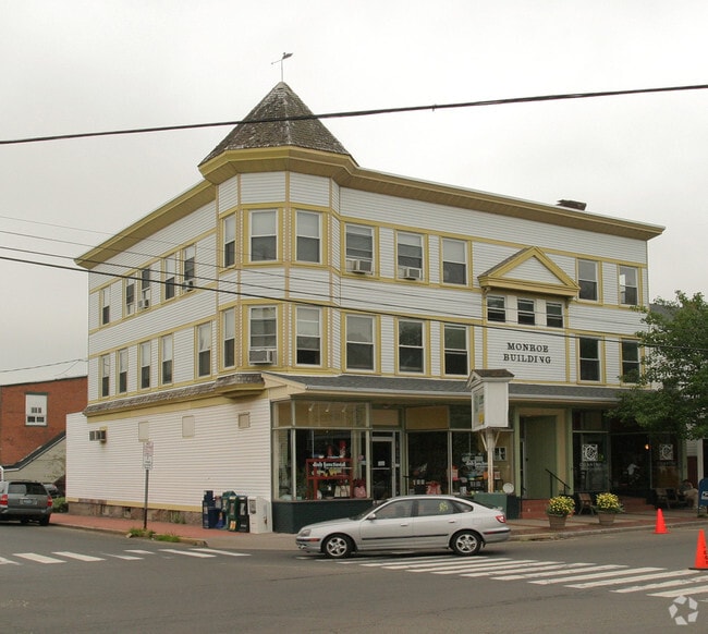
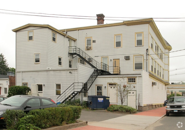
Property Record
89 Whitfield St, Guilford, CT 06437
NEARBY LISTINGS FOR SALE OR LEASE
Property Detail
89 Whitfield St
Storebuilding
New Haven
X
Connecticut
09009C0493J
0.15 AC
2024
Guilford
2025
Westchester/So Connecticut
190100
New Haven, CT
10,110 SF
GUIL-000000-000000-039089
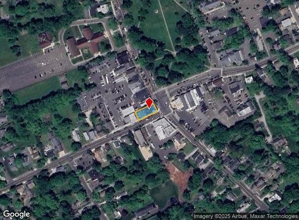
DEMOGRAPHICS near 89 Whitfield St
1 Mile
3 Mile
5 Mile
2024 Total Population
3,420
15,107
34,987
2029 Population
3,427
15,242
35,255
Pop Growth 2024-2029
+ 0.20%
+ 0.89%
+ 0.77%
Average Age
48
47
46
2024 Total Households
1,598
6,389
14,197
HH Growth 2024-2029
+ 0.19%
+ 0.88%
+ 0.79%
Median Household Inc
$84,375
$110,634
$127,783
Avg Household Size
2.10
2.30
2.40
2024 Avg HH Vehicles
2.00
2.00
2.00
Median Home Value
$534,607
$476,748
$471,698
Median Year Built
1963
1968
1972
Nearby Places
Map Layers
Map Styles
 Street
 Aerial
- Restaurants
- Banks
- Shops
- Fitness
- Groceries
PUBLIC TRANSPORTATION
COMMUTER RAIL
Guilford (Shore Line East - Shore Line East)
DRIVE
WALK
Distance
Guilford (Shore Line East - Shore Line East)
3 min
14 min
0.7 mi
Madison (Shore Line East - Shore Line East)
DRIVE
WALK
Distance
Madison (Shore Line East - Shore Line East)
7 min
4.7 mi
Freight Ports
Port of Davisville, RI
DRIVE
WALK
Distance
Port of Davisville, RI
1 min
69.8 mi
SALE & LEASE HISTORY
LISTING DATE
SALE/LEASE

Feb 10, 2020
For Lease
Nearby Properties
Address
Land Use
TOTAL SIZE
Lot Size
Zoning
Address
Land Use
TOTAL SIZE
Lot Size
Zoning
30 AC
R-5
Address
Land Use
TOTAL SIZE
Lot Size
Zoning
51,202 SF
19 AC
R-3
Address
Land Use
TOTAL SIZE
Lot Size
Zoning
27.83 AC
SC
Address
Land Use
TOTAL SIZE
Lot Size
Zoning
20,430 SF
6.47 AC
PRB3
Address
Land Use
TOTAL SIZE
Lot Size
Zoning
94,060 SF
18.20 AC
R-1
Address
Land Use
TOTAL SIZE
Lot Size
Zoning
49,294 SF
7.19 AC
C
Address
Land Use
TOTAL SIZE
Lot Size
Zoning
5,995 SF
26.51 AC
R-3
Address
Land Use
TOTAL SIZE
Lot Size
Zoning
142,136 SF
58.31 AC
R-8
Address
Land Use
TOTAL SIZE
Lot Size
Zoning
3.20 AC
PRB1
Address
Land Use
TOTAL SIZE
Lot Size
Zoning
2,196 SF
1.68 AC
PRB3
Address
Land Use
TOTAL SIZE
Lot Size
Zoning
49,145 SF
20.54 AC
R-3
Address
Land Use
TOTAL SIZE
Lot Size
Zoning
30,530 SF
0.55 AC
R-1
Address
Land Use
TOTAL SIZE
Lot Size
Zoning
166,717 SF
SC
Address
Land Use
TOTAL SIZE
Lot Size
Zoning
9.80 AC
I
Address
Land Use
TOTAL SIZE
Lot Size
Zoning
58,260 SF
8.59 AC
I
Address
Land Use
TOTAL SIZE
Lot Size
Zoning
3.60 AC
AA
Address
Land Use
TOTAL SIZE
Lot Size
Zoning
3,094 SF
16 AC
BMU
Address
Land Use
TOTAL SIZE
Lot Size
Zoning
26,326 SF
3.45 AC
R-1
Address
Land Use
TOTAL SIZE
Lot Size
Zoning
56,906 SF
16.62 AC
HCFD
Address
Land Use
TOTAL SIZE
Lot Size
Zoning
22,458 SF
6.44 AC
I
Address
Land Use
TOTAL SIZE
Lot Size
Zoning
27,486 SF
1.84 AC
PRB2
Address
Land Use
TOTAL SIZE
Lot Size
Zoning
53,998 SF
3.86 AC
PRB3
Address
Land Use
TOTAL SIZE
Lot Size
Zoning
17,136 SF
4.38 AC
PRB3
Address
Land Use
TOTAL SIZE
Lot Size
Zoning
6.41 AC
I
Address
Land Use
TOTAL SIZE
Lot Size
Zoning
6,406 SF
4.40 AC
PRB3
Address
Land Use
TOTAL SIZE
Lot Size
Zoning
14,466 SF
1.54 AC
PRB1
Address
Land Use
TOTAL SIZE
Lot Size
Zoning
3.87 AC
PRB3
Address
Land Use
TOTAL SIZE
Lot Size
Zoning
500 AC
R-8
Address
Land Use
TOTAL SIZE
Lot Size
Zoning
2.94 AC
R-6
Address
Land Use
TOTAL SIZE
Lot Size
Zoning
123,309 SF
20.50 AC
I
The World's #1 Commercial Real Estate Marketplace
Connect with us
© 2026 CoStar Group
The information above has been obtained from sources believed reliable. While we do not doubt its accuracy we have not verified it and make no guarantee, warranty or representation about it. It is your responsibility to independently confirm its accuracy and completeness. Any projections, opinions, assumptions, or estimates used are for example only and do not represent the current or future performance of the property. The value of this transaction to you depends on tax and other factors which should be evaluated by your tax, financial, and legal advisors. You and your advisors should conduct a careful, independent investigation of the property to determine to your satisfaction the suitability of the property for your needs.