Property Record
890 N Skyline Dr, Idaho Falls, ID 83402
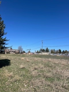

Property Detail
890 N Skyline Dr
RPA00007135420
.70 A NW1/4 SW1/4, SEC 13, T 2N, R 37
Municipalproperty
BONNEVILLE
R2
Idaho
2025
0.70 AC
2025
Idaho South Area
971301
Other Market Areas
3,456 SF
Idaho Falls, ID
NEARBY LISTINGS FOR SALE OR LEASE
DEMOGRAPHICS near 890 N Skyline Dr
1 mile
3 mile
5 mile
2025 Total Population
8,424
45,164
87,105
2030 Population
8,847
47,609
91,888
Pop Growth 2025-2030
+ 5.02%
+ 5.41%
+ 5.49%
Average Age
36
37
38
2025 Total Households
3,167
17,139
31,968
HH Growth 2025-2030
+ 5.15%
+ 5.49%
+ 5.56%
Median Household Inc
$69,849
$64,714
$68,639
Avg Household Size
2.60
2.50
2.60
2025 Avg HH Vehicles
2.00
2.00
2.00
Median Home Value
$314,715
$326,856
$356,220
Median Year Built
1975
1973
1983
Nearby Places
Map Layers
Map Styles
 Street
 Aerial
Layers
 Traffic
 Biking
Places
Listings with unknown addresses are not visible on the map
- Restaurants
- Banks
- Shops
- Fitness
- Groceries
PUBLIC TRANSPORTATION
AIRPORT
Idaho Falls Regional
Drive
Walk
Distance
Idaho Falls Regional
3 min
1.0 mi
Freight Ports
Port of Portland
Drive
Walk
Distance
Port of Portland
738 min
710.3 mi
Nearby Properties
Address
Land Use
TOTAL SIZE
Lot Size
Zoning
Address
Land Use
TOTAL SIZE
Lot Size
Zoning
57,420 SF
8.59 AC
Address
Land Use
TOTAL SIZE
Lot Size
Zoning
37,287 SF
9.46 AC
Address
Land Use
TOTAL SIZE
Lot Size
Zoning
136,343 SF
10 AC
Address
Land Use
TOTAL SIZE
Lot Size
Zoning
253,387 SF
18.33 AC
R2
Address
Land Use
TOTAL SIZE
Lot Size
Zoning
10,324 SF
8.73 AC
Address
Land Use
TOTAL SIZE
Lot Size
Zoning
220,179 SF
22.20 AC
R2
Address
Land Use
TOTAL SIZE
Lot Size
Zoning
111,649 SF
8.60 AC
Address
Land Use
TOTAL SIZE
Lot Size
Zoning
61,948 SF
4.51 AC
Address
Land Use
TOTAL SIZE
Lot Size
Zoning
273,545 SF
15.89 AC
R2
Address
Land Use
TOTAL SIZE
Lot Size
Zoning
27,084 SF
3.69 AC
Address
Land Use
TOTAL SIZE
Lot Size
Zoning
7,617 SF
4.65 AC
Address
Land Use
TOTAL SIZE
Lot Size
Zoning
89,263 SF
3.92 AC
Address
Land Use
TOTAL SIZE
Lot Size
Zoning
25,629 SF
14.42 AC
Address
Land Use
TOTAL SIZE
Lot Size
Zoning
61,715 SF
4.12 AC
Address
Land Use
TOTAL SIZE
Lot Size
Zoning
1,472 SF
4.38 AC
Address
Land Use
TOTAL SIZE
Lot Size
Zoning
98,476 SF
0.66 AC
R2
Address
Land Use
TOTAL SIZE
Lot Size
Zoning
163,776 SF
9.56 AC
R2
Address
Land Use
TOTAL SIZE
Lot Size
Zoning
152,632 SF
7.49 AC
R2
Address
Land Use
TOTAL SIZE
Lot Size
Zoning
91,002 SF
2.70 AC
R2
Address
Land Use
TOTAL SIZE
Lot Size
Zoning
140,391 SF
17.57 AC
R2
Address
Land Use
TOTAL SIZE
Lot Size
Zoning
216 SF
3.58 AC
Address
Land Use
TOTAL SIZE
Lot Size
Zoning
74,398 SF
1.87 AC
Address
Land Use
TOTAL SIZE
Lot Size
Zoning
133,191 SF
12.38 AC
Address
Land Use
TOTAL SIZE
Lot Size
Zoning
33,086 SF
0.30 AC
Address
Land Use
TOTAL SIZE
Lot Size
Zoning
43,783 SF
2.20 AC
R2
Address
Land Use
TOTAL SIZE
Lot Size
Zoning
76,649 SF
3.96 AC
Address
Land Use
TOTAL SIZE
Lot Size
Zoning
115,576 SF
12.08 AC
R2
Address
Land Use
TOTAL SIZE
Lot Size
Zoning
80,922 SF
10 AC
Address
Land Use
TOTAL SIZE
Lot Size
Zoning
58,902 SF
2.17 AC
Address
Land Use
TOTAL SIZE
Lot Size
Zoning
37,223 SF
5.96 AC
R2
The World's #1 Commercial Real Estate Marketplace
Connect with us
© 2026 CoStar Group
The information above has been obtained from sources believed reliable. While we do not doubt its accuracy we have not verified it and make no guarantee, warranty or representation about it. It is your responsibility to independently confirm its accuracy and completeness. Any projections, opinions, assumptions, or estimates used are for example only and do not represent the current or future performance of the property. The value of this transaction to you depends on tax and other factors which should be evaluated by your tax, financial, and legal advisors. You and your advisors should conduct a careful, independent investigation of the property to determine to your satisfaction the suitability of the property for your needs.