Property Record
8900 Broad St Sw, Pataskala, OH 43062
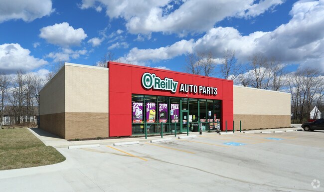

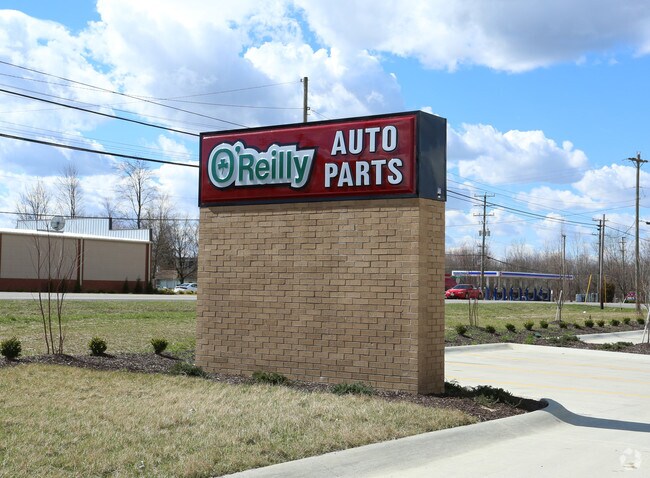
Property Detail
8900 Broad St Sw
063-151380-00.000
RES A SUMMIT RIDGE HTS NO 2 (1.128AC)
Storebuilding
LICKING
B and X Area of moderate flood hazard, usually the area between the limits of the 100-year and 500-year floods.
Ohio
2025
1.13 AC
2025
Licking County
756500
Columbus
7,504 SF
Columbus, OH
NEARBY LISTINGS FOR SALE OR LEASE
DEMOGRAPHICS near 8900 Broad St Sw
1 mile
3 mile
5 mile
2025 Total Population
6,819
59,431
130,270
2030 Population
6,949
61,000
134,124
Pop Growth 2025-2030
+ 1.91%
+ 2.64%
+ 2.96%
Average Age
37
37
39
2025 Total Households
2,565
21,345
48,817
HH Growth 2025-2030
+ 2.03%
+ 2.74%
+ 3.03%
Median Household Inc
$89,772
$89,199
$85,185
Avg Household Size
2.60
2.70
2.60
2025 Avg HH Vehicles
2.00
2.00
2.00
Median Home Value
$259,468
$289,435
$307,306
Median Year Built
2001
1998
1992
Nearby Places
Map Layers
Map Styles
 Street
 Aerial
Layers
 Traffic
 Biking
Places
Listings with unknown addresses are not visible on the map
- Restaurants
- Banks
- Shops
- Fitness
- Groceries
PUBLIC TRANSPORTATION
AIRPORT
John Glenn Columbus International
Drive
Walk
Distance
John Glenn Columbus International
17 min
9.5 mi
Rickenbacker International
Drive
Walk
Distance
Rickenbacker International
27 min
18.5 mi
Freight Ports
Port of Toledo
Drive
Walk
Distance
Port of Toledo
193 min
153.6 mi
Nearby Properties
Address
Land Use
TOTAL SIZE
Lot Size
Zoning
Address
Land Use
TOTAL SIZE
Lot Size
Zoning
2,556 SF
89.32 AC
Address
Land Use
TOTAL SIZE
Lot Size
Zoning
1,430,005 SF
101.26 AC
Address
Land Use
TOTAL SIZE
Lot Size
Zoning
946,400 SF
80.92 AC
Address
Land Use
TOTAL SIZE
Lot Size
Zoning
1,230,350 SF
78.26 AC
Address
Land Use
TOTAL SIZE
Lot Size
Zoning
1,091,997 SF
49.37 AC
Address
Land Use
TOTAL SIZE
Lot Size
Zoning
699,016 SF
43.57 AC
Address
Land Use
TOTAL SIZE
Lot Size
Zoning
Address
Land Use
TOTAL SIZE
Lot Size
Zoning
1,003,816 SF
75.60 AC
Address
Land Use
TOTAL SIZE
Lot Size
Zoning
978,491 SF
72.31 AC
Address
Land Use
TOTAL SIZE
Lot Size
Zoning
756,333 SF
44.37 AC
Address
Land Use
TOTAL SIZE
Lot Size
Zoning
705,707 SF
107.11 AC
Address
Land Use
TOTAL SIZE
Lot Size
Zoning
51,958 SF
48.39 AC
Address
Land Use
TOTAL SIZE
Lot Size
Zoning
60,056 SF
0.22 AC
Address
Land Use
TOTAL SIZE
Lot Size
Zoning
137,136 SF
69.71 AC
Address
Land Use
TOTAL SIZE
Lot Size
Zoning
4,208 SF
15.91 AC
Address
Land Use
TOTAL SIZE
Lot Size
Zoning
303,408 SF
29.74 AC
Address
Land Use
TOTAL SIZE
Lot Size
Zoning
2,594 SF
20.38 AC
Address
Land Use
TOTAL SIZE
Lot Size
Zoning
47.69 AC
Address
Land Use
TOTAL SIZE
Lot Size
Zoning
51,968 SF
22.80 AC
Address
Land Use
TOTAL SIZE
Lot Size
Zoning
82,450 SF
28.27 AC
Address
Land Use
TOTAL SIZE
Lot Size
Zoning
2,171 SF
14.44 AC
Address
Land Use
TOTAL SIZE
Lot Size
Zoning
209,585 SF
24.94 AC
Address
Land Use
TOTAL SIZE
Lot Size
Zoning
53,199 SF
50.28 AC
Address
Land Use
TOTAL SIZE
Lot Size
Zoning
95,576 SF
16 AC
Address
Land Use
TOTAL SIZE
Lot Size
Zoning
29,720 SF
0.23 AC
Address
Land Use
TOTAL SIZE
Lot Size
Zoning
55,327 SF
13.59 AC
Address
Land Use
TOTAL SIZE
Lot Size
Zoning
89.41 AC
Address
Land Use
TOTAL SIZE
Lot Size
Zoning
195,828 SF
25.61 AC
Address
Land Use
TOTAL SIZE
Lot Size
Zoning
119,914 SF
21.65 AC
Address
Land Use
TOTAL SIZE
Lot Size
Zoning
83,892 SF
15.04 AC
The World's #1 Commercial Real Estate Marketplace
Connect with us
© 2026 CoStar Group
The information above has been obtained from sources believed reliable. While we do not doubt its accuracy we have not verified it and make no guarantee, warranty or representation about it. It is your responsibility to independently confirm its accuracy and completeness. Any projections, opinions, assumptions, or estimates used are for example only and do not represent the current or future performance of the property. The value of this transaction to you depends on tax and other factors which should be evaluated by your tax, financial, and legal advisors. You and your advisors should conduct a careful, independent investigation of the property to determine to your satisfaction the suitability of the property for your needs.