Property Record
8900 Mathis Ave, Manassas, VA 20110

Property Detail
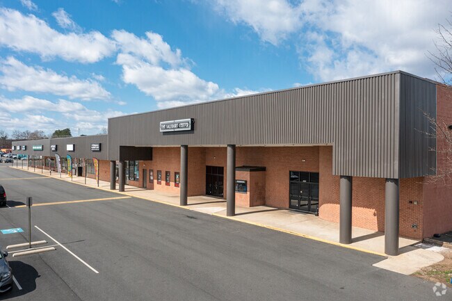
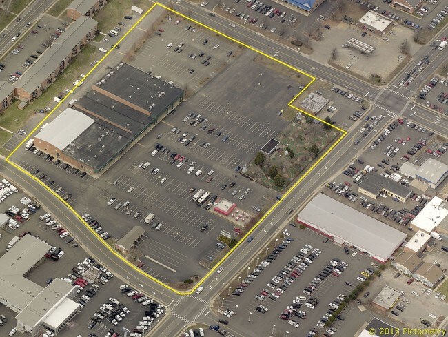
8900 Mathis Ave
Storebuilding
PARCEL G DEER PARK COMMERCIAL
GENERAL CO
Manassas City
B and X Area of moderate flood hazard, usually the area between the limits of the 100-year and 500-year floods.
Virginia
2025
Manassas
2025
Washington, DC
910201
Washington-Arlington-Alexandria, DC-VA-MD-WV
25,725 SF
111-15-00-G
NEARBY LISTINGS FOR SALE OR LEASE
DEMOGRAPHICS near 8900 Mathis Ave
1 mile
3 mile
5 mile
2024 Total Population
17,675
106,401
175,596
2029 Population
17,957
108,288
178,983
Pop Growth 2024-2029
+ 1.60%
+ 1.77%
+ 1.93%
Average Age
37
36
37
2024 Total Households
5,781
32,893
56,181
HH Growth 2024-2029
+ 1.59%
+ 1.77%
+ 1.94%
Median Household Inc
$108,579
$111,887
$117,798
Avg Household Size
3.00
3.10
3.00
2024 Avg HH Vehicles
2.00
2.00
2.00
Median Home Value
$439,533
$459,105
$488,104
Median Year Built
1980
1985
1988
Nearby Places
Map Layers
Map Styles
 Street
 Aerial
Transit
 Traffic
 Biking
Places
Listings with unknown addresses are not visible on the map
- Restaurants
- Banks
- Shops
- Fitness
- Groceries
SALE & LEASE HISTORY
LISTING DATE
SALE/LEASE

May 02, 2017
For Lease
Jul 20, 2020
For Lease
Nearby Properties
Address
Land Use
TOTAL SIZE
Lot Size
Zoning
Address
Land Use
TOTAL SIZE
Lot Size
Zoning
795,191 SF
82.58 AC
M1
Address
Land Use
TOTAL SIZE
Lot Size
Zoning
305,510 SF
22.72 AC
M2
Address
Land Use
TOTAL SIZE
Lot Size
Zoning
269,091 SF
32.31 AC
M2
Address
Land Use
TOTAL SIZE
Lot Size
Zoning
656,797 SF
Address
Land Use
TOTAL SIZE
Lot Size
Zoning
127,000 SF
12.40 AC
M2
Address
Land Use
TOTAL SIZE
Lot Size
Zoning
440,331 SF
61.47 AC
M1
Address
Land Use
TOTAL SIZE
Lot Size
Zoning
409,252 SF
18.75 AC
M2
Address
Land Use
TOTAL SIZE
Lot Size
Zoning
136,228 SF
9.19 AC
M2
Address
Land Use
TOTAL SIZE
Lot Size
Zoning
270,540 SF
13.65 AC
PBD
Address
Land Use
TOTAL SIZE
Lot Size
Zoning
352,401 SF
91.60 AC
M2
Address
Land Use
TOTAL SIZE
Lot Size
Zoning
187,752 SF
20.77 AC
HEAVY INDU
Address
Land Use
TOTAL SIZE
Lot Size
Zoning
51.84 AC
MIXED
Address
Land Use
TOTAL SIZE
Lot Size
Zoning
382,368 SF
18.40 AC
PMR
Address
Land Use
TOTAL SIZE
Lot Size
Zoning
402,295 SF
8.50 AC
A1
Address
Land Use
TOTAL SIZE
Lot Size
Zoning
23.93 AC
PUD
Address
Land Use
TOTAL SIZE
Lot Size
Zoning
203,544 SF
20.90 AC
GENERAL CO
Address
Land Use
TOTAL SIZE
Lot Size
Zoning
243,217 SF
LIGHT INDU
Address
Land Use
TOTAL SIZE
Lot Size
Zoning
529,436 SF
24.63 AC
MIXED
Address
Land Use
TOTAL SIZE
Lot Size
Zoning
10.62 AC
PUD
Address
Land Use
TOTAL SIZE
Lot Size
Zoning
18,128 SF
MULTI-FAMI
Address
Land Use
TOTAL SIZE
Lot Size
Zoning
69,276 SF
18.15 AC
R16
Address
Land Use
TOTAL SIZE
Lot Size
Zoning
406,297 SF
67.08 AC
A1
Address
Land Use
TOTAL SIZE
Lot Size
Zoning
3,621 SF
48.25 AC
A1
Address
Land Use
TOTAL SIZE
Lot Size
Zoning
213,662 SF
22.18 AC
R16
Address
Land Use
TOTAL SIZE
Lot Size
Zoning
198,708 SF
16.21 AC
MULTI-FAMI
Address
Land Use
TOTAL SIZE
Lot Size
Zoning
349,608 SF
60.83 AC
A1
Address
Land Use
TOTAL SIZE
Lot Size
Zoning
49,528 SF
15.34 AC
R16
Address
Land Use
TOTAL SIZE
Lot Size
Zoning
499,912 SF
49.96 AC
B1
Address
Land Use
TOTAL SIZE
Lot Size
Zoning
31,032 SF
15.29 AC
MULTI-FAMI
Address
Land Use
TOTAL SIZE
Lot Size
Zoning
3.49 AC
MU-D
The World's #1 Commercial Real Estate Marketplace
Connect with us
© 2026 CoStar Group
The information above has been obtained from sources believed reliable. While we do not doubt its accuracy we have not verified it and make no guarantee, warranty or representation about it. It is your responsibility to independently confirm its accuracy and completeness. Any projections, opinions, assumptions, or estimates used are for example only and do not represent the current or future performance of the property. The value of this transaction to you depends on tax and other factors which should be evaluated by your tax, financial, and legal advisors. You and your advisors should conduct a careful, independent investigation of the property to determine to your satisfaction the suitability of the property for your needs.