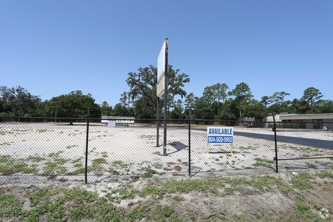
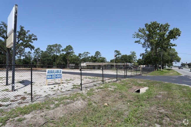
Property Record
8900 Philips Hwy, Jacksonville, FL 32256

NEARBY LISTINGS FOR SALE OR LEASE
Property Detail
8900 Philips Hwy
Jacksonville (Florida)
Section Land
Jacksonville, FL
34-3S-27E 2.99 PT LOT 1 RECD O/R 16694-864
149130-0000
Duval
Shipyard
Florida
2024
1
2025
2.99 AC
016725
Mandarin
840 SF
DEMOGRAPHICS near 8900 Philips Hwy
1 Mile
3 Mile
5 Mile
2024 Total Population
3,342
80,607
178,575
2029 Population
3,574
84,796
187,737
Pop Growth 2024-2029
+ 6.94%
+ 5.20%
+ 5.13%
Average Age
37
40
40
2024 Total Households
1,290
35,318
77,620
HH Growth 2024-2029
+ 6.90%
+ 5.41%
+ 5.28%
Median Household Inc
$82,234
$64,304
$70,879
Avg Household Size
2.60
2.20
2.20
2024 Avg HH Vehicles
2.00
2.00
2.00
Median Home Value
$321,448
$271,512
$286,522
Median Year Built
1994
1987
1992
Nearby Places
Map Layers
Map Styles
 Street
 Aerial
- Restaurants
- Banks
- Shops
- Fitness
- Groceries
PUBLIC TRANSPORTATION
AIRPORT
Jacksonville International
DRIVE
WALK
Distance
Jacksonville International
40 min
26.4 mi
Freight Ports
Jacksonville Port
DRIVE
WALK
Distance
Jacksonville Port
24 min
14.9 mi
Nearby Properties
Address
Land Use
TOTAL SIZE
Lot Size
Zoning
Address
Land Use
TOTAL SIZE
Lot Size
Zoning
1,159,855 SF
89.44 AC
RMD-D
Address
Land Use
TOTAL SIZE
Lot Size
Zoning
1,013,318 SF
131.30 AC
PUD
Address
Land Use
TOTAL SIZE
Lot Size
Zoning
251,691 SF
17.51 AC
PUD
Address
Land Use
TOTAL SIZE
Lot Size
Zoning
810,921 SF
58.85 AC
PUD
Address
Land Use
TOTAL SIZE
Lot Size
Zoning
723,629 SF
18.30 AC
PUD
Address
Land Use
TOTAL SIZE
Lot Size
Zoning
345,678 SF
30.40 AC
PUD
Address
Land Use
TOTAL SIZE
Lot Size
Zoning
223,939 SF
13.28 AC
PUD
Address
Land Use
TOTAL SIZE
Lot Size
Zoning
446,326 SF
23.68 AC
RMD-D
Address
Land Use
TOTAL SIZE
Lot Size
Zoning
464,189 SF
44.85 AC
RMD-D
Address
Land Use
TOTAL SIZE
Lot Size
Zoning
358,537 SF
29.16 AC
RMD-C
Address
Land Use
TOTAL SIZE
Lot Size
Zoning
367,197 SF
42.36 AC
RMD-B
Address
Land Use
TOTAL SIZE
Lot Size
Zoning
266,087 SF
35.07 AC
RMD-D
Address
Land Use
TOTAL SIZE
Lot Size
Zoning
193,941 SF
7.35 AC
PUD
Address
Land Use
TOTAL SIZE
Lot Size
Zoning
325,620 SF
17.76 AC
PUD
Address
Land Use
TOTAL SIZE
Lot Size
Zoning
273,616 SF
34.49 AC
RMD-B
Address
Land Use
TOTAL SIZE
Lot Size
Zoning
307,396 SF
24.45 AC
PUD
Address
Land Use
TOTAL SIZE
Lot Size
Zoning
365,629 SF
23.23 AC
RMD-D
Address
Land Use
TOTAL SIZE
Lot Size
Zoning
348,919 SF
18.08 AC
RMD-D
Address
Land Use
TOTAL SIZE
Lot Size
Zoning
330,037 SF
28.33 AC
RMD-C
Address
Land Use
TOTAL SIZE
Lot Size
Zoning
325,890 SF
25.78 AC
RMD-C
Address
Land Use
TOTAL SIZE
Lot Size
Zoning
236,068 SF
18.87 AC
PUD
Address
Land Use
TOTAL SIZE
Lot Size
Zoning
989 AC
PUD
Address
Land Use
TOTAL SIZE
Lot Size
Zoning
237,625 SF
29.34 AC
RMD-B
Address
Land Use
TOTAL SIZE
Lot Size
Zoning
310,983 SF
16.16 AC
RMD-C
Address
Land Use
TOTAL SIZE
Lot Size
Zoning
236,617 SF
16.38 AC
RMD-D
Address
Land Use
TOTAL SIZE
Lot Size
Zoning
278,282 SF
20.45 AC
RMD-D
Address
Land Use
TOTAL SIZE
Lot Size
Zoning
250,507 SF
26.01 AC
PUD
Address
Land Use
TOTAL SIZE
Lot Size
Zoning
485,498 SF
12.25 AC
PUD
Address
Land Use
TOTAL SIZE
Lot Size
Zoning
169,086 SF
10.01 AC
PUD
Address
Land Use
TOTAL SIZE
Lot Size
Zoning
294,353 SF
14.58 AC
RMD-D
The World's #1 Commercial Real Estate Marketplace
Connect with us
© 2025 CoStar Group
The information above has been obtained from sources believed reliable. While we do not doubt its accuracy we have not verified it and make no guarantee, warranty or representation about it. It is your responsibility to independently confirm its accuracy and completeness. Any projections, opinions, assumptions, or estimates used are for example only and do not represent the current or future performance of the property. The value of this transaction to you depends on tax and other factors which should be evaluated by your tax, financial, and legal advisors. You and your advisors should conduct a careful, independent investigation of the property to determine to your satisfaction the suitability of the property for your needs.