Property Record
8901 Weldon Ave, Saint Louis, MO 63121
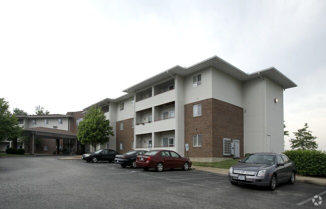

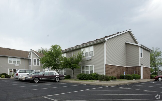
Property Detail
8901 Weldon Ave
13J-21-1322
HERITAGE-DUNBAR LOT 1
Apartment
Saint Louis
7R-2
Missouri
B and X Area of moderate flood hazard, usually the area between the limits of the 100-year and 500-year floods.
1
2024
4.62 AC
2025
Bel-Ridge
213600
St. Louis
52,053 SF
St. Louis, MO-IL
NEARBY LISTINGS FOR SALE OR LEASE
-
-
View all Saint Louis listings for sale on LoopNet.com
DEMOGRAPHICS near 8901 Weldon Ave
1 mile
3 mile
5 mile
2025 Total Population
7,014
92,772
281,756
2030 Population
7,177
94,105
283,500
Pop Growth 2025-2030
+ 2.32%
+ 1.44%
+ 0.62%
Average Age
38
39
40
2025 Total Households
2,962
38,394
118,537
HH Growth 2025-2030
+ 2.77%
+ 1.41%
+ 0.49%
Median Household Inc
$39,725
$46,178
$52,566
Avg Household Size
2.20
2.30
2.30
2025 Avg HH Vehicles
1.00
1.00
1.00
Median Home Value
$94,269
$92,676
$126,217
Median Year Built
1956
1953
1955
Nearby Places
Map Layers
Map Styles
 Street
 Aerial
Transit
 Traffic
 Biking
Places
Listings with unknown addresses are not visible on the map
- Restaurants
- Banks
- Shops
- Fitness
- Groceries
PUBLIC TRANSPORTATION
COMMUTER RAIL
North Hanley (Lambert Airport Shiloh-Scott - St. Louis MetroLink (MetroLink))
Drive
Walk
Distance
North Hanley (Lambert Airport Shiloh-Scott - St. Louis MetroLink (MetroLink))
3 min
7 min
0.3 mi
UM St. Louis South (Lambert Airport Shiloh-Scott - St. Louis MetroLink (MetroLink))
Drive
Walk
Distance
UM St. Louis South (Lambert Airport Shiloh-Scott - St. Louis MetroLink (MetroLink))
5 min
1.9 mi
AIRPORT
St Louis Lambert International
Drive
Walk
Distance
St Louis Lambert International
8 min
3.8 mi
Scott AFB/Midamerica St Louis
Drive
Walk
Distance
Scott AFB/Midamerica St Louis
52 min
34.9 mi
Nearby Properties
Address
Land Use
TOTAL SIZE
Lot Size
Zoning
Address
Land Use
TOTAL SIZE
Lot Size
Zoning
1,770,455 SF
1,090.47 AC
NU
Address
Land Use
TOTAL SIZE
Lot Size
Zoning
72,612 SF
118.34 AC
3INSTU
Address
Land Use
TOTAL SIZE
Lot Size
Zoning
2,640,818 SF
159.97 AC
7M-1
Address
Land Use
TOTAL SIZE
Lot Size
Zoning
378,915 SF
12.16 AC
73C
Address
Land Use
TOTAL SIZE
Lot Size
Zoning
815,658 SF
28.70 AC
M1
Address
Land Use
TOTAL SIZE
Lot Size
Zoning
348,233 SF
23.68 AC
Address
Land Use
TOTAL SIZE
Lot Size
Zoning
42.40 AC
M2
Address
Land Use
TOTAL SIZE
Lot Size
Zoning
309,486 SF
10.73 AC
7M-1
Address
Land Use
TOTAL SIZE
Lot Size
Zoning
231,336 SF
18.88 AC
7M-2
Address
Land Use
TOTAL SIZE
Lot Size
Zoning
136,258 SF
263.16 AC
7M-1
Address
Land Use
TOTAL SIZE
Lot Size
Zoning
277,926 SF
12.61 AC
67C-2
Address
Land Use
TOTAL SIZE
Lot Size
Zoning
14,371 SF
22.26 AC
84R-2
Address
Land Use
TOTAL SIZE
Lot Size
Zoning
18.32 AC
PA
Address
Land Use
TOTAL SIZE
Lot Size
Zoning
151,640 SF
5.38 AC
D
Address
Land Use
TOTAL SIZE
Lot Size
Zoning
0.73 AC
B
Address
Land Use
TOTAL SIZE
Lot Size
Zoning
460,170 SF
152.70 AC
22M-1
Address
Land Use
TOTAL SIZE
Lot Size
Zoning
5,640 SF
10.42 AC
A
Address
Land Use
TOTAL SIZE
Lot Size
Zoning
303,535 SF
16.44 AC
B
Address
Land Use
TOTAL SIZE
Lot Size
Zoning
226,000 SF
34.48 AC
7M-2
Address
Land Use
TOTAL SIZE
Lot Size
Zoning
1,428 SF
131.27 AC
C
Address
Land Use
TOTAL SIZE
Lot Size
Zoning
19.94 AC
39SFR
Address
Land Use
TOTAL SIZE
Lot Size
Zoning
659,138 SF
1,142.84 AC
M1
Address
Land Use
TOTAL SIZE
Lot Size
Zoning
15,149 SF
120.85 AC
A
Address
Land Use
TOTAL SIZE
Lot Size
Zoning
219,310 SF
16.57 AC
61INDUS
Address
Land Use
TOTAL SIZE
Lot Size
Zoning
218,766 SF
13.34 AC
7M-1
Address
Land Use
TOTAL SIZE
Lot Size
Zoning
17.37 AC
B
Address
Land Use
TOTAL SIZE
Lot Size
Zoning
106,957 SF
6.10 AC
C
Address
Land Use
TOTAL SIZE
Lot Size
Zoning
27.96 AC
NU
Address
Land Use
TOTAL SIZE
Lot Size
Zoning
675 SF
20.38 AC
R5
Address
Land Use
TOTAL SIZE
Lot Size
Zoning
494,237 SF
3.56 AC
73PD-C
The World's #1 Commercial Real Estate Marketplace
Connect with us
© 2026 CoStar Group
The information above has been obtained from sources believed reliable. While we do not doubt its accuracy we have not verified it and make no guarantee, warranty or representation about it. It is your responsibility to independently confirm its accuracy and completeness. Any projections, opinions, assumptions, or estimates used are for example only and do not represent the current or future performance of the property. The value of this transaction to you depends on tax and other factors which should be evaluated by your tax, financial, and legal advisors. You and your advisors should conduct a careful, independent investigation of the property to determine to your satisfaction the suitability of the property for your needs.