Property Record
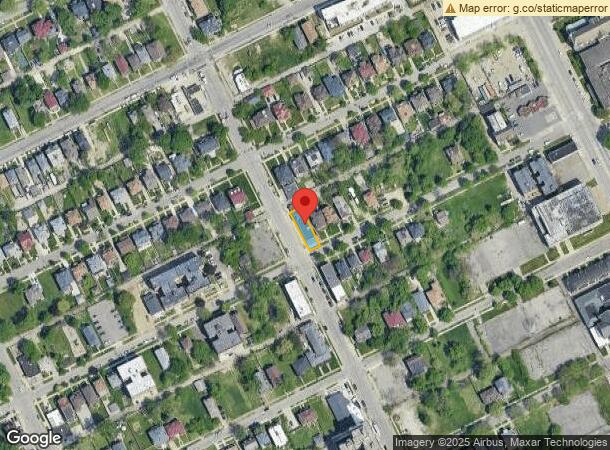
160 Hazelwood St, Detroit, MI 48202


NEARBY LISTINGS FOR SALE OR LEASE
Property Detail
160 Hazelwood St
02-001372
Warners
Storebuilding
N HAZELWOOD 45 WARNERS SUB L13 P93 PLATS, W C R 2/132 36 X 125
X
Wayne
26163C0125E
Michigan
2025
0.10 AC
2025
Detroit W of Woodward
533900
Detroit
4,148 SF
Detroit-Warren-Dearborn, MI
DEMOGRAPHICS near 160 Hazelwood St
1 Mile
3 Mile
5 Mile
2024 Total Population
17,402
151,104
374,622
2029 Population
17,560
151,838
374,519
Pop Growth 2024-2029
+ 0.91%
+ 0.49%
(0.03%)
Average Age
40
37
38
2024 Total Households
8,387
62,084
152,472
HH Growth 2024-2029
+ 0.73%
+ 0.87%
+ 0.11%
Median Household Inc
$35,295
$31,106
$35,023
Avg Household Size
2.00
2.30
2.30
2024 Avg HH Vehicles
1.00
1.00
1.00
Median Home Value
$202,282
$93,062
$85,933
Median Year Built
1946
1947
1948
Nearby Places
Map Layers
Map Styles
 Street
 Aerial
- Restaurants
- Banks
- Shops
- Fitness
- Groceries
PUBLIC TRANSPORTATION
AIRPORT
Windsor International
DRIVE
WALK
Distance
Windsor International
31 min
14.4 mi
Detroit Metro Wayne County
DRIVE
WALK
Distance
Detroit Metro Wayne County
34 min
22.7 mi
Freight Ports
DRIVE
WALK
Distance
80 min
63.5 mi
SALE & LEASE HISTORY
LISTING DATE
SALE/LEASE

Dec 29, 2024
For Sale
Nearby Properties
Address
Land Use
TOTAL SIZE
Lot Size
Zoning
Address
Land Use
TOTAL SIZE
Lot Size
Zoning
1,409,416 SF
13.53 AC
R6
Address
Land Use
TOTAL SIZE
Lot Size
Zoning
873,048 SF
7.70 AC
R6
Address
Land Use
TOTAL SIZE
Lot Size
Zoning
1,017,009 SF
1.35 AC
R6
Address
Land Use
TOTAL SIZE
Lot Size
Zoning
848,598 SF
8.78 AC
SD5
Address
Land Use
TOTAL SIZE
Lot Size
Zoning
252,150 SF
2.46 AC
SD5
Address
Land Use
TOTAL SIZE
Lot Size
Zoning
3,793,609 SF
265.70 AC
M4
Address
Land Use
TOTAL SIZE
Lot Size
Zoning
306,496 SF
1.91 AC
R6
Address
Land Use
TOTAL SIZE
Lot Size
Zoning
328,284 SF
768.89 AC
PD
Address
Land Use
TOTAL SIZE
Lot Size
Zoning
334,904 SF
B5
Address
Land Use
TOTAL SIZE
Lot Size
Zoning
627,489 SF
5.82 AC
B4
Address
Land Use
TOTAL SIZE
Lot Size
Zoning
506,450 SF
3.84 AC
B5
Address
Land Use
TOTAL SIZE
Lot Size
Zoning
596,304 SF
2.57 AC
R6
Address
Land Use
TOTAL SIZE
Lot Size
Zoning
266,016 SF
7.76 AC
PD
Address
Land Use
TOTAL SIZE
Lot Size
Zoning
82,528 SF
6.03 AC
PD
Address
Land Use
TOTAL SIZE
Lot Size
Zoning
475,252 SF
1.74 AC
B4
Address
Land Use
TOTAL SIZE
Lot Size
Zoning
167,000 SF
1.83 AC
PD
Address
Land Use
TOTAL SIZE
Lot Size
Zoning
996,200 SF
2.14 AC
Address
Land Use
TOTAL SIZE
Lot Size
Zoning
332,208 SF
2.72 AC
R6
Address
Land Use
TOTAL SIZE
Lot Size
Zoning
152,232 SF
SD2
Address
Land Use
TOTAL SIZE
Lot Size
Zoning
162,182 SF
SD2
Address
Land Use
TOTAL SIZE
Lot Size
Zoning
147,879 SF
2.05 AC
B6
Address
Land Use
TOTAL SIZE
Lot Size
Zoning
531,360 SF
1.44 AC
B5
Address
Land Use
TOTAL SIZE
Lot Size
Zoning
79,070 SF
0.36 AC
PD
Address
Land Use
TOTAL SIZE
Lot Size
Zoning
389,290 SF
3.78 AC
R6
Address
Land Use
TOTAL SIZE
Lot Size
Zoning
506,404 SF
198 AC
M4
Address
Land Use
TOTAL SIZE
Lot Size
Zoning
78,037 SF
0.35 AC
PD
Address
Land Use
TOTAL SIZE
Lot Size
Zoning
678,539 SF
3.52 AC
B5
Address
Land Use
TOTAL SIZE
Lot Size
Zoning
104,790 SF
0.36 AC
PD
Address
Land Use
TOTAL SIZE
Lot Size
Zoning
65,625 SF
2.70 AC
PD
Address
Land Use
TOTAL SIZE
Lot Size
Zoning
158,535 SF
B4
The World's #1 Commercial Real Estate Marketplace
Connect with us
© 2026 CoStar Group
The information above has been obtained from sources believed reliable. While we do not doubt its accuracy we have not verified it and make no guarantee, warranty or representation about it. It is your responsibility to independently confirm its accuracy and completeness. Any projections, opinions, assumptions, or estimates used are for example only and do not represent the current or future performance of the property. The value of this transaction to you depends on tax and other factors which should be evaluated by your tax, financial, and legal advisors. You and your advisors should conduct a careful, independent investigation of the property to determine to your satisfaction the suitability of the property for your needs.