Property Record
891 N Eagle Rd, Havertown, PA 19083

Property Detail
891 N Eagle Rd
22-01-00335-00
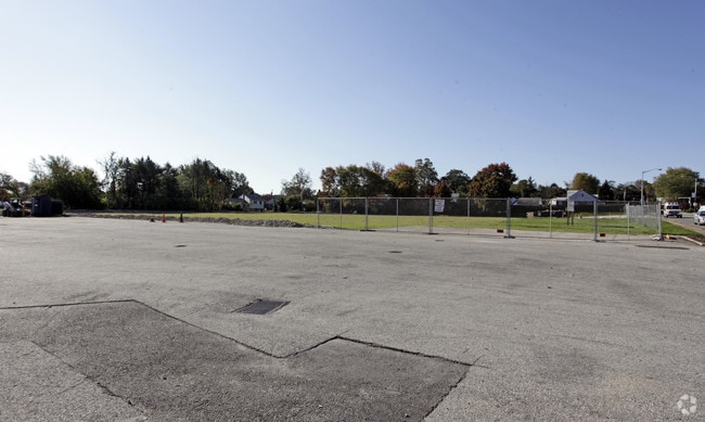
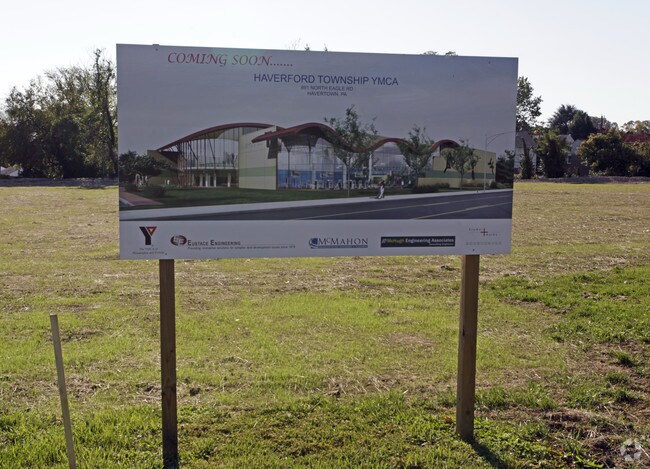
YMCA 3.198 ACRES
Charitableorganization
DELAWARE
B and X Area of moderate flood hazard, usually the area between the limits of the 100-year and 500-year floods.
Pennsylvania
2024
3.20 AC
2025
Delaware County
409200
Philadelphia
114,058 SF
Philadelphia-Camden-Wilmington, PA-NJ-DE-MD
NEARBY LISTINGS FOR SALE OR LEASE
DEMOGRAPHICS near 891 N Eagle Rd
1 mile
3 mile
5 mile
2025 Total Population
20,807
148,370
426,016
2030 Population
20,916
149,753
429,377
Pop Growth 2025-2030
+ 0.52%
+ 0.93%
+ 0.79%
Average Age
40
41
40
2025 Total Households
7,482
55,925
159,555
HH Growth 2025-2030
+ 0.60%
+ 0.95%
+ 0.72%
Median Household Inc
$115,972
$105,486
$81,678
Avg Household Size
2.70
2.50
2.50
2025 Avg HH Vehicles
2.00
2.00
1.00
Median Home Value
$455,666
$427,673
$347,629
Median Year Built
1949
1951
1949
Nearby Places
Map Layers
Map Styles
 Street
 Aerial
Layers
 Traffic
 Biking
Places
Listings with unknown addresses are not visible on the map
- Restaurants
- Banks
- Shops
- Fitness
- Groceries
PUBLIC TRANSPORTATION
COMMUTER RAIL
Ardmore (R5 - Southeastern Pennsylvania Transportation Authority Regional Rail (SEPTA Regional Rail))
Drive
Walk
Distance
Ardmore (R5 - Southeastern Pennsylvania Transportation Authority Regional Rail (SEPTA Regional Rail))
7 min
2.7 mi
Haverford (R5 - Southeastern Pennsylvania Transportation Authority Regional Rail (SEPTA Regional Rail))
Drive
Walk
Distance
Haverford (R5 - Southeastern Pennsylvania Transportation Authority Regional Rail (SEPTA Regional Rail))
8 min
3.1 mi
AIRPORT
Philadelphia International
Drive
Walk
Distance
Philadelphia International
27 min
16.3 mi
Freight Ports
South Jersey Port
Drive
Walk
Distance
South Jersey Port
29 min
14.3 mi
Nearby Properties
Address
Land Use
TOTAL SIZE
Lot Size
Zoning
Address
Land Use
TOTAL SIZE
Lot Size
Zoning
158,496 SF
Address
Land Use
TOTAL SIZE
Lot Size
Zoning
59,126 SF
84.57 AC
Address
Land Use
TOTAL SIZE
Lot Size
Zoning
1,600 SF
177.07 AC
SPPOA
Address
Land Use
TOTAL SIZE
Lot Size
Zoning
1,174,127 SF
2 AC
C1
Address
Land Use
TOTAL SIZE
Lot Size
Zoning
15,660 SF
56.60 AC
Address
Land Use
TOTAL SIZE
Lot Size
Zoning
448,864 SF
32.89 AC
Address
Land Use
TOTAL SIZE
Lot Size
Zoning
479,520 SF
21.26 AC
R1
Address
Land Use
TOTAL SIZE
Lot Size
Zoning
90,784 SF
26.26 AC
Address
Land Use
TOTAL SIZE
Lot Size
Zoning
377,851 SF
19.18 AC
R4
Address
Land Use
TOTAL SIZE
Lot Size
Zoning
112,268 SF
28.27 AC
Address
Land Use
TOTAL SIZE
Lot Size
Zoning
530,525 SF
36.29 AC
R3
Address
Land Use
TOTAL SIZE
Lot Size
Zoning
73,193 SF
37.01 AC
Address
Land Use
TOTAL SIZE
Lot Size
Zoning
82,153 SF
13.97 AC
Address
Land Use
TOTAL SIZE
Lot Size
Zoning
257,405 SF
4.26 AC
C2
Address
Land Use
TOTAL SIZE
Lot Size
Zoning
20,880 SF
27.20 AC
Address
Land Use
TOTAL SIZE
Lot Size
Zoning
321,744 SF
14 AC
C1
Address
Land Use
TOTAL SIZE
Lot Size
Zoning
78,250 SF
34.50 AC
Address
Land Use
TOTAL SIZE
Lot Size
Zoning
30,204 SF
13.75 AC
Address
Land Use
TOTAL SIZE
Lot Size
Zoning
4,350 SF
20 AC
Address
Land Use
TOTAL SIZE
Lot Size
Zoning
261,618 SF
30.57 AC
Address
Land Use
TOTAL SIZE
Lot Size
Zoning
69,420 SF
17.12 AC
Address
Land Use
TOTAL SIZE
Lot Size
Zoning
112,597 SF
6.47 AC
C2
Address
Land Use
TOTAL SIZE
Lot Size
Zoning
338,088 SF
9.82 AC
R7
Address
Land Use
TOTAL SIZE
Lot Size
Zoning
140,820 SF
3.57 AC
RM2
Address
Land Use
TOTAL SIZE
Lot Size
Zoning
272,405 SF
12.62 AC
R7
Address
Land Use
TOTAL SIZE
Lot Size
Zoning
283,058 SF
10.24 AC
R4
Address
Land Use
TOTAL SIZE
Lot Size
Zoning
285,171 SF
12.32 AC
R7
Address
Land Use
TOTAL SIZE
Lot Size
Zoning
Address
Land Use
TOTAL SIZE
Lot Size
Zoning
72,564 SF
24.44 AC
The World's #1 Commercial Real Estate Marketplace
Connect with us
© 2026 CoStar Group
The information above has been obtained from sources believed reliable. While we do not doubt its accuracy we have not verified it and make no guarantee, warranty or representation about it. It is your responsibility to independently confirm its accuracy and completeness. Any projections, opinions, assumptions, or estimates used are for example only and do not represent the current or future performance of the property. The value of this transaction to you depends on tax and other factors which should be evaluated by your tax, financial, and legal advisors. You and your advisors should conduct a careful, independent investigation of the property to determine to your satisfaction the suitability of the property for your needs.