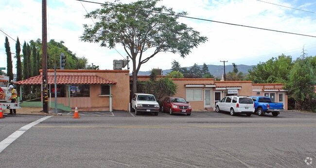
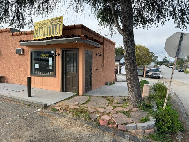
Property Record
891 N Ventura St, Ojai, CA 93023
NEARBY LISTINGS FOR SALE OR LEASE
Property Detail
891 N Ventura St
061-0-047-015
Oak View Home Gardens Subdivision #2
Storebuilding
MAP 14 PG 47 LOT 15,16
X
Ventura
06111C0568F
California
2024
0.22 AC
2025
Ojai/NW County
000901
Los Angeles
2,191 SF
Oxnard-Thousand Oaks-Ventura, CA
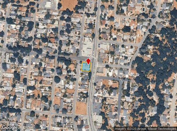
DEMOGRAPHICS near 891 N Ventura St
1 Mile
3 Mile
5 Mile
2024 Total Population
5,048
13,578
23,429
2029 Population
4,965
13,368
23,027
Pop Growth 2024-2029
(1.64%)
(1.55%)
(1.72%)
Average Age
43
45
45
2024 Total Households
1,865
5,161
9,052
HH Growth 2024-2029
(1.82%)
(1.69%)
(1.87%)
Median Household Inc
$97,830
$94,291
$88,498
Avg Household Size
2.70
2.50
2.50
2024 Avg HH Vehicles
3.00
2.00
2.00
Median Home Value
$756,804
$765,029
$775,189
Median Year Built
1964
1966
1966
Nearby Places
Map Layers
Map Styles
 Street
 Aerial
- Restaurants
- Banks
- Shops
- Fitness
- Groceries
PUBLIC TRANSPORTATION
COMMUTER RAIL
DRIVE
WALK
Distance
16 min
9.5 mi
AIRPORT
Santa Barbara Municipal
DRIVE
WALK
Distance
Santa Barbara Municipal
70 min
42.3 mi
SALE & LEASE HISTORY
LISTING DATE
SALE/LEASE

Jun 18, 2024
For Lease
Nearby Properties
Address
Land Use
TOTAL SIZE
Lot Size
Zoning
Address
Land Use
TOTAL SIZE
Lot Size
Zoning
37,790 SF
5.13 AC
RPD-10U
Address
Land Use
TOTAL SIZE
Lot Size
Zoning
4,900 SF
11.01 AC
Address
Land Use
TOTAL SIZE
Lot Size
Zoning
126.17 AC
OS20AC
Address
Land Use
TOTAL SIZE
Lot Size
Zoning
1,440 SF
98.32 AC
AE
Address
Land Use
TOTAL SIZE
Lot Size
Zoning
15,668 SF
1.46 AC
CPD
Address
Land Use
TOTAL SIZE
Lot Size
Zoning
36.15 AC
RA20AC
Address
Land Use
TOTAL SIZE
Lot Size
Zoning
107.07 AC
OS80AC
Address
Land Use
TOTAL SIZE
Lot Size
Zoning
0.67 AC
Address
Land Use
TOTAL SIZE
Lot Size
Zoning
2,257 SF
162.04 AC
Address
Land Use
TOTAL SIZE
Lot Size
Zoning
1,170 SF
106.57 AC
Address
Land Use
TOTAL SIZE
Lot Size
Zoning
36.20 AC
AE
Address
Land Use
TOTAL SIZE
Lot Size
Zoning
3,630 SF
45.17 AC
OS-40
Address
Land Use
TOTAL SIZE
Lot Size
Zoning
83.56 AC
Address
Land Use
TOTAL SIZE
Lot Size
Zoning
3,320 SF
5 AC
RA5AC
Address
Land Use
TOTAL SIZE
Lot Size
Zoning
37,014 SF
1.41 AC
M1
Address
Land Use
TOTAL SIZE
Lot Size
Zoning
8,538 SF
3.84 AC
RE1AC
Address
Land Use
TOTAL SIZE
Lot Size
Zoning
434 SF
0.50 AC
CPD
Address
Land Use
TOTAL SIZE
Lot Size
Zoning
1.20 AC
RPD-4U
Address
Land Use
TOTAL SIZE
Lot Size
Zoning
3,024 SF
328.74 AC
AEA-E/
Address
Land Use
TOTAL SIZE
Lot Size
Zoning
1,050 SF
0.77 AC
CPD
Address
Land Use
TOTAL SIZE
Lot Size
Zoning
3,019 SF
11.28 AC
RE2AC
Address
Land Use
TOTAL SIZE
Lot Size
Zoning
4,862 SF
34.23 AC
OS40AC
Address
Land Use
TOTAL SIZE
Lot Size
Zoning
21.90 AC
Address
Land Use
TOTAL SIZE
Lot Size
Zoning
12,951 SF
1.35 AC
CPD
Address
Land Use
TOTAL SIZE
Lot Size
Zoning
28.69 AC
OS40AC
Address
Land Use
TOTAL SIZE
Lot Size
Zoning
3,349 SF
5.24 AC
AE/SRP
Address
Land Use
TOTAL SIZE
Lot Size
Zoning
0.73 AC
RE20
Address
Land Use
TOTAL SIZE
Lot Size
Zoning
86.87 AC
OS40AC
Address
Land Use
TOTAL SIZE
Lot Size
Zoning
2,118 SF
40 AC
Address
Land Use
TOTAL SIZE
Lot Size
Zoning
91.83 AC
AEA-E/
The World's #1 Commercial Real Estate Marketplace
Connect with us
© 2025 CoStar Group
The information above has been obtained from sources believed reliable. While we do not doubt its accuracy we have not verified it and make no guarantee, warranty or representation about it. It is your responsibility to independently confirm its accuracy and completeness. Any projections, opinions, assumptions, or estimates used are for example only and do not represent the current or future performance of the property. The value of this transaction to you depends on tax and other factors which should be evaluated by your tax, financial, and legal advisors. You and your advisors should conduct a careful, independent investigation of the property to determine to your satisfaction the suitability of the property for your needs.