Property Record
8911 S Union Ave W, Tulsa, OK 74132

NEARBY LISTINGS FOR SALE OR LEASE
Property Detail
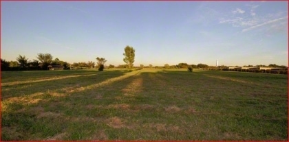
8911 S Union Ave W
Tulsa, OK
Unplatted
98214-82-14-11310
BEG 927.95N SWC SW TH N398 E643.40 SW405.61 W564.20 POB LESS W50 THEREOF FOR ST SEC 14 18 12 5.036ACS
Commercialacreage
Tulsa
X
Oklahoma
40143C0342L
5.04 AC
2025
Southwest
2025
Tulsa
006713
DEMOGRAPHICS near 8911 S Union Ave W
1 Mile
3 Mile
5 Mile
2024 Total Population
2,144
34,091
111,899
2029 Population
2,193
35,232
115,915
Pop Growth 2024-2029
+ 2.29%
+ 3.35%
+ 3.59%
Average Age
37
37
38
2024 Total Households
849
13,824
45,971
HH Growth 2024-2029
+ 2.12%
+ 3.27%
+ 3.60%
Median Household Inc
$88,551
$60,294
$59,041
Avg Household Size
2.50
2.40
2.30
2024 Avg HH Vehicles
2.00
2.00
2.00
Median Home Value
$284,552
$249,460
$228,385
Median Year Built
2005
1992
1981
Nearby Places
Map Layers
Map Styles
 Street
 Aerial
- Restaurants
- Banks
- Shops
- Fitness
- Groceries
PUBLIC TRANSPORTATION
AIRPORT
Tulsa International
DRIVE
WALK
Distance
Tulsa International
26 min
18.1 mi
Freight Ports
Tulsa Port Of Catoosa
DRIVE
WALK
Distance
Tulsa Port Of Catoosa
35 min
25.6 mi
Nearby Properties
Address
Land Use
TOTAL SIZE
Lot Size
Zoning
Address
Land Use
TOTAL SIZE
Lot Size
Zoning
1,584,609 SF
84.41 AC
AG
Address
Land Use
TOTAL SIZE
Lot Size
Zoning
49,344 SF
5.34 AC
CG
Address
Land Use
TOTAL SIZE
Lot Size
Zoning
290,963 SF
10.77 AC
RM1
Address
Land Use
TOTAL SIZE
Lot Size
Zoning
325 SF
44.06 AC
RM2
Address
Land Use
TOTAL SIZE
Lot Size
Zoning
415.28 AC
IL
Address
Land Use
TOTAL SIZE
Lot Size
Zoning
301,267 SF
25.06 AC
IL
Address
Land Use
TOTAL SIZE
Lot Size
Zoning
358,394 SF
38.86 AC
Address
Land Use
TOTAL SIZE
Lot Size
Zoning
15.98 AC
OMH
Address
Land Use
TOTAL SIZE
Lot Size
Zoning
56,984 SF
5.54 AC
RS3
Address
Land Use
TOTAL SIZE
Lot Size
Zoning
30,418 SF
7.86 AC
CM
Address
Land Use
TOTAL SIZE
Lot Size
Zoning
330,521 SF
22.04 AC
PUD
Address
Land Use
TOTAL SIZE
Lot Size
Zoning
31,313 SF
17.95 AC
IL
Address
Land Use
TOTAL SIZE
Lot Size
Zoning
1 SF
11.34 AC
CS
Address
Land Use
TOTAL SIZE
Lot Size
Zoning
35,845 SF
14.38 AC
CS
Address
Land Use
TOTAL SIZE
Lot Size
Zoning
13,691 SF
2.66 AC
CO
Address
Land Use
TOTAL SIZE
Lot Size
Zoning
270,584 SF
28.85 AC
CO
Address
Land Use
TOTAL SIZE
Lot Size
Zoning
8.06 AC
RM2
Address
Land Use
TOTAL SIZE
Lot Size
Zoning
20,286 SF
21.68 AC
AG
Address
Land Use
TOTAL SIZE
Lot Size
Zoning
432 SF
72.60 AC
AG
Address
Land Use
TOTAL SIZE
Lot Size
Zoning
87,304 SF
3.29 AC
CN
Address
Land Use
TOTAL SIZE
Lot Size
Zoning
14,496 SF
100.21 AC
AG
Address
Land Use
TOTAL SIZE
Lot Size
Zoning
137,364 SF
14.65 AC
RS3
Address
Land Use
TOTAL SIZE
Lot Size
Zoning
86,843 SF
8.93 AC
CS
Address
Land Use
TOTAL SIZE
Lot Size
Zoning
300,577 SF
13.74 AC
RM1
Address
Land Use
TOTAL SIZE
Lot Size
Zoning
11,620 SF
4.16 AC
RM2
Address
Land Use
TOTAL SIZE
Lot Size
Zoning
23,269 SF
263.40 AC
NCU
Address
Land Use
TOTAL SIZE
Lot Size
Zoning
136,079 SF
9 AC
CO
Address
Land Use
TOTAL SIZE
Lot Size
Zoning
186,012 SF
9.31 AC
RS3
Address
Land Use
TOTAL SIZE
Lot Size
Zoning
301,395 SF
13.07 AC
CO
Address
Land Use
TOTAL SIZE
Lot Size
Zoning
25,555 SF
17.31 AC
CN
The World's #1 Commercial Real Estate Marketplace
Connect with us
© 2025 CoStar Group
The information above has been obtained from sources believed reliable. While we do not doubt its accuracy we have not verified it and make no guarantee, warranty or representation about it. It is your responsibility to independently confirm its accuracy and completeness. Any projections, opinions, assumptions, or estimates used are for example only and do not represent the current or future performance of the property. The value of this transaction to you depends on tax and other factors which should be evaluated by your tax, financial, and legal advisors. You and your advisors should conduct a careful, independent investigation of the property to determine to your satisfaction the suitability of the property for your needs.