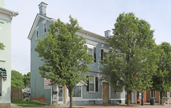
Property Record
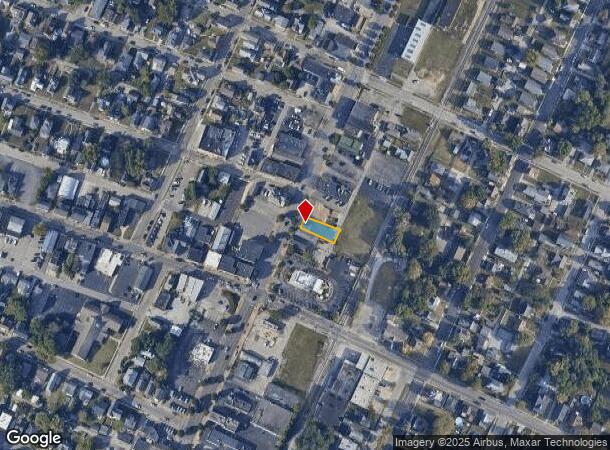
8918 Reading Rd, Cincinnati, OH 45215
NEARBY LISTINGS FOR SALE OR LEASE
Property Detail
8918 Reading Rd
Cincinnati, OH-KY-IN
Olivers 2Ndsub
671-0007-0398
38.67 X 110 PT LOT 38 J H OLIVERS 2NDSUB
Retailwithmorethanonenonretailuse
Hamilton
X
Ohio
39061C0227E
38
2024
0.11 AC
2024
Reading/Roselawn
023201
Cincinnati/Dayton
2,276 SF
DEMOGRAPHICS near 8918 Reading Rd
1 Mile
3 Mile
5 Mile
2024 Total Population
10,274
75,722
201,701
2029 Population
10,189
75,002
199,574
Pop Growth 2024-2029
(0.83%)
(0.95%)
(1.05%)
Average Age
39
41
41
2024 Total Households
4,607
32,707
86,850
HH Growth 2024-2029
(0.93%)
(0.98%)
(1.15%)
Median Household Inc
$55,000
$67,678
$68,357
Avg Household Size
2.20
2.20
2.20
2024 Avg HH Vehicles
2.00
2.00
2.00
Median Home Value
$151,810
$190,696
$205,102
Median Year Built
1953
1956
1957
Nearby Places
Map Layers
Map Styles
 Street
 Aerial
- Restaurants
- Banks
- Shops
- Fitness
- Groceries
PUBLIC TRANSPORTATION
AIRPORT
Cincinnati/Northern Kentucky International
DRIVE
WALK
Distance
Cincinnati/Northern Kentucky International
43 min
25.7 mi
Freight Ports
Port of Toledo
DRIVE
WALK
Distance
Port of Toledo
228 min
195.0 mi
SALE & LEASE HISTORY
LISTING DATE
SALE/LEASE

Jun 27, 2023
For Lease
Dec 27, 2023
For Sale
Nearby Properties
Address
Land Use
TOTAL SIZE
Lot Size
Zoning
Address
Land Use
TOTAL SIZE
Lot Size
Zoning
119.08 AC
R1
Address
Land Use
TOTAL SIZE
Lot Size
Zoning
1,238 SF
14.03 AC
Address
Land Use
TOTAL SIZE
Lot Size
Zoning
29.67 AC
RM20
Address
Land Use
TOTAL SIZE
Lot Size
Zoning
23.45 AC
Address
Land Use
TOTAL SIZE
Lot Size
Zoning
15.61 AC
Address
Land Use
TOTAL SIZE
Lot Size
Zoning
4,599 SF
29.03 AC
R4
Address
Land Use
TOTAL SIZE
Lot Size
Zoning
8,964 SF
11.61 AC
Address
Land Use
TOTAL SIZE
Lot Size
Zoning
330,335 SF
0.80 AC
R3
Address
Land Use
TOTAL SIZE
Lot Size
Zoning
42.41 AC
Address
Land Use
TOTAL SIZE
Lot Size
Zoning
344,923 SF
18.47 AC
RM20
Address
Land Use
TOTAL SIZE
Lot Size
Zoning
210,743 SF
0.35 AC
DD
Address
Land Use
TOTAL SIZE
Lot Size
Zoning
Address
Land Use
TOTAL SIZE
Lot Size
Zoning
Address
Land Use
TOTAL SIZE
Lot Size
Zoning
2.22 AC
Address
Land Use
TOTAL SIZE
Lot Size
Zoning
13,248 SF
24.99 AC
B
Address
Land Use
TOTAL SIZE
Lot Size
Zoning
Address
Land Use
TOTAL SIZE
Lot Size
Zoning
17,758 SF
7 AC
RM20
Address
Land Use
TOTAL SIZE
Lot Size
Zoning
Address
Land Use
TOTAL SIZE
Lot Size
Zoning
14.35 AC
Address
Land Use
TOTAL SIZE
Lot Size
Zoning
8,720 SF
33.28 AC
R3
Address
Land Use
TOTAL SIZE
Lot Size
Zoning
15.95 AC
C
Address
Land Use
TOTAL SIZE
Lot Size
Zoning
23.41 AC
Address
Land Use
TOTAL SIZE
Lot Size
Zoning
4.64 AC
SF20
Address
Land Use
TOTAL SIZE
Lot Size
Zoning
31.98 AC
Address
Land Use
TOTAL SIZE
Lot Size
Zoning
13.43 AC
Address
Land Use
TOTAL SIZE
Lot Size
Zoning
1,942 SF
10.48 AC
R3
Address
Land Use
TOTAL SIZE
Lot Size
Zoning
25.07 AC
R2
Address
Land Use
TOTAL SIZE
Lot Size
Zoning
223,920 SF
9.55 AC
RM20
Address
Land Use
TOTAL SIZE
Lot Size
Zoning
10.36 AC
E
Address
Land Use
TOTAL SIZE
Lot Size
Zoning
The World's #1 Commercial Real Estate Marketplace
Connect with us
© 2026 CoStar Group
The information above has been obtained from sources believed reliable. While we do not doubt its accuracy we have not verified it and make no guarantee, warranty or representation about it. It is your responsibility to independently confirm its accuracy and completeness. Any projections, opinions, assumptions, or estimates used are for example only and do not represent the current or future performance of the property. The value of this transaction to you depends on tax and other factors which should be evaluated by your tax, financial, and legal advisors. You and your advisors should conduct a careful, independent investigation of the property to determine to your satisfaction the suitability of the property for your needs.