Property Record
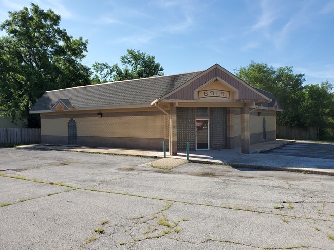
8919 Leavenworth Rd, Kansas City, KS 66109


NEARBY LISTINGS FOR SALE OR LEASE
Property Detail
8919 Leavenworth Rd
Kansas City, MO-KS
Frances Place
184703
FRANCES PLACE, S31, T10, R24, ACRES 0.970000, N 300FT L5 EAST OF 89TH TERRACE
Restaurantbuilding
Wyandotte
X
Kansas
20103C0275G
5
2025
0.94 AC
2025
Kansas City KS
044201
Kansas City
3,671 SF
DEMOGRAPHICS near 8919 Leavenworth Rd
1 Mile
3 Mile
5 Mile
2024 Total Population
2,349
27,505
56,544
2029 Population
2,265
26,689
55,008
Pop Growth 2024-2029
(3.58%)
(2.97%)
(2.72%)
Average Age
42
39
39
2024 Total Households
888
10,323
21,205
HH Growth 2024-2029
(3.72%)
(2.97%)
(2.80%)
Median Household Inc
$90,178
$67,595
$66,923
Avg Household Size
2.50
2.60
2.60
2024 Avg HH Vehicles
2.00
2.00
2.00
Median Home Value
$158,681
$172,763
$173,334
Median Year Built
1963
1971
1972
Nearby Places
Map Layers
Map Styles
 Street
 Aerial
- Restaurants
- Banks
- Shops
- Fitness
- Groceries
PUBLIC TRANSPORTATION
AIRPORT
Kansas City International
DRIVE
WALK
Distance
Kansas City International
30 min
22.4 mi
SALE & LEASE HISTORY
LISTING DATE
SALE/LEASE

Mar 04, 2022
For Lease
Jul 12, 2019
For Sale
Jan 28, 2019
For Sale
Jan 27, 2022
For Sale
Dec 17, 2020
For Sale
Aug 19, 2021
For Lease
Aug 19, 2021
For Sale
Apr 25, 2017
For Sale
Nearby Properties
Address
Land Use
TOTAL SIZE
Lot Size
Zoning
Address
Land Use
TOTAL SIZE
Lot Size
Zoning
123,957 SF
16.88 AC
Address
Land Use
TOTAL SIZE
Lot Size
Zoning
61,159 SF
2.45 AC
Address
Land Use
TOTAL SIZE
Lot Size
Zoning
309,440 SF
120.73 AC
KR1
Address
Land Use
TOTAL SIZE
Lot Size
Zoning
176.36 AC
Address
Land Use
TOTAL SIZE
Lot Size
Zoning
700,029 SF
49.54 AC
Address
Land Use
TOTAL SIZE
Lot Size
Zoning
51,739 SF
46.71 AC
Address
Land Use
TOTAL SIZE
Lot Size
Zoning
37,521 SF
11.77 AC
Address
Land Use
TOTAL SIZE
Lot Size
Zoning
108,385 SF
22.86 AC
KAG
Address
Land Use
TOTAL SIZE
Lot Size
Zoning
75,027 SF
13.51 AC
Address
Land Use
TOTAL SIZE
Lot Size
Zoning
224,020 SF
24.72 AC
KR1
Address
Land Use
TOTAL SIZE
Lot Size
Zoning
1,099,964 SF
115.80 AC
Address
Land Use
TOTAL SIZE
Lot Size
Zoning
212,021 SF
50.16 AC
KAG
Address
Land Use
TOTAL SIZE
Lot Size
Zoning
66.54 AC
Address
Land Use
TOTAL SIZE
Lot Size
Zoning
48,278 SF
14.62 AC
Address
Land Use
TOTAL SIZE
Lot Size
Zoning
54,578 SF
12.01 AC
KR1
Address
Land Use
TOTAL SIZE
Lot Size
Zoning
186,293 SF
63.45 AC
Address
Land Use
TOTAL SIZE
Lot Size
Zoning
139,495 SF
35.01 AC
KR1
Address
Land Use
TOTAL SIZE
Lot Size
Zoning
96,144 SF
38.53 AC
Address
Land Use
TOTAL SIZE
Lot Size
Zoning
437,300 SF
50.66 AC
Address
Land Use
TOTAL SIZE
Lot Size
Zoning
122,784 SF
13.05 AC
Address
Land Use
TOTAL SIZE
Lot Size
Zoning
39,012 SF
13.38 AC
Address
Land Use
TOTAL SIZE
Lot Size
Zoning
116,455 SF
16.49 AC
Address
Land Use
TOTAL SIZE
Lot Size
Zoning
40,016 SF
5.20 AC
Address
Land Use
TOTAL SIZE
Lot Size
Zoning
57,384 SF
18.81 AC
CPO
Address
Land Use
TOTAL SIZE
Lot Size
Zoning
1,036,732 SF
25.08 AC
KC1
Address
Land Use
TOTAL SIZE
Lot Size
Zoning
19,392 SF
2.77 AC
KCP1
Address
Land Use
TOTAL SIZE
Lot Size
Zoning
1,542 SF
48.61 AC
KR1
Address
Land Use
TOTAL SIZE
Lot Size
Zoning
239,205 SF
17.52 AC
Address
Land Use
TOTAL SIZE
Lot Size
Zoning
56.66 AC
KC1
Address
Land Use
TOTAL SIZE
Lot Size
Zoning
15,131 SF
1,502.41 AC
The World's #1 Commercial Real Estate Marketplace
Connect with us
© 2026 CoStar Group
The information above has been obtained from sources believed reliable. While we do not doubt its accuracy we have not verified it and make no guarantee, warranty or representation about it. It is your responsibility to independently confirm its accuracy and completeness. Any projections, opinions, assumptions, or estimates used are for example only and do not represent the current or future performance of the property. The value of this transaction to you depends on tax and other factors which should be evaluated by your tax, financial, and legal advisors. You and your advisors should conduct a careful, independent investigation of the property to determine to your satisfaction the suitability of the property for your needs.