Property Record
892-896 County Road 10 Ne, Minneapolis, MN 55434

NEARBY LISTINGS FOR SALE OR LEASE
Property Detail
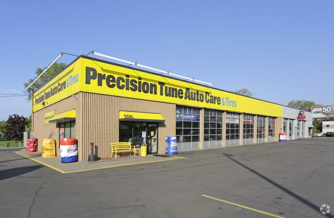
892-896 County Road 10 Ne
Minneapolis-St. Paul-Bloomington, MN-WI
Park Manor Unit 3 Blks 8 9 10
02-30-24-11-0079
LOT 3 BLOCK 8 PARK MANOR UNIT 3 BLKS 8 9 10, SUBJ TO EASE OF REC
Commercialacreage
Anoka
X
Minnesota
27053C0250F
3
2025
0.18 AC
2025
Northtown
051102
Minneapolis/St Paul
DEMOGRAPHICS near 892-896 County Road 10 Ne
1 Mile
3 Mile
5 Mile
2024 Total Population
8,401
71,296
216,695
2029 Population
8,721
72,782
220,173
Pop Growth 2024-2029
+ 3.81%
+ 2.08%
+ 1.61%
Average Age
42
40
39
2024 Total Households
3,421
27,411
80,462
HH Growth 2024-2029
+ 3.86%
+ 2.12%
+ 1.69%
Median Household Inc
$75,285
$76,180
$80,871
Avg Household Size
2.40
2.50
2.60
2024 Avg HH Vehicles
2.00
2.00
2.00
Median Home Value
$252,358
$255,459
$266,290
Median Year Built
1966
1976
1979
Nearby Places
Map Layers
Map Styles
 Street
 Aerial
- Restaurants
- Banks
- Shops
- Fitness
- Groceries
PUBLIC TRANSPORTATION
COMMUTER RAIL
Fridley Station (Northstar Corridor - Northstar Commuter Rail)
DRIVE
WALK
Distance
Fridley Station (Northstar Corridor - Northstar Commuter Rail)
9 min
4.7 mi
Coon Rapids-Riverdale Station (Northstar Corridor - Northstar Commuter Rail)
DRIVE
WALK
Distance
Coon Rapids-Riverdale Station (Northstar Corridor - Northstar Commuter Rail)
12 min
8.2 mi
AIRPORT
Minneapolis-St Paul International/Wold-Chamberlain
DRIVE
WALK
Distance
Minneapolis-St Paul International/Wold-Chamberlain
37 min
22.7 mi
Freight Ports
Port Milwaukee
DRIVE
WALK
Distance
Port Milwaukee
382 min
344.9 mi
Nearby Properties
Address
Land Use
TOTAL SIZE
Lot Size
Zoning
Address
Land Use
TOTAL SIZE
Lot Size
Zoning
2,443,869 SF
31.79 AC
Address
Land Use
TOTAL SIZE
Lot Size
Zoning
47,727 SF
17.03 AC
Address
Land Use
TOTAL SIZE
Lot Size
Zoning
100,260 SF
74.82 AC
Address
Land Use
TOTAL SIZE
Lot Size
Zoning
35,488 SF
39.07 AC
Address
Land Use
TOTAL SIZE
Lot Size
Zoning
Address
Land Use
TOTAL SIZE
Lot Size
Zoning
663,908 SF
109.91 AC
Address
Land Use
TOTAL SIZE
Lot Size
Zoning
417,810 SF
20.60 AC
Address
Land Use
TOTAL SIZE
Lot Size
Zoning
33,060 SF
20.14 AC
Address
Land Use
TOTAL SIZE
Lot Size
Zoning
66,342 SF
8.85 AC
Address
Land Use
TOTAL SIZE
Lot Size
Zoning
229,420 SF
4.14 AC
Address
Land Use
TOTAL SIZE
Lot Size
Zoning
214,300 SF
9.15 AC
Address
Land Use
TOTAL SIZE
Lot Size
Zoning
539,671 SF
26.93 AC
Address
Land Use
TOTAL SIZE
Lot Size
Zoning
13,588 SF
129.03 AC
Address
Land Use
TOTAL SIZE
Lot Size
Zoning
8,400 SF
10.10 AC
Address
Land Use
TOTAL SIZE
Lot Size
Zoning
Address
Land Use
TOTAL SIZE
Lot Size
Zoning
12.37 AC
Address
Land Use
TOTAL SIZE
Lot Size
Zoning
208 SF
228 AC
Address
Land Use
TOTAL SIZE
Lot Size
Zoning
194,221 SF
27.83 AC
Address
Land Use
TOTAL SIZE
Lot Size
Zoning
14,908 SF
28.38 AC
Address
Land Use
TOTAL SIZE
Lot Size
Zoning
342,686 SF
13.60 AC
Address
Land Use
TOTAL SIZE
Lot Size
Zoning
105,324 SF
13.36 AC
Address
Land Use
TOTAL SIZE
Lot Size
Zoning
186,928 SF
4.07 AC
Address
Land Use
TOTAL SIZE
Lot Size
Zoning
196 SF
9.81 AC
Address
Land Use
TOTAL SIZE
Lot Size
Zoning
169,628 SF
2.67 AC
Address
Land Use
TOTAL SIZE
Lot Size
Zoning
368,545 SF
18.09 AC
Address
Land Use
TOTAL SIZE
Lot Size
Zoning
122,498 SF
31.67 AC
Address
Land Use
TOTAL SIZE
Lot Size
Zoning
262,452 SF
Address
Land Use
TOTAL SIZE
Lot Size
Zoning
121,740 SF
9.40 AC
Address
Land Use
TOTAL SIZE
Lot Size
Zoning
286,519 SF
24.51 AC
Address
Land Use
TOTAL SIZE
Lot Size
Zoning
287,568 SF
8.01 AC
The World's #1 Commercial Real Estate Marketplace
Connect with us
© 2026 CoStar Group
The information above has been obtained from sources believed reliable. While we do not doubt its accuracy we have not verified it and make no guarantee, warranty or representation about it. It is your responsibility to independently confirm its accuracy and completeness. Any projections, opinions, assumptions, or estimates used are for example only and do not represent the current or future performance of the property. The value of this transaction to you depends on tax and other factors which should be evaluated by your tax, financial, and legal advisors. You and your advisors should conduct a careful, independent investigation of the property to determine to your satisfaction the suitability of the property for your needs.