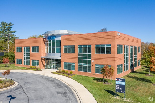
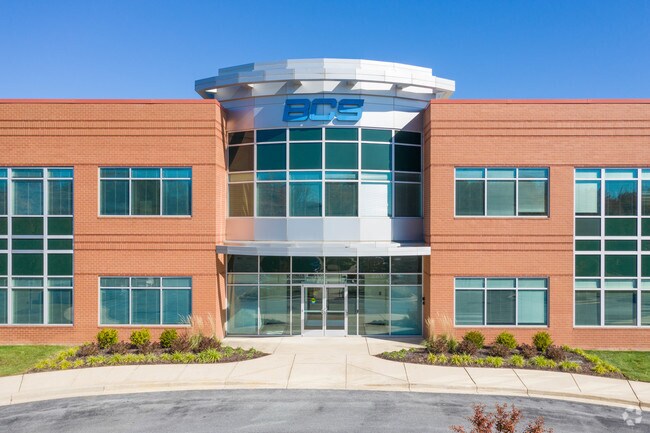
Property Record
8920 Stephens Rd, Laurel, MD 20723


Property Detail
8920 Stephens Rd
06-572189
PAR A 2.834 A 8920 STEPHENS RD REVITZ PROPERTY REVISION
Officebuilding
Howard
PEC
Maryland
B and X Area of moderate flood hazard, usually the area between the limits of the 100-year and 500-year floods.
a
2024
2.83 AC
2025
Columbia South
606907
Baltimore
30,260 SF
Baltimore-Columbia-Towson, MD
NEARBY LISTINGS FOR SALE OR LEASE
DEMOGRAPHICS near 8920 Stephens Rd
1 mile
3 mile
5 mile
2024 Total Population
16,829
92,001
187,818
2029 Population
17,035
93,223
190,820
Pop Growth 2024-2029
+ 1.22%
+ 1.33%
+ 1.60%
Average Age
37
38
38
2024 Total Households
5,765
33,962
68,129
HH Growth 2024-2029
+ 1.16%
+ 1.34%
+ 1.52%
Median Household Inc
$114,830
$110,858
$114,373
Avg Household Size
2.80
2.70
2.70
2024 Avg HH Vehicles
2.00
2.00
2.00
Median Home Value
$444,046
$442,341
$465,538
Median Year Built
1990
1985
1987
Nearby Places
Map Layers
Map Styles
 Street
 Aerial
Transit
 Traffic
 Biking
Places
Listings with unknown addresses are not visible on the map
- Restaurants
- Banks
- Shops
- Fitness
- Groceries
PUBLIC TRANSPORTATION
COMMUTER RAIL
Drive
Walk
Distance
7 min
2.3 mi
Drive
Walk
Distance
7 min
2.4 mi
AIRPORT
Baltimore/Washington International Thurgood Marshall
Drive
Walk
Distance
Baltimore/Washington International Thurgood Marshall
24 min
16.9 mi
Ronald Reagan Washington Ntl
Drive
Walk
Distance
Ronald Reagan Washington Ntl
45 min
26.9 mi
Washington Dulles International
Drive
Walk
Distance
Washington Dulles International
66 min
44.0 mi
Freight Ports
Port of Baltimore
Drive
Walk
Distance
Port of Baltimore
28 min
19.5 mi
SALE & LEASE HISTORY
LISTING DATE
SALE/LEASE

Sep 24, 2016
For Sale
Sep 10, 2018
For Lease
Oct 07, 2019
For Sale
Jun 28, 2017
For Lease
Jun 28, 2017
For Sale
Jul 23, 2019
For Lease
Jul 11, 2023
For Sale
Nearby Properties
Address
Land Use
TOTAL SIZE
Lot Size
Zoning
Address
Land Use
TOTAL SIZE
Lot Size
Zoning
238,700 SF
7.43 AC
TOD
Address
Land Use
TOTAL SIZE
Lot Size
Zoning
399,715 SF
23.04 AC
LAUR
Address
Land Use
TOTAL SIZE
Lot Size
Zoning
657,100 SF
7.39 AC
LAUR
Address
Land Use
TOTAL SIZE
Lot Size
Zoning
279,320 SF
15.25 AC
R15
Address
Land Use
TOTAL SIZE
Lot Size
Zoning
14.84 AC
R-15
Address
Land Use
TOTAL SIZE
Lot Size
Zoning
165,236 SF
5.24 AC
LAUR
Address
Land Use
TOTAL SIZE
Lot Size
Zoning
379,264 SF
23.08 AC
LAUR
Address
Land Use
TOTAL SIZE
Lot Size
Zoning
539,758 SF
48.32 AC
M1
Address
Land Use
TOTAL SIZE
Lot Size
Zoning
16,016 SF
19.95 AC
RA15
Address
Land Use
TOTAL SIZE
Lot Size
Zoning
12,936 SF
19.50 AC
RA15
Address
Land Use
TOTAL SIZE
Lot Size
Zoning
302,887 SF
24.96 AC
LAUR
Address
Land Use
TOTAL SIZE
Lot Size
Zoning
364,609 SF
8.57 AC
R22
Address
Land Use
TOTAL SIZE
Lot Size
Zoning
291,250 SF
30.09 AC
CECLI
Address
Land Use
TOTAL SIZE
Lot Size
Zoning
149,990 SF
10.41 AC
PEC
Address
Land Use
TOTAL SIZE
Lot Size
Zoning
91,666 SF
39.10 AC
RED
Address
Land Use
TOTAL SIZE
Lot Size
Zoning
149,990 SF
9.70 AC
PEC
Address
Land Use
TOTAL SIZE
Lot Size
Zoning
6,201 SF
71.87 AC
M 2
Address
Land Use
TOTAL SIZE
Lot Size
Zoning
304,575 SF
33.71 AC
TOD
Address
Land Use
TOTAL SIZE
Lot Size
Zoning
13,624 SF
17.08 AC
RA15
Address
Land Use
TOTAL SIZE
Lot Size
Zoning
155,446 SF
10.76 AC
PEC
Address
Land Use
TOTAL SIZE
Lot Size
Zoning
242,910 SF
32.60 AC
NT
Address
Land Use
TOTAL SIZE
Lot Size
Zoning
489,896 SF
73.65 AC
M2
Address
Land Use
TOTAL SIZE
Lot Size
Zoning
56,148 SF
8.24 AC
PEC
Address
Land Use
TOTAL SIZE
Lot Size
Zoning
149,990 SF
6.40 AC
PEC
Address
Land Use
TOTAL SIZE
Lot Size
Zoning
61,198 SF
10.10 AC
PEC
Address
Land Use
TOTAL SIZE
Lot Size
Zoning
10.52 AC
RMF20
Address
Land Use
TOTAL SIZE
Lot Size
Zoning
110,336 SF
41.82 AC
PECMX
Address
Land Use
TOTAL SIZE
Lot Size
Zoning
126,078 SF
10.57 AC
W2
Address
Land Use
TOTAL SIZE
Lot Size
Zoning
63,896 SF
229.19 AC
W1B
Address
Land Use
TOTAL SIZE
Lot Size
Zoning
12,786 SF
12 AC
RA15
The World's #1 Commercial Real Estate Marketplace
Connect with us
© 2026 CoStar Group
The information above has been obtained from sources believed reliable. While we do not doubt its accuracy we have not verified it and make no guarantee, warranty or representation about it. It is your responsibility to independently confirm its accuracy and completeness. Any projections, opinions, assumptions, or estimates used are for example only and do not represent the current or future performance of the property. The value of this transaction to you depends on tax and other factors which should be evaluated by your tax, financial, and legal advisors. You and your advisors should conduct a careful, independent investigation of the property to determine to your satisfaction the suitability of the property for your needs.