Property Record
8920 Tabler Rd, Morris, IL 60450
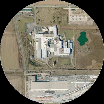
Property Detail
8920 Tabler Rd
Chicago-Naperville-Elgin, IL-IN
W16.5' NE LYG N OF COM ED CO ROW (EX PT LYG IN FOL DESC TR: PT N1/2 SEC BEG 2448.22'W & 59.45'S NE COR NE, S354.52' SW21.21'
03-21-200-013
Grundy
Industrialgeneral
Illinois
B and X Area of moderate flood hazard, usually the area between the limits of the 100-year and 500-year floods.
29.48 AC
2024
Grundy County
2024
Chicago
000300
NEARBY LISTINGS FOR SALE OR LEASE
DEMOGRAPHICS near 8920 Tabler Rd
1 mile
3 mile
5 mile
2025 Total Population
281
9,125
25,866
2030 Population
287
9,324
26,431
Pop Growth 2025-2030
+ 2.14%
+ 2.18%
+ 2.18%
Average Age
39
35
37
2025 Total Households
98
3,000
8,598
HH Growth 2025-2030
+ 2.04%
+ 2.13%
+ 2.17%
Median Household Inc
$112,500
$111,081
$114,833
Avg Household Size
2.80
3.00
3.00
2025 Avg HH Vehicles
3.00
2.00
2.00
Median Home Value
$286,666
$289,044
$317,599
Median Year Built
2001
2004
2001
Nearby Places
Map Layers
Map Styles
 Street
 Aerial
Layers
 Traffic
 Biking
Places
Listings with unknown addresses are not visible on the map
- Restaurants
- Banks
- Shops
- Fitness
- Groceries
Nearby Properties
Address
Land Use
TOTAL SIZE
Lot Size
Zoning
Address
Land Use
TOTAL SIZE
Lot Size
Zoning
1,920 SF
119.06 AC
Address
Land Use
TOTAL SIZE
Lot Size
Zoning
138.51 AC
Address
Land Use
TOTAL SIZE
Lot Size
Zoning
132.70 AC
Address
Land Use
TOTAL SIZE
Lot Size
Zoning
79.57 AC
Address
Land Use
TOTAL SIZE
Lot Size
Zoning
364 SF
48.93 AC
Address
Land Use
TOTAL SIZE
Lot Size
Zoning
64.23 AC
Address
Land Use
TOTAL SIZE
Lot Size
Zoning
Address
Land Use
TOTAL SIZE
Lot Size
Zoning
160 AC
Address
Land Use
TOTAL SIZE
Lot Size
Zoning
1,034,100 SF
54.99 AC
Address
Land Use
TOTAL SIZE
Lot Size
Zoning
15,600 SF
7.60 AC
Address
Land Use
TOTAL SIZE
Lot Size
Zoning
43.43 AC
Address
Land Use
TOTAL SIZE
Lot Size
Zoning
598,380 SF
32.69 AC
Address
Land Use
TOTAL SIZE
Lot Size
Zoning
306,240 SF
19.99 AC
Address
Land Use
TOTAL SIZE
Lot Size
Zoning
160 AC
Address
Land Use
TOTAL SIZE
Lot Size
Zoning
160 AC
Address
Land Use
TOTAL SIZE
Lot Size
Zoning
22.27 AC
Address
Land Use
TOTAL SIZE
Lot Size
Zoning
Address
Land Use
TOTAL SIZE
Lot Size
Zoning
134,300 SF
18.29 AC
Address
Land Use
TOTAL SIZE
Lot Size
Zoning
24.22 AC
Address
Land Use
TOTAL SIZE
Lot Size
Zoning
160 AC
Address
Land Use
TOTAL SIZE
Lot Size
Zoning
60,804 SF
7.29 AC
Address
Land Use
TOTAL SIZE
Lot Size
Zoning
77,000 SF
7.43 AC
Address
Land Use
TOTAL SIZE
Lot Size
Zoning
13.80 AC
Address
Land Use
TOTAL SIZE
Lot Size
Zoning
3,360 SF
43.42 AC
Address
Land Use
TOTAL SIZE
Lot Size
Zoning
59,138 SF
3.19 AC
Address
Land Use
TOTAL SIZE
Lot Size
Zoning
1.50 AC
Address
Land Use
TOTAL SIZE
Lot Size
Zoning
56.84 AC
Address
Land Use
TOTAL SIZE
Lot Size
Zoning
127.41 AC
The World's #1 Commercial Real Estate Marketplace
Connect with us
© 2026 CoStar Group
The information above has been obtained from sources believed reliable. While we do not doubt its accuracy we have not verified it and make no guarantee, warranty or representation about it. It is your responsibility to independently confirm its accuracy and completeness. Any projections, opinions, assumptions, or estimates used are for example only and do not represent the current or future performance of the property. The value of this transaction to you depends on tax and other factors which should be evaluated by your tax, financial, and legal advisors. You and your advisors should conduct a careful, independent investigation of the property to determine to your satisfaction the suitability of the property for your needs.