Property Record
8923 E Euclid Ave, Spokane, WA 99212


Save to a Folder
{{folder.Name}}
{{folder.ListingIds.length}} Properties
{{folder.ListingIds.length}} Property
Create a New Folder
Property Detail
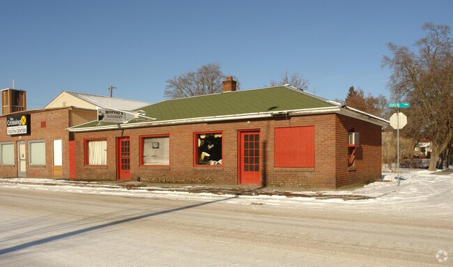
8923 E Euclid Ave
45064.2403
PRIOR REF
Financialbuilding
Spokane
C-2
Washington
B and X Area of moderate flood hazard, usually the area between the limits of the 100-year and 500-year floods.
c
2026
0.09 AC
2026
Valley
011600
Spokane
1,109 SF
Spokane-Spokane Valley, WA
NEARBY LISTINGS FOR SALE OR LEASE
DEMOGRAPHICS near 8923 E Euclid Ave
1 mile
3 mile
5 mile
2025 Total Population
7,523
53,321
143,044
2030 Population
7,601
54,337
145,656
Pop Growth 2025-2030
+ 1.04%
+ 1.91%
+ 1.83%
Average Age
42
40
40
2025 Total Households
3,172
22,186
56,956
HH Growth 2025-2030
+ 0.85%
+ 1.88%
+ 1.81%
Median Household Inc
$77,786
$67,561
$69,088
Avg Household Size
2.30
2.30
2.40
2025 Avg HH Vehicles
2.00
2.00
2.00
Median Home Value
$402,708
$369,528
$368,810
Median Year Built
1966
1978
1975
Nearby Places
Map Layers
Map Styles
 Street
 Aerial
Layers
 Traffic
 Biking
Places
Listings with unknown addresses are not visible on the map
- Restaurants
- Banks
- Shops
- Fitness
- Groceries
PUBLIC TRANSPORTATION
COMMUTER RAIL
Drive
Walk
Distance
14 min
7.9 mi
AIRPORT
Spokane International
Drive
Walk
Distance
Spokane International
21 min
13.8 mi
Nearby Properties
Address
Land Use
TOTAL SIZE
Lot Size
Zoning
Address
Land Use
TOTAL SIZE
Lot Size
Zoning
361,310 SF
35.83 AC
I-2
Address
Land Use
TOTAL SIZE
Lot Size
Zoning
248,117 SF
13.42 AC
MF-2
Address
Land Use
TOTAL SIZE
Lot Size
Zoning
378,750 SF
17.38 AC
R-2
Address
Land Use
TOTAL SIZE
Lot Size
Zoning
320,056 SF
13.64 AC
MF-2
Address
Land Use
TOTAL SIZE
Lot Size
Zoning
161,130 SF
6.45 AC
GO
Address
Land Use
TOTAL SIZE
Lot Size
Zoning
84,600 SF
17.95 AC
MF-1
Address
Land Use
TOTAL SIZE
Lot Size
Zoning
136,518 SF
7.96 AC
O
Address
Land Use
TOTAL SIZE
Lot Size
Zoning
204,727 SF
8.60 AC
MUC
Address
Land Use
TOTAL SIZE
Lot Size
Zoning
87,848 SF
7.36 AC
MF-2
Address
Land Use
TOTAL SIZE
Lot Size
Zoning
150,944 SF
12.16 AC
MF-2
Address
Land Use
TOTAL SIZE
Lot Size
Zoning
61,059 SF
54.20 AC
P/OS
Address
Land Use
TOTAL SIZE
Lot Size
Zoning
96,424 SF
9.04 AC
I-1
Address
Land Use
TOTAL SIZE
Lot Size
Zoning
141,372 SF
10.67 AC
MF-2
Address
Land Use
TOTAL SIZE
Lot Size
Zoning
153,262 SF
7.89 AC
MF-2
Address
Land Use
TOTAL SIZE
Lot Size
Zoning
47,612 SF
3.38 AC
CMU
Address
Land Use
TOTAL SIZE
Lot Size
Zoning
81,746 SF
6 AC
Address
Land Use
TOTAL SIZE
Lot Size
Zoning
87,989 SF
5.38 AC
MF-2
Address
Land Use
TOTAL SIZE
Lot Size
Zoning
89,357 SF
5.83 AC
MDR
Address
Land Use
TOTAL SIZE
Lot Size
Zoning
117,680 SF
9.26 AC
MF-2
Address
Land Use
TOTAL SIZE
Lot Size
Zoning
76,190 SF
4.03 AC
MUC
Address
Land Use
TOTAL SIZE
Lot Size
Zoning
118,060 SF
6.17 AC
MUC
Address
Land Use
TOTAL SIZE
Lot Size
Zoning
418,875 SF
18.79 AC
I-1
Address
Land Use
TOTAL SIZE
Lot Size
Zoning
123,938 SF
7.70 AC
MF-2
Address
Land Use
TOTAL SIZE
Lot Size
Zoning
139,164 SF
5.62 AC
MUC
Address
Land Use
TOTAL SIZE
Lot Size
Zoning
134,116 SF
5.89 AC
HDR
Address
Land Use
TOTAL SIZE
Lot Size
Zoning
107,419 SF
7.82 AC
MF-2
Address
Land Use
TOTAL SIZE
Lot Size
Zoning
21,502 SF
4.68 AC
GO
Address
Land Use
TOTAL SIZE
Lot Size
Zoning
118,810 SF
11.23 AC
MUC
Address
Land Use
TOTAL SIZE
Lot Size
Zoning
107,242 SF
8.90 AC
I-1
Address
Land Use
TOTAL SIZE
Lot Size
Zoning
38,889 SF
114.18 AC
LI
The World's #1 Commercial Real Estate Marketplace
Connect with us
© 2026 CoStar Group
The information above has been obtained from sources believed reliable. While we do not doubt its accuracy we have not verified it and make no guarantee, warranty or representation about it. It is your responsibility to independently confirm its accuracy and completeness. Any projections, opinions, assumptions, or estimates used are for example only and do not represent the current or future performance of the property. The value of this transaction to you depends on tax and other factors which should be evaluated by your tax, financial, and legal advisors. You and your advisors should conduct a careful, independent investigation of the property to determine to your satisfaction the suitability of the property for your needs.