Property Record
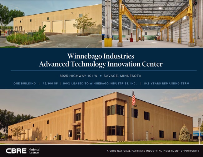
8925 Highway 101 W, Savage, MN 55378


NEARBY LISTINGS FOR SALE OR LEASE
Property Detail
8925 Highway 101 W
Minneapolis/St Paul
Sampson Addn
Minneapolis-St. Paul-Bloomington, MN-WI
BLOCK 001 LOT 001 SAMPSON ADDN
26-476-001-0
Scott
Manufacturinglight
Minnesota
2025
1
2025
2.88 AC
080201
Southwest
45,161 SF
DEMOGRAPHICS near 8925 Highway 101 W
1 Mile
3 Mile
5 Mile
2024 Total Population
1,981
44,358
134,580
2029 Population
2,117
45,909
138,187
Pop Growth 2024-2029
+ 6.87%
+ 3.50%
+ 2.68%
Average Age
37
40
40
2024 Total Households
678
16,564
49,986
HH Growth 2024-2029
+ 7.23%
+ 3.23%
+ 2.44%
Median Household Inc
$114,719
$110,347
$108,963
Avg Household Size
2.90
2.60
2.60
2024 Avg HH Vehicles
3.00
2.00
2.00
Median Home Value
$379,031
$381,478
$367,880
Median Year Built
2000
1990
1987
Nearby Places
Map Layers
Map Styles
 Street
 Aerial
- Restaurants
- Banks
- Shops
- Fitness
- Groceries
PUBLIC TRANSPORTATION
AIRPORT
Minneapolis-St Paul International/Wold-Chamberlain
DRIVE
WALK
Distance
Minneapolis-St Paul International/Wold-Chamberlain
27 min
17.3 mi
SALE & LEASE HISTORY
LISTING DATE
SALE/LEASE

May 19, 2022
For Sale
May 09, 2017
For Lease
Jun 28, 2022
For Lease
Apr 01, 2024
For Sale
Nearby Properties
Address
Land Use
TOTAL SIZE
Lot Size
Zoning
Address
Land Use
TOTAL SIZE
Lot Size
Zoning
378,396 SF
20.25 AC
Address
Land Use
TOTAL SIZE
Lot Size
Zoning
114,152 SF
18.42 AC
Address
Land Use
TOTAL SIZE
Lot Size
Zoning
38.59 AC
Address
Land Use
TOTAL SIZE
Lot Size
Zoning
581,195 SF
37 AC
Address
Land Use
TOTAL SIZE
Lot Size
Zoning
26.13 AC
Address
Land Use
TOTAL SIZE
Lot Size
Zoning
184,747 SF
8.44 AC
Address
Land Use
TOTAL SIZE
Lot Size
Zoning
45,147 SF
11.24 AC
Address
Land Use
TOTAL SIZE
Lot Size
Zoning
85,614 SF
11.77 AC
Address
Land Use
TOTAL SIZE
Lot Size
Zoning
497,443 SF
37.88 AC
Address
Land Use
TOTAL SIZE
Lot Size
Zoning
88,213 SF
3.77 AC
Address
Land Use
TOTAL SIZE
Lot Size
Zoning
216,960 SF
19.58 AC
Address
Land Use
TOTAL SIZE
Lot Size
Zoning
436,995 SF
22.36 AC
Address
Land Use
TOTAL SIZE
Lot Size
Zoning
10.57 AC
Address
Land Use
TOTAL SIZE
Lot Size
Zoning
83,736 SF
11.69 AC
Address
Land Use
TOTAL SIZE
Lot Size
Zoning
43,038 SF
10.81 AC
Address
Land Use
TOTAL SIZE
Lot Size
Zoning
310,400 SF
18.60 AC
Address
Land Use
TOTAL SIZE
Lot Size
Zoning
136,535 SF
4.99 AC
Address
Land Use
TOTAL SIZE
Lot Size
Zoning
122,765 SF
4.58 AC
Address
Land Use
TOTAL SIZE
Lot Size
Zoning
369,600 SF
20.22 AC
Address
Land Use
TOTAL SIZE
Lot Size
Zoning
150,867 SF
100.29 AC
Address
Land Use
TOTAL SIZE
Lot Size
Zoning
47,509 SF
4.64 AC
Address
Land Use
TOTAL SIZE
Lot Size
Zoning
206,005 SF
13.97 AC
Address
Land Use
TOTAL SIZE
Lot Size
Zoning
75,339 SF
3.99 AC
Address
Land Use
TOTAL SIZE
Lot Size
Zoning
216,770 SF
39.23 AC
Address
Land Use
TOTAL SIZE
Lot Size
Zoning
17.85 AC
Address
Land Use
TOTAL SIZE
Lot Size
Zoning
173,686 SF
18.92 AC
Address
Land Use
TOTAL SIZE
Lot Size
Zoning
340,588 SF
16.54 AC
Address
Land Use
TOTAL SIZE
Lot Size
Zoning
162,675 SF
9.91 AC
Address
Land Use
TOTAL SIZE
Lot Size
Zoning
162,675 SF
11.95 AC
Address
Land Use
TOTAL SIZE
Lot Size
Zoning
131,612 SF
17.80 AC
The World's #1 Commercial Real Estate Marketplace
Connect with us
© 2026 CoStar Group
The information above has been obtained from sources believed reliable. While we do not doubt its accuracy we have not verified it and make no guarantee, warranty or representation about it. It is your responsibility to independently confirm its accuracy and completeness. Any projections, opinions, assumptions, or estimates used are for example only and do not represent the current or future performance of the property. The value of this transaction to you depends on tax and other factors which should be evaluated by your tax, financial, and legal advisors. You and your advisors should conduct a careful, independent investigation of the property to determine to your satisfaction the suitability of the property for your needs.