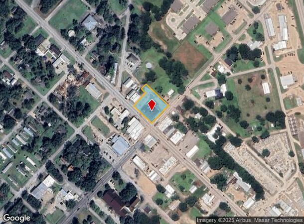
Property Record
8925 Main St, Needville, TX 77461
NEARBY LISTINGS FOR SALE OR LEASE
Property Detail
8925 Main St
0219-00-000-1402-906
H And Tc Ry
Commercialnec
0219 H AND TC RY, ACRES 0.7185
X
Fort Bend
48157C0400M
Texas
2024
0.96 AC
2025
Southwest Outlier
675600
Houston
9,940 SF
Houston-The Woodlands-Sugar Land, TX
DEMOGRAPHICS near 8925 Main St
1 Mile
3 Mile
5 Mile
2024 Total Population
3,440
6,983
11,376
2029 Population
4,120
8,381
13,680
Pop Growth 2024-2029
+ 19.77%
+ 20.02%
+ 20.25%
Average Age
39
38
39
2024 Total Households
1,239
2,431
3,873
HH Growth 2024-2029
+ 20.34%
+ 20.65%
+ 20.86%
Median Household Inc
$71,485
$71,608
$69,565
Avg Household Size
2.70
2.90
2.90
2024 Avg HH Vehicles
2.00
2.00
2.00
Median Home Value
$218,540
$231,323
$249,161
Median Year Built
1984
1991
1992
Nearby Places
Map Layers
Map Styles
 Street
 Aerial
- Restaurants
- Banks
- Shops
- Fitness
- Groceries
PUBLIC TRANSPORTATION
AIRPORT
William P Hobby
DRIVE
WALK
Distance
William P Hobby
68 min
47.9 mi
Freight Ports
Port Freeport
DRIVE
WALK
Distance
Port Freeport
70 min
46.5 mi
Nearby Properties
Address
Land Use
TOTAL SIZE
Lot Size
Zoning
Address
Land Use
TOTAL SIZE
Lot Size
Zoning
61.23 AC
Address
Land Use
TOTAL SIZE
Lot Size
Zoning
113,567 SF
18 AC
Address
Land Use
TOTAL SIZE
Lot Size
Zoning
72,244 SF
17.68 AC
Address
Land Use
TOTAL SIZE
Lot Size
Zoning
3.74 AC
SY
Address
Land Use
TOTAL SIZE
Lot Size
Zoning
22,980 SF
7.65 AC
Address
Land Use
TOTAL SIZE
Lot Size
Zoning
112,221 SF
30.39 AC
Address
Land Use
TOTAL SIZE
Lot Size
Zoning
18,870 SF
3 AC
O
Address
Land Use
TOTAL SIZE
Lot Size
Zoning
624 SF
156.97 AC
YOT
Address
Land Use
TOTAL SIZE
Lot Size
Zoning
7,093 SF
8.08 AC
Address
Land Use
TOTAL SIZE
Lot Size
Zoning
155.81 AC
Address
Land Use
TOTAL SIZE
Lot Size
Zoning
14,234 SF
10.18 AC
Y
Address
Land Use
TOTAL SIZE
Lot Size
Zoning
17.59 AC
S
Address
Land Use
TOTAL SIZE
Lot Size
Zoning
1,176 SF
95.69 AC
YOQ
Address
Land Use
TOTAL SIZE
Lot Size
Zoning
1,304 SF
5.50 AC
Y
Address
Land Use
TOTAL SIZE
Lot Size
Zoning
20,053 SF
3.16 AC
Address
Land Use
TOTAL SIZE
Lot Size
Zoning
15,000 SF
1.38 AC
SHMY
Address
Land Use
TOTAL SIZE
Lot Size
Zoning
9,478 SF
3.83 AC
NS
Address
Land Use
TOTAL SIZE
Lot Size
Zoning
20,303 SF
4.72 AC
SY
Address
Land Use
TOTAL SIZE
Lot Size
Zoning
800 SF
100.51 AC
OY
Address
Land Use
TOTAL SIZE
Lot Size
Zoning
98 AC
OS
Address
Land Use
TOTAL SIZE
Lot Size
Zoning
10,975 SF
1.16 AC
SHMY
Address
Land Use
TOTAL SIZE
Lot Size
Zoning
800 SF
6.77 AC
Address
Land Use
TOTAL SIZE
Lot Size
Zoning
1.91 AC
Address
Land Use
TOTAL SIZE
Lot Size
Zoning
9.17 AC
Address
Land Use
TOTAL SIZE
Lot Size
Zoning
6,848 SF
0.68 AC
Address
Land Use
TOTAL SIZE
Lot Size
Zoning
5,040 SF
1.96 AC
XY
Address
Land Use
TOTAL SIZE
Lot Size
Zoning
6,945 SF
18.39 AC
QS
Address
Land Use
TOTAL SIZE
Lot Size
Zoning
4,000 SF
10.74 AC
Address
Land Use
TOTAL SIZE
Lot Size
Zoning
6,212 SF
1.17 AC
X
Address
Land Use
TOTAL SIZE
Lot Size
Zoning
68.62 AC
STY
The World's #1 Commercial Real Estate Marketplace
Connect with us
© 2025 CoStar Group
The information above has been obtained from sources believed reliable. While we do not doubt its accuracy we have not verified it and make no guarantee, warranty or representation about it. It is your responsibility to independently confirm its accuracy and completeness. Any projections, opinions, assumptions, or estimates used are for example only and do not represent the current or future performance of the property. The value of this transaction to you depends on tax and other factors which should be evaluated by your tax, financial, and legal advisors. You and your advisors should conduct a careful, independent investigation of the property to determine to your satisfaction the suitability of the property for your needs.