Property Record
8930 Maple Hill Rd, Howard City, MI 49329

NEARBY LISTINGS FOR SALE OR LEASE
-
-
View all Howard City listings for sale on LoopNet.com
Property Detail
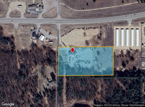
8930 Maple Hill Rd
Grand Rapids-Wyoming, MI
NW 1/4 OF NW 1/4 OF NW 1/4 EX N 320 FT THEREOF SEC 23 T12N R10W
017-023-067-20
Montcalm
Commercialnec
Michigan
2025
5.18 AC
2025
Michigan North Central Area
970501
Other Market Areas
DEMOGRAPHICS near 8930 Maple Hill Rd
1 Mile
3 Mile
5 Mile
2024 Total Population
609
5,489
8,966
2029 Population
634
5,729
9,366
Pop Growth 2024-2029
+ 4.11%
+ 4.37%
+ 4.46%
Average Age
39
39
40
2024 Total Households
227
2,031
3,314
HH Growth 2024-2029
+ 4.41%
+ 4.28%
+ 4.38%
Median Household Inc
$64,062
$63,687
$63,880
Avg Household Size
2.60
2.60
2.60
2024 Avg HH Vehicles
2.00
2.00
2.00
Median Home Value
$141,666
$163,801
$165,834
Median Year Built
1991
1991
1991
Nearby Places
Map Layers
Map Styles
 Street
 Aerial
- Restaurants
- Banks
- Shops
- Fitness
- Groceries
SALE & LEASE HISTORY
LISTING DATE
SALE/LEASE

Jun 07, 2017
For Sale
Nearby Properties
Address
Land Use
TOTAL SIZE
Lot Size
Zoning
Address
Land Use
TOTAL SIZE
Lot Size
Zoning
23.93 AC
I
Address
Land Use
TOTAL SIZE
Lot Size
Zoning
40.25 AC
Address
Land Use
TOTAL SIZE
Lot Size
Zoning
6.50 AC
C-2
Address
Land Use
TOTAL SIZE
Lot Size
Zoning
5.56 AC
C-2
Address
Land Use
TOTAL SIZE
Lot Size
Zoning
24.39 AC
Address
Land Use
TOTAL SIZE
Lot Size
Zoning
Address
Land Use
TOTAL SIZE
Lot Size
Zoning
9.99 AC
I
Address
Land Use
TOTAL SIZE
Lot Size
Zoning
Address
Land Use
TOTAL SIZE
Lot Size
Zoning
3.75 AC
Address
Land Use
TOTAL SIZE
Lot Size
Zoning
Address
Land Use
TOTAL SIZE
Lot Size
Zoning
1.75 AC
Address
Land Use
TOTAL SIZE
Lot Size
Zoning
0.28 AC
Address
Land Use
TOTAL SIZE
Lot Size
Zoning
73.83 AC
R-1
Address
Land Use
TOTAL SIZE
Lot Size
Zoning
1.18 AC
Address
Land Use
TOTAL SIZE
Lot Size
Zoning
82.48 AC
Address
Land Use
TOTAL SIZE
Lot Size
Zoning
Address
Land Use
TOTAL SIZE
Lot Size
Zoning
119.78 AC
Address
Land Use
TOTAL SIZE
Lot Size
Zoning
69.95 AC
Address
Land Use
TOTAL SIZE
Lot Size
Zoning
0.55 AC
C-2
Address
Land Use
TOTAL SIZE
Lot Size
Zoning
156.10 AC
Address
Land Use
TOTAL SIZE
Lot Size
Zoning
0.83 AC
Address
Land Use
TOTAL SIZE
Lot Size
Zoning
1.72 AC
C-2
Address
Land Use
TOTAL SIZE
Lot Size
Zoning
5.38 AC
C-2
Address
Land Use
TOTAL SIZE
Lot Size
Zoning
153.86 AC
Address
Land Use
TOTAL SIZE
Lot Size
Zoning
1.82 AC
Address
Land Use
TOTAL SIZE
Lot Size
Zoning
2.22 AC
Address
Land Use
TOTAL SIZE
Lot Size
Zoning
0.21 AC
LR
Address
Land Use
TOTAL SIZE
Lot Size
Zoning
6.20 AC
Address
Land Use
TOTAL SIZE
Lot Size
Zoning
14.95 AC
Address
Land Use
TOTAL SIZE
Lot Size
Zoning
133.91 AC
The World's #1 Commercial Real Estate Marketplace
Connect with us
© 2025 CoStar Group
The information above has been obtained from sources believed reliable. While we do not doubt its accuracy we have not verified it and make no guarantee, warranty or representation about it. It is your responsibility to independently confirm its accuracy and completeness. Any projections, opinions, assumptions, or estimates used are for example only and do not represent the current or future performance of the property. The value of this transaction to you depends on tax and other factors which should be evaluated by your tax, financial, and legal advisors. You and your advisors should conduct a careful, independent investigation of the property to determine to your satisfaction the suitability of the property for your needs.