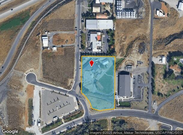
Property Record
894 Tulip Ln, Richland, WA 99352


NEARBY LISTINGS FOR SALE OR LEASE
Property Detail
894 Tulip Ln
Other Market Areas
Badger Heights Sub
Kennewick-Richland, WA
BADGER HEIGHTS SUBDIVISION BLOCK 2 LOT 14 RIGHT OF WAY EASEMENT 10-7-81 TOGETHER WITH PORTION OF VACATED ROAD RIGHT OF WAY PER RESOL #91-16685 RECD 91791 TOGETHER WITH PORTION OF VACATED ROAD RIGHT OF WAY PER RESOL #95-438 RECD 112095 AF#95-26680
122982020002014
Benton
Foodprocessing
Washington
2024
14
2024
3.84 AC
010818
Yakima/Kennewick
3,631 SF
DEMOGRAPHICS near 894 Tulip Ln
1 Mile
3 Mile
5 Mile
2024 Total Population
4,767
46,275
114,390
2029 Population
5,102
49,779
123,286
Pop Growth 2024-2029
+ 7.03%
+ 7.57%
+ 7.78%
Average Age
39
39
38
2024 Total Households
1,898
17,612
43,000
HH Growth 2024-2029
+ 6.64%
+ 7.59%
+ 7.74%
Median Household Inc
$121,220
$96,685
$96,410
Avg Household Size
2.50
2.60
2.60
2024 Avg HH Vehicles
2.00
2.00
2.00
Median Home Value
$445,041
$379,377
$372,779
Median Year Built
2001
1993
1996
Nearby Places
Map Layers
Map Styles
 Street
 Aerial
- Restaurants
- Banks
- Shops
- Fitness
- Groceries
PUBLIC TRANSPORTATION
AIRPORT
Tri-Cities
DRIVE
WALK
Distance
Tri-Cities
16 min
11.0 mi
Freight Ports
Port of Tacoma
DRIVE
WALK
Distance
Port of Tacoma
260 min
227.5 mi
SALE & LEASE HISTORY
LISTING DATE
SALE/LEASE

May 24, 2019
For Sale
Jul 26, 2024
For Sale
Nearby Properties
Address
Land Use
TOTAL SIZE
Lot Size
Zoning
Address
Land Use
TOTAL SIZE
Lot Size
Zoning
562,186 SF
7.61 AC
Address
Land Use
TOTAL SIZE
Lot Size
Zoning
378,471 SF
16.21 AC
RICHLAND -
Address
Land Use
TOTAL SIZE
Lot Size
Zoning
183,204 SF
14.94 AC
Address
Land Use
TOTAL SIZE
Lot Size
Zoning
143,592 SF
6.86 AC
RICHLAND -
Address
Land Use
TOTAL SIZE
Lot Size
Zoning
428,225 SF
12.60 AC
Address
Land Use
TOTAL SIZE
Lot Size
Zoning
351,217 SF
60.86 AC
Address
Land Use
TOTAL SIZE
Lot Size
Zoning
236,556 SF
11.34 AC
Address
Land Use
TOTAL SIZE
Lot Size
Zoning
185,302 SF
9.13 AC
Address
Land Use
TOTAL SIZE
Lot Size
Zoning
220,970 SF
1.28 AC
Address
Land Use
TOTAL SIZE
Lot Size
Zoning
200,734 SF
12.38 AC
Address
Land Use
TOTAL SIZE
Lot Size
Zoning
216,270 SF
22.32 AC
Address
Land Use
TOTAL SIZE
Lot Size
Zoning
113,052 SF
3.32 AC
Address
Land Use
TOTAL SIZE
Lot Size
Zoning
81,497 SF
16.69 AC
Address
Land Use
TOTAL SIZE
Lot Size
Zoning
69,488 SF
1.69 AC
Address
Land Use
TOTAL SIZE
Lot Size
Zoning
170,307 SF
14.15 AC
Address
Land Use
TOTAL SIZE
Lot Size
Zoning
109,517 SF
4.67 AC
Address
Land Use
TOTAL SIZE
Lot Size
Zoning
157,320 SF
3.80 AC
53
Address
Land Use
TOTAL SIZE
Lot Size
Zoning
126,251 SF
7 AC
Address
Land Use
TOTAL SIZE
Lot Size
Zoning
116,318 SF
2.74 AC
Address
Land Use
TOTAL SIZE
Lot Size
Zoning
74,089 SF
12.33 AC
Address
Land Use
TOTAL SIZE
Lot Size
Zoning
76,249 SF
13 AC
Address
Land Use
TOTAL SIZE
Lot Size
Zoning
96,486 SF
13.24 AC
Address
Land Use
TOTAL SIZE
Lot Size
Zoning
39,875 SF
1.80 AC
Address
Land Use
TOTAL SIZE
Lot Size
Zoning
86,104 SF
3.26 AC
Address
Land Use
TOTAL SIZE
Lot Size
Zoning
137,322 SF
10.63 AC
Address
Land Use
TOTAL SIZE
Lot Size
Zoning
61,068 SF
0.78 AC
Address
Land Use
TOTAL SIZE
Lot Size
Zoning
127,195 SF
9.16 AC
Address
Land Use
TOTAL SIZE
Lot Size
Zoning
99,409 SF
9.08 AC
Address
Land Use
TOTAL SIZE
Lot Size
Zoning
66,380 SF
2.98 AC
Address
Land Use
TOTAL SIZE
Lot Size
Zoning
87,117 SF
3.94 AC
The World's #1 Commercial Real Estate Marketplace
Connect with us
© 2025 CoStar Group
The information above has been obtained from sources believed reliable. While we do not doubt its accuracy we have not verified it and make no guarantee, warranty or representation about it. It is your responsibility to independently confirm its accuracy and completeness. Any projections, opinions, assumptions, or estimates used are for example only and do not represent the current or future performance of the property. The value of this transaction to you depends on tax and other factors which should be evaluated by your tax, financial, and legal advisors. You and your advisors should conduct a careful, independent investigation of the property to determine to your satisfaction the suitability of the property for your needs.