Property Record
8949 Zachary Ln N, Maple Grove, MN 55369


NEARBY LISTINGS FOR SALE OR LEASE
Property Detail
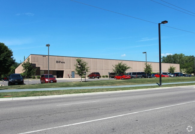
8949 Zachary Ln N
Minneapolis-St. Paul-Bloomington, MN-WI
Redson Industrial Park
14-119-22-14-0028
LOT 005 BLOCK 001 A REDSON INDUSTRIAL PARK ALSO THAT PART OF LOT 4 BLK 1 LYING ELY OF A LINE DESC AS BEG AT A PT ON THE N LINE OF SAID LOT 4 DIST 90 FT WLY OF THE NE COR THOF TH SLY T IRREGULAR
Industrialgeneral
Hennepin
X
Minnesota
27053C0181F
5
2024
4.61 AC
2024
Northwest
026726
Minneapolis/St Paul
90,480 SF
DEMOGRAPHICS near 8949 Zachary Ln N
1 Mile
3 Mile
5 Mile
2024 Total Population
6,573
47,368
179,743
2029 Population
6,540
46,638
176,786
Pop Growth 2024-2029
(0.50%)
(1.54%)
(1.65%)
Average Age
39
41
39
2024 Total Households
2,528
18,605
65,719
HH Growth 2024-2029
(0.59%)
(1.66%)
(1.80%)
Median Household Inc
$124,084
$104,338
$97,923
Avg Household Size
2.50
2.50
2.70
2024 Avg HH Vehicles
2.00
2.00
2.00
Median Home Value
$325,193
$318,383
$328,336
Median Year Built
1990
1985
1986
Nearby Places
Map Layers
Map Styles
 Street
 Aerial
- Restaurants
- Banks
- Shops
- Fitness
- Groceries
PUBLIC TRANSPORTATION
COMMUTER RAIL
Anoka Station (Northstar Corridor - Northstar Commuter Rail)
DRIVE
WALK
Distance
Anoka Station (Northstar Corridor - Northstar Commuter Rail)
15 min
8.8 mi
AIRPORT
Minneapolis-St Paul International/Wold-Chamberlain
DRIVE
WALK
Distance
Minneapolis-St Paul International/Wold-Chamberlain
40 min
27.8 mi
Freight Ports
Port Milwaukee
DRIVE
WALK
Distance
Port Milwaukee
392 min
353.3 mi
Nearby Properties
Address
Land Use
TOTAL SIZE
Lot Size
Zoning
Address
Land Use
TOTAL SIZE
Lot Size
Zoning
69.46 AC
Address
Land Use
TOTAL SIZE
Lot Size
Zoning
Address
Land Use
TOTAL SIZE
Lot Size
Zoning
52,110 SF
35.71 AC
Address
Land Use
TOTAL SIZE
Lot Size
Zoning
68.12 AC
Address
Land Use
TOTAL SIZE
Lot Size
Zoning
10.90 AC
Address
Land Use
TOTAL SIZE
Lot Size
Zoning
297,060 SF
19.17 AC
Address
Land Use
TOTAL SIZE
Lot Size
Zoning
7.53 AC
Address
Land Use
TOTAL SIZE
Lot Size
Zoning
Address
Land Use
TOTAL SIZE
Lot Size
Zoning
Address
Land Use
TOTAL SIZE
Lot Size
Zoning
8.11 AC
Address
Land Use
TOTAL SIZE
Lot Size
Zoning
42.65 AC
Address
Land Use
TOTAL SIZE
Lot Size
Zoning
Address
Land Use
TOTAL SIZE
Lot Size
Zoning
409,456 SF
12.40 AC
Address
Land Use
TOTAL SIZE
Lot Size
Zoning
Address
Land Use
TOTAL SIZE
Lot Size
Zoning
196,970 SF
15.63 AC
Address
Land Use
TOTAL SIZE
Lot Size
Zoning
Address
Land Use
TOTAL SIZE
Lot Size
Zoning
24.75 AC
Address
Land Use
TOTAL SIZE
Lot Size
Zoning
16.54 AC
Address
Land Use
TOTAL SIZE
Lot Size
Zoning
58,119 SF
18.55 AC
Address
Land Use
TOTAL SIZE
Lot Size
Zoning
14.72 AC
Address
Land Use
TOTAL SIZE
Lot Size
Zoning
21.53 AC
Address
Land Use
TOTAL SIZE
Lot Size
Zoning
228,208 SF
24.92 AC
Address
Land Use
TOTAL SIZE
Lot Size
Zoning
Address
Land Use
TOTAL SIZE
Lot Size
Zoning
1.99 AC
Address
Land Use
TOTAL SIZE
Lot Size
Zoning
Address
Land Use
TOTAL SIZE
Lot Size
Zoning
35.38 AC
Address
Land Use
TOTAL SIZE
Lot Size
Zoning
13.63 AC
Address
Land Use
TOTAL SIZE
Lot Size
Zoning
90,700 SF
17.07 AC
Address
Land Use
TOTAL SIZE
Lot Size
Zoning
18.59 AC
Address
Land Use
TOTAL SIZE
Lot Size
Zoning
The World's #1 Commercial Real Estate Marketplace
Connect with us
© 2025 CoStar Group
The information above has been obtained from sources believed reliable. While we do not doubt its accuracy we have not verified it and make no guarantee, warranty or representation about it. It is your responsibility to independently confirm its accuracy and completeness. Any projections, opinions, assumptions, or estimates used are for example only and do not represent the current or future performance of the property. The value of this transaction to you depends on tax and other factors which should be evaluated by your tax, financial, and legal advisors. You and your advisors should conduct a careful, independent investigation of the property to determine to your satisfaction the suitability of the property for your needs.