Property Record
895 Boston Post Rd E, Marlborough, MA 01752

Property Detail
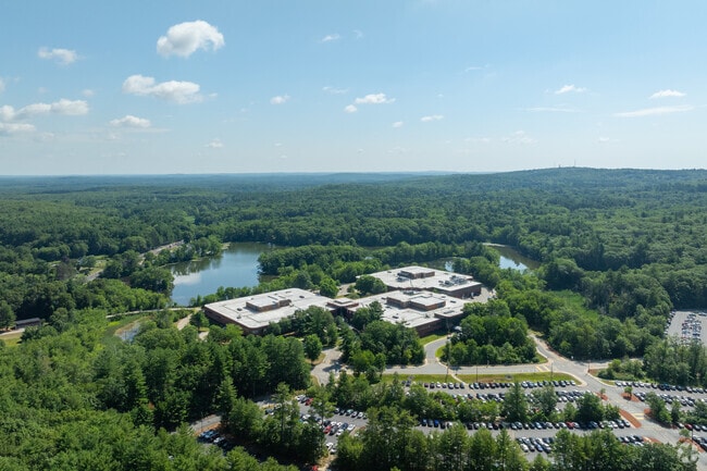
895 Boston Post Rd E
MARL-000062-000015
MIDDLESEX
Industrialgeneral
Massachusetts
LI
157.48 AC
B and X Area of moderate flood hazard, usually the area between the limits of the 100-year and 500-year floods.
Concord/Maynard
2024
Boston
2025
Boston-Cambridge-Newton, MA-NH
321100
NEARBY LISTINGS FOR SALE OR LEASE
DEMOGRAPHICS near 895 Boston Post Rd E
1 mile
3 mile
5 mile
2025 Total Population
3,007
36,495
113,113
2030 Population
3,176
37,993
117,582
Pop Growth 2025-2030
+ 5.62%
+ 4.10%
+ 3.95%
Average Age
43
42
42
2025 Total Households
1,285
14,351
43,631
HH Growth 2025-2030
+ 5.76%
+ 4.26%
+ 4.13%
Median Household Inc
$73,763
$109,696
$122,375
Avg Household Size
2.30
2.50
2.50
2025 Avg HH Vehicles
2.00
2.00
2.00
Median Home Value
$379,917
$661,781
$689,400
Median Year Built
1988
1976
1971
Nearby Places
Map Layers
Map Styles
 Street
 Aerial
Transit
 Traffic
 Biking
Places
Listings with unknown addresses are not visible on the map
- Restaurants
- Banks
- Shops
- Fitness
- Groceries
PUBLIC TRANSPORTATION
COMMUTER RAIL
Southborough (Framingham/Worcester Line - Massachusetts Bay Transportation Authority Commuter Rail (Purple Line))
Drive
Walk
Distance
Southborough (Framingham/Worcester Line - Massachusetts Bay Transportation Authority Commuter Rail (Purple Line))
18 min
7.6 mi
AIRPORT
Worcester Regional
Drive
Walk
Distance
Worcester Regional
39 min
25.7 mi
General Edward Lawrence Logan International
Drive
Walk
Distance
General Edward Lawrence Logan International
49 min
29.4 mi
Freight Ports
Port of Boston
Drive
Walk
Distance
Port of Boston
48 min
27.7 mi
Nearby Properties
Address
Land Use
TOTAL SIZE
Lot Size
Zoning
Address
Land Use
TOTAL SIZE
Lot Size
Zoning
21.41 AC
LI
Address
Land Use
TOTAL SIZE
Lot Size
Zoning
23,890 SF
36.39 AC
A3
Address
Land Use
TOTAL SIZE
Lot Size
Zoning
4,188 SF
23.20 AC
B
Address
Land Use
TOTAL SIZE
Lot Size
Zoning
7,960 SF
17.89 AC
RR
Address
Land Use
TOTAL SIZE
Lot Size
Zoning
182,524 SF
3.60 AC
B2
Address
Land Use
TOTAL SIZE
Lot Size
Zoning
22.74 AC
A1
Address
Land Use
TOTAL SIZE
Lot Size
Zoning
35,211 SF
89 AC
RA
Address
Land Use
TOTAL SIZE
Lot Size
Zoning
9.66 AC
A1
Address
Land Use
TOTAL SIZE
Lot Size
Zoning
21.17 AC
A1
Address
Land Use
TOTAL SIZE
Lot Size
Zoning
85,958 SF
13.52 AC
A3
Address
Land Use
TOTAL SIZE
Lot Size
Zoning
126,828 SF
8.81 AC
R4
Address
Land Use
TOTAL SIZE
Lot Size
Zoning
71.89 AC
RR
Address
Land Use
TOTAL SIZE
Lot Size
Zoning
3.58 AC
B
Address
Land Use
TOTAL SIZE
Lot Size
Zoning
116,597 SF
11.29 AC
B
Address
Land Use
TOTAL SIZE
Lot Size
Zoning
127,400 SF
14.55 AC
I
Address
Land Use
TOTAL SIZE
Lot Size
Zoning
105,560 SF
4.62 AC
B
Address
Land Use
TOTAL SIZE
Lot Size
Zoning
93,315 SF
13 AC
B
Address
Land Use
TOTAL SIZE
Lot Size
Zoning
285.64 AC
R3
Address
Land Use
TOTAL SIZE
Lot Size
Zoning
75,513 SF
9.70 AC
A3
Address
Land Use
TOTAL SIZE
Lot Size
Zoning
102,581 SF
2.66 AC
I
Address
Land Use
TOTAL SIZE
Lot Size
Zoning
9.90 AC
I
Address
Land Use
TOTAL SIZE
Lot Size
Zoning
122.98 AC
SA8
Address
Land Use
TOTAL SIZE
Lot Size
Zoning
10.60 AC
B
Address
Land Use
TOTAL SIZE
Lot Size
Zoning
22.61 AC
RESC
Address
Land Use
TOTAL SIZE
Lot Size
Zoning
117,439 SF
2.42 AC
B
Address
Land Use
TOTAL SIZE
Lot Size
Zoning
65.15 AC
WI
Address
Land Use
TOTAL SIZE
Lot Size
Zoning
12.30 AC
B
Address
Land Use
TOTAL SIZE
Lot Size
Zoning
1,492 AC
RA
Address
Land Use
TOTAL SIZE
Lot Size
Zoning
71,873 SF
22.53 AC
RR
The World's #1 Commercial Real Estate Marketplace
Connect with us
© 2026 CoStar Group
The information above has been obtained from sources believed reliable. While we do not doubt its accuracy we have not verified it and make no guarantee, warranty or representation about it. It is your responsibility to independently confirm its accuracy and completeness. Any projections, opinions, assumptions, or estimates used are for example only and do not represent the current or future performance of the property. The value of this transaction to you depends on tax and other factors which should be evaluated by your tax, financial, and legal advisors. You and your advisors should conduct a careful, independent investigation of the property to determine to your satisfaction the suitability of the property for your needs.