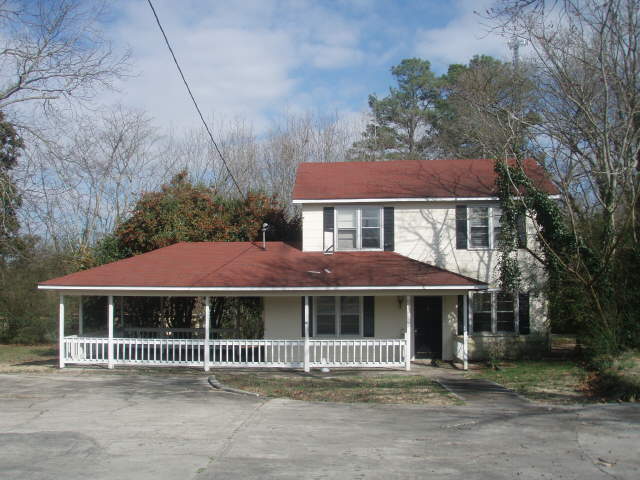
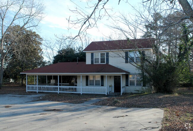
Property Record
895 Senoia Rd, Tyrone, GA 30290
NEARBY LISTINGS FOR SALE OR LEASE
Property Detail
895 Senoia Rd
07-38-00-006
.333 ACRES
Officebuilding
Fayette
X
Georgia
13077C0180D
139
2024
0.33 AC
2024
Fayette/Coweta County
140203
Atlanta
1,480 SF
Atlanta-Sandy Springs-Roswell, GA
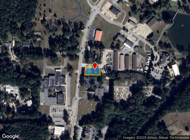
DEMOGRAPHICS near 895 Senoia Rd
1 Mile
3 Mile
5 Mile
2024 Total Population
2,059
16,865
56,327
2029 Population
2,189
17,987
60,166
Pop Growth 2024-2029
+ 6.31%
+ 6.65%
+ 6.82%
Average Age
43
42
40
2024 Total Households
731
6,014
20,229
HH Growth 2024-2029
+ 6.43%
+ 6.62%
+ 6.69%
Median Household Inc
$82,980
$96,686
$94,191
Avg Household Size
2.80
2.80
2.80
2024 Avg HH Vehicles
2.00
2.00
2.00
Median Home Value
$346,327
$377,448
$367,837
Median Year Built
1994
1996
1997
Nearby Places
Map Layers
Map Styles
 Street
 Aerial
- Restaurants
- Banks
- Shops
- Fitness
- Groceries
PUBLIC TRANSPORTATION
AIRPORT
Hartsfield - Jackson Atlanta International
DRIVE
WALK
Distance
Hartsfield - Jackson Atlanta International
30 min
19.9 mi
Nearby Properties
Address
Land Use
TOTAL SIZE
Lot Size
Zoning
Address
Land Use
TOTAL SIZE
Lot Size
Zoning
412,253 SF
134.50 AC
Address
Land Use
TOTAL SIZE
Lot Size
Zoning
194,839 SF
25.40 AC
C GC
Address
Land Use
TOTAL SIZE
Lot Size
Zoning
39,195 SF
14.06 AC
C GC
Address
Land Use
TOTAL SIZE
Lot Size
Zoning
96,409 SF
12.74 AC
C GC
Address
Land Use
TOTAL SIZE
Lot Size
Zoning
93,925 SF
5.18 AC
C GC
Address
Land Use
TOTAL SIZE
Lot Size
Zoning
80,800 SF
9.39 AC
C C2
Address
Land Use
TOTAL SIZE
Lot Size
Zoning
80,956 SF
60.90 AC
Address
Land Use
TOTAL SIZE
Lot Size
Zoning
125,421 SF
12.99 AC
C GC
Address
Land Use
TOTAL SIZE
Lot Size
Zoning
72,376 SF
30.30 AC
Address
Land Use
TOTAL SIZE
Lot Size
Zoning
47,555 SF
20.10 AC
AR
Address
Land Use
TOTAL SIZE
Lot Size
Zoning
14,636 SF
6.50 AC
C OI
Address
Land Use
TOTAL SIZE
Lot Size
Zoning
35,455 SF
2.30 AC
C GC
Address
Land Use
TOTAL SIZE
Lot Size
Zoning
36,900 SF
8.12 AC
C OI
Address
Land Use
TOTAL SIZE
Lot Size
Zoning
49,935 SF
3.99 AC
C GC
Address
Land Use
TOTAL SIZE
Lot Size
Zoning
66,390 SF
3.61 AC
I M1
Address
Land Use
TOTAL SIZE
Lot Size
Zoning
60.89 AC
I M1
Address
Land Use
TOTAL SIZE
Lot Size
Zoning
30,397 SF
24.50 AC
Address
Land Use
TOTAL SIZE
Lot Size
Zoning
12,859 SF
50.50 AC
Address
Land Use
TOTAL SIZE
Lot Size
Zoning
15,440 SF
10.86 AC
C C1
Address
Land Use
TOTAL SIZE
Lot Size
Zoning
17,248 SF
3.47 AC
C OI
Address
Land Use
TOTAL SIZE
Lot Size
Zoning
49,680 SF
2.92 AC
I M2
Address
Land Use
TOTAL SIZE
Lot Size
Zoning
26,022 SF
3.48 AC
C C2
Address
Land Use
TOTAL SIZE
Lot Size
Zoning
72,227 SF
7.40 AC
Address
Land Use
TOTAL SIZE
Lot Size
Zoning
24,100 SF
4.30 AC
C C3
Address
Land Use
TOTAL SIZE
Lot Size
Zoning
27,270 SF
3.28 AC
C C2
Address
Land Use
TOTAL SIZE
Lot Size
Zoning
6,302 SF
3.15 AC
I M2
Address
Land Use
TOTAL SIZE
Lot Size
Zoning
60,099 SF
3.60 AC
Address
Land Use
TOTAL SIZE
Lot Size
Zoning
14,375 SF
1.85 AC
C C1
Address
Land Use
TOTAL SIZE
Lot Size
Zoning
15,184 SF
1.33 AC
C GC
Address
Land Use
TOTAL SIZE
Lot Size
Zoning
17,330 SF
4.16 AC
C OI
The World's #1 Commercial Real Estate Marketplace
Connect with us
© 2025 CoStar Group
The information above has been obtained from sources believed reliable. While we do not doubt its accuracy we have not verified it and make no guarantee, warranty or representation about it. It is your responsibility to independently confirm its accuracy and completeness. Any projections, opinions, assumptions, or estimates used are for example only and do not represent the current or future performance of the property. The value of this transaction to you depends on tax and other factors which should be evaluated by your tax, financial, and legal advisors. You and your advisors should conduct a careful, independent investigation of the property to determine to your satisfaction the suitability of the property for your needs.