Property Record
8951 Whitepine Rd, North Chesterfield, VA 23237

NEARBY LISTINGS FOR SALE OR LEASE
Property Detail
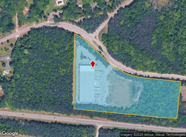
8951 Whitepine Rd
758-67-31-29-500-000
S/L Belmont Rd & Whitepine Rd
Multipleuses
S/L BELMONT RD & WHITEPINE RD
X
Chesterfield
5101290075E
Virginia
2025
11.56 AC
2025
Rt 288 Corridor
100820
Richmond VA
55,000 SF
Richmond, VA
DEMOGRAPHICS near 8951 Whitepine Rd
1 Mile
3 Mile
5 Mile
2024 Total Population
999
25,815
107,694
2029 Population
1,096
28,196
117,738
Pop Growth 2024-2029
+ 9.71%
+ 9.22%
+ 9.33%
Average Age
39
39
40
2024 Total Households
328
9,362
40,021
HH Growth 2024-2029
+ 9.76%
+ 9.37%
+ 9.51%
Median Household Inc
$107,790
$82,485
$77,546
Avg Household Size
2.90
2.70
2.60
2024 Avg HH Vehicles
3.00
2.00
2.00
Median Home Value
$286,576
$273,222
$268,071
Median Year Built
1998
1989
1987
Nearby Places
Map Layers
Map Styles
 Street
 Aerial
- Restaurants
- Banks
- Shops
- Fitness
- Groceries
PUBLIC TRANSPORTATION
AIRPORT
Richmond International
DRIVE
WALK
Distance
Richmond International
35 min
20.1 mi
Freight Ports
Virginia Port Authority - Richmond
DRIVE
WALK
Distance
Virginia Port Authority - Richmond
26 min
12.5 mi
SALE & LEASE HISTORY
LISTING DATE
SALE/LEASE

Sep 25, 2016
For Lease
Nearby Properties
Address
Land Use
TOTAL SIZE
Lot Size
Zoning
Address
Land Use
TOTAL SIZE
Lot Size
Zoning
111,744 SF
13.26 AC
C3 - COMMU
Address
Land Use
TOTAL SIZE
Lot Size
Zoning
387,548 SF
16.18 AC
C3 - COMMU
Address
Land Use
TOTAL SIZE
Lot Size
Zoning
3,168 SF
7,724.18 AC
A - AGRICU
Address
Land Use
TOTAL SIZE
Lot Size
Zoning
613,315 SF
12.94 AC
I1 - LT IN
Address
Land Use
TOTAL SIZE
Lot Size
Zoning
16,052 SF
552.02 AC
I1 - LT IN
Address
Land Use
TOTAL SIZE
Lot Size
Zoning
40,729 SF
22.64 AC
A - AGRICU
Address
Land Use
TOTAL SIZE
Lot Size
Zoning
62,112 SF
32.90 AC
C3 - COMMU
Address
Land Use
TOTAL SIZE
Lot Size
Zoning
53,100 SF
37.74 AC
O2 - CORP
Address
Land Use
TOTAL SIZE
Lot Size
Zoning
46,989 SF
2.24 AC
C5 - GEN B
Address
Land Use
TOTAL SIZE
Lot Size
Zoning
92,000 SF
5.41 AC
C5 - GEN B
Address
Land Use
TOTAL SIZE
Lot Size
Zoning
47,351 SF
10.30 AC
C3 - COMMU
Address
Land Use
TOTAL SIZE
Lot Size
Zoning
68,933 SF
19.84 AC
A - AGRICU
Address
Land Use
TOTAL SIZE
Lot Size
Zoning
91,010 SF
18.36 AC
I1 - LT IN
Address
Land Use
TOTAL SIZE
Lot Size
Zoning
41,796 SF
13.39 AC
C3 - COMMU
Address
Land Use
TOTAL SIZE
Lot Size
Zoning
55,000 SF
13.41 AC
C5 - GEN B
Address
Land Use
TOTAL SIZE
Lot Size
Zoning
336 SF
191.77 AC
A - AGRICU
Address
Land Use
TOTAL SIZE
Lot Size
Zoning
108,000 SF
9.15 AC
I1 - LT IN
Address
Land Use
TOTAL SIZE
Lot Size
Zoning
6,400 SF
12.12 AC
C5 - GEN B
Address
Land Use
TOTAL SIZE
Lot Size
Zoning
127,140 SF
22.84 AC
A - AGRICU
Address
Land Use
TOTAL SIZE
Lot Size
Zoning
35,438 SF
7.81 AC
C3 - COMMU
Address
Land Use
TOTAL SIZE
Lot Size
Zoning
99,850 SF
7.39 AC
I1 - LT IN
Address
Land Use
TOTAL SIZE
Lot Size
Zoning
96,948 SF
2.89 AC
C3 - COMMU
Address
Land Use
TOTAL SIZE
Lot Size
Zoning
41,146 SF
5.67 AC
C3 - COMMU
Address
Land Use
TOTAL SIZE
Lot Size
Zoning
109,520 SF
9.26 AC
I1 - LT IN
Address
Land Use
TOTAL SIZE
Lot Size
Zoning
38,218 SF
18.41 AC
A - AGRICU
Address
Land Use
TOTAL SIZE
Lot Size
Zoning
70,440 SF
7.62 AC
I1 - LT IN
Address
Land Use
TOTAL SIZE
Lot Size
Zoning
86,720 SF
7.08 AC
I1 - LT IN
Address
Land Use
TOTAL SIZE
Lot Size
Zoning
26,388 SF
7.75 AC
C3 - COMMU
Address
Land Use
TOTAL SIZE
Lot Size
Zoning
13,087 SF
2.12 AC
C3 - COMMU
Address
Land Use
TOTAL SIZE
Lot Size
Zoning
4,564 SF
6.18 AC
A - AGRICU
The World's #1 Commercial Real Estate Marketplace
Connect with us
© 2025 CoStar Group
The information above has been obtained from sources believed reliable. While we do not doubt its accuracy we have not verified it and make no guarantee, warranty or representation about it. It is your responsibility to independently confirm its accuracy and completeness. Any projections, opinions, assumptions, or estimates used are for example only and do not represent the current or future performance of the property. The value of this transaction to you depends on tax and other factors which should be evaluated by your tax, financial, and legal advisors. You and your advisors should conduct a careful, independent investigation of the property to determine to your satisfaction the suitability of the property for your needs.