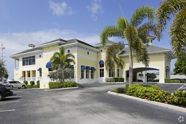
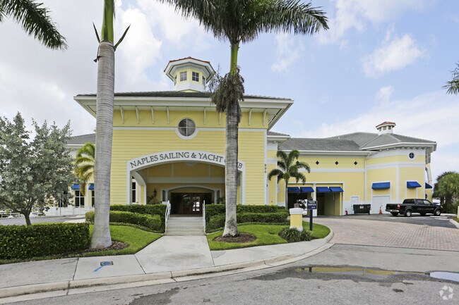
Property Record
896 River Point Dr, Naples, FL 34102

Property Detail
896 River Point Dr
03330160002
BEAUMARIS REPLAT LOTS 9 + 10 OR 273 PG 429
Bartavern
Collier
NAPLES
Florida
AE The base floodplain where base flood elevations are provided. AE Zones are now used on new format FIRMs instead of A1-A30 Zones.
9
2024
1.01 AC
2025
East Naples
000101
Southwest Florida
20,760 SF
Naples-Marco Island, FL
NEARBY LISTINGS FOR SALE OR LEASE
DEMOGRAPHICS near 896 River Point Dr
1 mile
3 mile
5 mile
2025 Total Population
9,682
43,673
107,448
2030 Population
10,974
48,340
118,810
Pop Growth 2025-2030
+ 13.34%
+ 10.69%
+ 10.57%
Average Age
54
51
53
2025 Total Households
4,827
19,995
50,199
HH Growth 2025-2030
+ 13.03%
+ 10.39%
+ 10.32%
Median Household Inc
$91,010
$81,256
$82,983
Avg Household Size
1.90
2.00
2.00
2025 Avg HH Vehicles
1.00
2.00
2.00
Median Home Value
$1,008,591
$660,145
$571,883
Median Year Built
1984
1984
1988
Nearby Places
Map Layers
Map Styles
 Street
 Aerial
Transit
 Traffic
 Biking
Places
Listings with unknown addresses are not visible on the map
- Restaurants
- Banks
- Shops
- Fitness
- Groceries
PUBLIC TRANSPORTATION
AIRPORT
Southwest Florida International
Drive
Walk
Distance
Southwest Florida International
50 min
36.0 mi
Nearby Properties
Address
Land Use
TOTAL SIZE
Lot Size
Zoning
Address
Land Use
TOTAL SIZE
Lot Size
Zoning
1,429,641 SF
45.28 AC
P
Address
Land Use
TOTAL SIZE
Lot Size
Zoning
556,070 SF
13.72 AC
NAPLES
Address
Land Use
TOTAL SIZE
Lot Size
Zoning
Address
Land Use
TOTAL SIZE
Lot Size
Zoning
1,850 SF
5.20 AC
Address
Land Use
TOTAL SIZE
Lot Size
Zoning
560,854 SF
592.62 AC
NAPLES
Address
Land Use
TOTAL SIZE
Lot Size
Zoning
2,440 SF
3.99 AC
NAPLES
Address
Land Use
TOTAL SIZE
Lot Size
Zoning
77,529 SF
1.15 AC
NAPLES
Address
Land Use
TOTAL SIZE
Lot Size
Zoning
250,674 SF
33.61 AC
NAPLES
Address
Land Use
TOTAL SIZE
Lot Size
Zoning
362,032 SF
15.97 AC
PUD
Address
Land Use
TOTAL SIZE
Lot Size
Zoning
936 SF
2.47 AC
Address
Land Use
TOTAL SIZE
Lot Size
Zoning
140,512 SF
12.10 AC
PUD
Address
Land Use
TOTAL SIZE
Lot Size
Zoning
26,296 SF
2.10 AC
Address
Land Use
TOTAL SIZE
Lot Size
Zoning
291,699 SF
18.17 AC
PUD
Address
Land Use
TOTAL SIZE
Lot Size
Zoning
932,389 SF
36.28 AC
NAPLES
Address
Land Use
TOTAL SIZE
Lot Size
Zoning
137,799 SF
5.78 AC
Address
Land Use
TOTAL SIZE
Lot Size
Zoning
159,901 SF
10.08 AC
RMF-16
Address
Land Use
TOTAL SIZE
Lot Size
Zoning
93,542 SF
4.09 AC
NAPLES
Address
Land Use
TOTAL SIZE
Lot Size
Zoning
39,546 SF
1.62 AC
Address
Land Use
TOTAL SIZE
Lot Size
Zoning
71,516 SF
2.88 AC
NAPLES
Address
Land Use
TOTAL SIZE
Lot Size
Zoning
217,119 SF
4.20 AC
NAPLES
Address
Land Use
TOTAL SIZE
Lot Size
Zoning
61,910 SF
45.05 AC
A
Address
Land Use
TOTAL SIZE
Lot Size
Zoning
69,767 SF
1.89 AC
NAPLES
Address
Land Use
TOTAL SIZE
Lot Size
Zoning
70,944 SF
9.51 AC
P
Address
Land Use
TOTAL SIZE
Lot Size
Zoning
203,171 SF
16.64 AC
NAPLES
Address
Land Use
TOTAL SIZE
Lot Size
Zoning
168,247 SF
25.60 AC
RMF-6
Address
Land Use
TOTAL SIZE
Lot Size
Zoning
19,641 SF
2.93 AC
NAPLES
Address
Land Use
TOTAL SIZE
Lot Size
Zoning
1,388 SF
6.89 AC
NAPLES
Address
Land Use
TOTAL SIZE
Lot Size
Zoning
240,746 SF
30.45 AC
PUD
Address
Land Use
TOTAL SIZE
Lot Size
Zoning
49,687 SF
3.16 AC
NAPLES
Address
Land Use
TOTAL SIZE
Lot Size
Zoning
29,443 SF
26.05 AC
NAPLES
The World's #1 Commercial Real Estate Marketplace
Connect with us
© 2026 CoStar Group
The information above has been obtained from sources believed reliable. While we do not doubt its accuracy we have not verified it and make no guarantee, warranty or representation about it. It is your responsibility to independently confirm its accuracy and completeness. Any projections, opinions, assumptions, or estimates used are for example only and do not represent the current or future performance of the property. The value of this transaction to you depends on tax and other factors which should be evaluated by your tax, financial, and legal advisors. You and your advisors should conduct a careful, independent investigation of the property to determine to your satisfaction the suitability of the property for your needs.