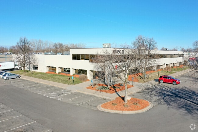
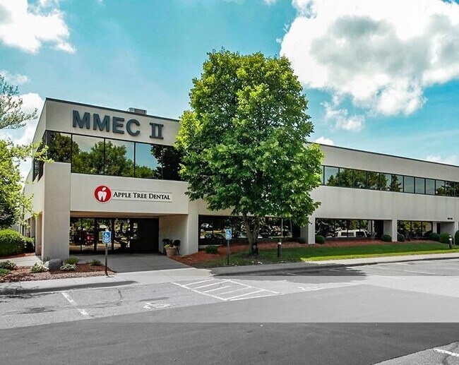
Property Record
8960 Springbrook Dr Nw, Minneapolis, MN 55433
NEARBY LISTINGS FOR SALE OR LEASE
Property Detail
8960 Springbrook Dr Nw
Minneapolis-St. Paul-Bloomington, MN-WI
Medical Enterprise Add
36-31-24-13-0059
THAT PRT OF LOT 2 BLOCK 1 MEDICAL ENTERPRISE ADD LYG WITHIN LOT 5 BLK 1 EVERGREEN INDUSTRIAL PARK SOUTH, EX RD SUBJ TO EASE O
Industrialgeneral
Anoka
X
Minnesota
27053C0100F
2
2025
2.24 AC
2025
Suburban St Paul
050607
Minneapolis/St Paul
40,500 SF
DEMOGRAPHICS near 8960 Springbrook Dr Nw
1 mile
3 mile
5 mile
2024 Total Population
5,322
78,621
230,610
2029 Population
5,564
80,434
233,776
Pop Growth 2024-2029
+ 4.55%
+ 2.31%
+ 1.37%
Average Age
41
40
39
2024 Total Households
2,212
29,424
84,100
HH Growth 2024-2029
+ 4.57%
+ 2.51%
+ 1.49%
Median Household Inc
$72,305
$78,810
$80,191
Avg Household Size
2.40
2.60
2.70
2024 Avg HH Vehicles
2.00
2.00
2.00
Median Home Value
$242,553
$251,819
$265,286
Median Year Built
1982
1980
1980
Nearby Places
Map Layers
Map Styles
 Street
 Aerial
Transit
 Traffic
 Biking
Places
Listings with unknown addresses are not visible on the map
- Restaurants
- Banks
- Shops
- Fitness
- Groceries
PUBLIC TRANSPORTATION
COMMUTER RAIL
Fridley Station (Northstar Corridor - Northstar Commuter Rail)
Drive
Walk
Distance
Fridley Station (Northstar Corridor - Northstar Commuter Rail)
9 min
4.8 mi
Coon Rapids-Riverdale Station (Northstar Corridor - Northstar Commuter Rail)
Drive
Walk
Distance
Coon Rapids-Riverdale Station (Northstar Corridor - Northstar Commuter Rail)
12 min
7.4 mi
AIRPORT
Minneapolis-St Paul International/Wold-Chamberlain
Drive
Walk
Distance
Minneapolis-St Paul International/Wold-Chamberlain
40 min
24.4 mi
SALE & LEASE HISTORY
LISTING DATE
SALE/LEASE

Sep 25, 2016
For Lease
Oct 09, 2020
For Lease
Nearby Properties
Address
Land Use
TOTAL SIZE
Lot Size
Zoning
Address
Land Use
TOTAL SIZE
Lot Size
Zoning
47,727 SF
17.03 AC
Address
Land Use
TOTAL SIZE
Lot Size
Zoning
100,260 SF
74.82 AC
Address
Land Use
TOTAL SIZE
Lot Size
Zoning
35,488 SF
39.07 AC
Address
Land Use
TOTAL SIZE
Lot Size
Zoning
417,810 SF
20.60 AC
Address
Land Use
TOTAL SIZE
Lot Size
Zoning
66,342 SF
8.85 AC
Address
Land Use
TOTAL SIZE
Lot Size
Zoning
229,420 SF
4.14 AC
Address
Land Use
TOTAL SIZE
Lot Size
Zoning
214,300 SF
9.15 AC
Address
Land Use
TOTAL SIZE
Lot Size
Zoning
13,588 SF
129.03 AC
Address
Land Use
TOTAL SIZE
Lot Size
Zoning
8,400 SF
10.10 AC
Address
Land Use
TOTAL SIZE
Lot Size
Zoning
Address
Land Use
TOTAL SIZE
Lot Size
Zoning
12.37 AC
Address
Land Use
TOTAL SIZE
Lot Size
Zoning
208 SF
228 AC
Address
Land Use
TOTAL SIZE
Lot Size
Zoning
14,908 SF
28.38 AC
Address
Land Use
TOTAL SIZE
Lot Size
Zoning
342,686 SF
13.60 AC
Address
Land Use
TOTAL SIZE
Lot Size
Zoning
105,324 SF
13.36 AC
Address
Land Use
TOTAL SIZE
Lot Size
Zoning
368,545 SF
18.09 AC
Address
Land Use
TOTAL SIZE
Lot Size
Zoning
122,498 SF
31.67 AC
Address
Land Use
TOTAL SIZE
Lot Size
Zoning
262,452 SF
Address
Land Use
TOTAL SIZE
Lot Size
Zoning
2.95 AC
Address
Land Use
TOTAL SIZE
Lot Size
Zoning
286,519 SF
24.51 AC
Address
Land Use
TOTAL SIZE
Lot Size
Zoning
287,568 SF
8.01 AC
Address
Land Use
TOTAL SIZE
Lot Size
Zoning
160 SF
11.54 AC
Address
Land Use
TOTAL SIZE
Lot Size
Zoning
179,523 SF
16.58 AC
Address
Land Use
TOTAL SIZE
Lot Size
Zoning
376,275 SF
16.50 AC
Address
Land Use
TOTAL SIZE
Lot Size
Zoning
130,125 SF
4.17 AC
Address
Land Use
TOTAL SIZE
Lot Size
Zoning
191,881 SF
9.40 AC
Address
Land Use
TOTAL SIZE
Lot Size
Zoning
116,452 SF
8.68 AC
Address
Land Use
TOTAL SIZE
Lot Size
Zoning
125,850 SF
3.27 AC
Address
Land Use
TOTAL SIZE
Lot Size
Zoning
2,278 SF
22.15 AC
The World's #1 Commercial Real Estate Marketplace
Connect with us
© 2026 CoStar Group
The information above has been obtained from sources believed reliable. While we do not doubt its accuracy we have not verified it and make no guarantee, warranty or representation about it. It is your responsibility to independently confirm its accuracy and completeness. Any projections, opinions, assumptions, or estimates used are for example only and do not represent the current or future performance of the property. The value of this transaction to you depends on tax and other factors which should be evaluated by your tax, financial, and legal advisors. You and your advisors should conduct a careful, independent investigation of the property to determine to your satisfaction the suitability of the property for your needs.