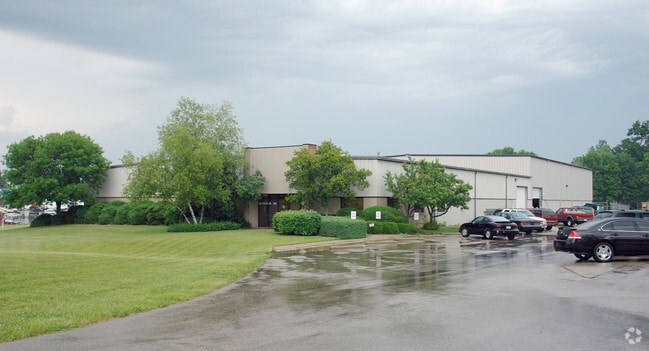
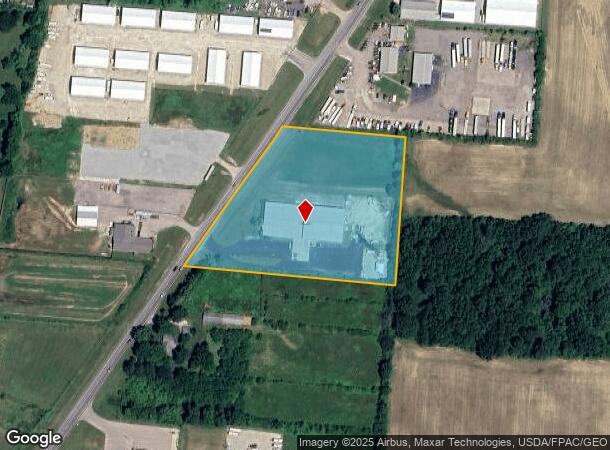
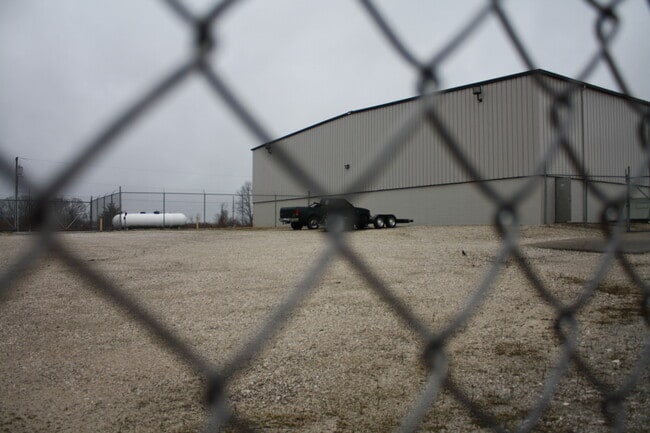
Property Record
8973 State Route 201, Tipp City, OH 45371
Current Lease Availabilities
NEARBY LISTINGS FOR SALE OR LEASE
Property Detail
8973 State Route 201
A01048260
9-2-14 SE COR SE
Lightindustrial
Miami
X
Ohio
39109C0290E
5.08 AC
2024
Northeast Cent Dayton
2024
Cincinnati/Dayton
380100
Dayton, OH
24,000 SF
DEMOGRAPHICS near 8973 State Route 201
1 Mile
3 Mile
5 Mile
2024 Total Population
1,027
21,319
60,923
2029 Population
1,079
21,553
60,533
Pop Growth 2024-2029
+ 5.06%
+ 1.10%
(0.64%)
Average Age
42
40
40
2024 Total Households
393
8,097
23,876
HH Growth 2024-2029
+ 5.09%
+ 0.98%
(0.74%)
Median Household Inc
$79,500
$82,702
$71,356
Avg Household Size
2.50
2.60
2.50
2024 Avg HH Vehicles
2.00
2.00
2.00
Median Home Value
$257,812
$192,000
$163,374
Median Year Built
1992
1982
1972
Nearby Places
- Restaurants
- Banks
- Shops
- Fitness
- Groceries
PUBLIC TRANSPORTATION
AIRPORT
James M Cox Dayton International
DRIVE
WALK
Distance
James M Cox Dayton International
18 min
11.9 mi
Nearby Properties
Address
Land Use
TOTAL SIZE
Lot Size
Zoning
Address
Land Use
TOTAL SIZE
Lot Size
Zoning
4,800 SF
0.28 AC
Address
Land Use
TOTAL SIZE
Lot Size
Zoning
0.28 AC
Address
Land Use
TOTAL SIZE
Lot Size
Zoning
99,176 SF
125.08 AC
Address
Land Use
TOTAL SIZE
Lot Size
Zoning
97,034 SF
10 AC
Address
Land Use
TOTAL SIZE
Lot Size
Zoning
74,330 SF
23.79 AC
Address
Land Use
TOTAL SIZE
Lot Size
Zoning
Address
Land Use
TOTAL SIZE
Lot Size
Zoning
135,300 SF
13.75 AC
Address
Land Use
TOTAL SIZE
Lot Size
Zoning
23,980 SF
9.47 AC
Address
Land Use
TOTAL SIZE
Lot Size
Zoning
5,809 SF
12.84 AC
Address
Land Use
TOTAL SIZE
Lot Size
Zoning
3,903 SF
5.38 AC
Address
Land Use
TOTAL SIZE
Lot Size
Zoning
257,104 SF
80.05 AC
Address
Land Use
TOTAL SIZE
Lot Size
Zoning
3,420 SF
12.59 AC
Address
Land Use
TOTAL SIZE
Lot Size
Zoning
207,442 SF
42.40 AC
Address
Land Use
TOTAL SIZE
Lot Size
Zoning
8,081 SF
8.42 AC
Address
Land Use
TOTAL SIZE
Lot Size
Zoning
Address
Land Use
TOTAL SIZE
Lot Size
Zoning
203,243 SF
24.41 AC
Address
Land Use
TOTAL SIZE
Lot Size
Zoning
25.14 AC
A-1
Address
Land Use
TOTAL SIZE
Lot Size
Zoning
173,672 SF
38.87 AC
Address
Land Use
TOTAL SIZE
Lot Size
Zoning
121,366 SF
12.79 AC
Address
Land Use
TOTAL SIZE
Lot Size
Zoning
47,904 SF
2.25 AC
Address
Land Use
TOTAL SIZE
Lot Size
Zoning
16,778 SF
1.89 AC
Address
Land Use
TOTAL SIZE
Lot Size
Zoning
71,007 SF
5.35 AC
Address
Land Use
TOTAL SIZE
Lot Size
Zoning
101,500 SF
37.45 AC
Address
Land Use
TOTAL SIZE
Lot Size
Zoning
131,592 SF
11.05 AC
Address
Land Use
TOTAL SIZE
Lot Size
Zoning
33,634 SF
3.12 AC
Address
Land Use
TOTAL SIZE
Lot Size
Zoning
41,046 SF
17.94 AC
Address
Land Use
TOTAL SIZE
Lot Size
Zoning
104,000 SF
10.29 AC
Address
Land Use
TOTAL SIZE
Lot Size
Zoning
109,818 SF
35.83 AC
Address
Land Use
TOTAL SIZE
Lot Size
Zoning
8,413 SF
1.76 AC
Address
Land Use
TOTAL SIZE
Lot Size
Zoning
132,218 SF
41.35 AC
The World's #1 Commercial Real Estate Marketplace
Connect with us
© 2025 CoStar Group
The information above has been obtained from sources believed reliable. While we do not doubt its accuracy we have not verified it and make no guarantee, warranty or representation about it. It is your responsibility to independently confirm its accuracy and completeness. Any projections, opinions, assumptions, or estimates used are for example only and do not represent the current or future performance of the property. The value of this transaction to you depends on tax and other factors which should be evaluated by your tax, financial, and legal advisors. You and your advisors should conduct a careful, independent investigation of the property to determine to your satisfaction the suitability of the property for your needs.