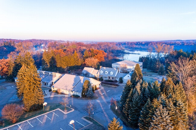
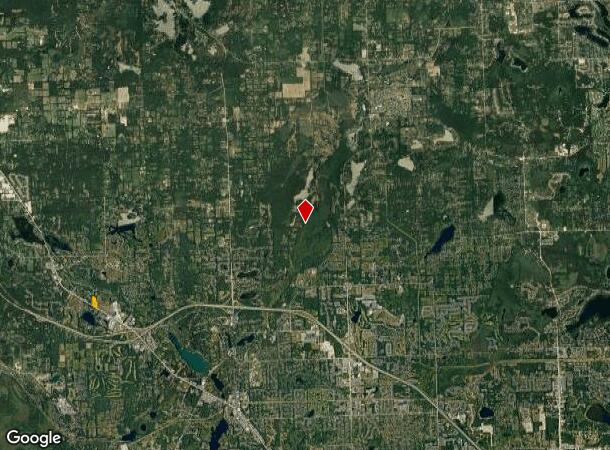
Property Record
8980 Dixie Hwy, Clarkston, MI 48348
NEARBY LISTINGS FOR SALE OR LEASE
Property Detail
8980 Dixie Hwy
07-13-301-004
T4N, R8E, SEC 13 PART OF SW 1/4 BEG AT PT DIST N 00-21-24 W 867.50 FT FROM SW SEC COR, TH N 765 FT, TH S 47-26-12 E 247.19 FT, TH S 04-45-35 W 202.14 FT, TH S 35-05-35 E 207.36 FT, TH S 03-26-20 W 397 FT, TH N 56-57-19 W 310.99 FT TO BEG 4 A 4-3-90 F
Publicschool
Oakland
X
Michigan
26125C0327F
4 AC
2024
St Clair & Lapeer Counties
2024
Detroit
127100
Detroit-Warren-Dearborn, MI
16,585 SF
DEMOGRAPHICS near 8980 Dixie Hwy
1 Mile
3 Mile
5 Mile
2024 Total Population
2,460
17,023
43,683
2029 Population
2,429
16,885
43,341
Pop Growth 2024-2029
(1.26%)
(0.81%)
(0.78%)
Average Age
42
43
43
2024 Total Households
944
6,217
16,847
HH Growth 2024-2029
(1.27%)
(0.87%)
(0.86%)
Median Household Inc
$95,138
$117,692
$101,318
Avg Household Size
2.60
2.70
2.50
2024 Avg HH Vehicles
2.00
2.00
2.00
Median Home Value
$434,920
$376,001
$326,551
Median Year Built
1992
1984
1981
Nearby Places
Map Layers
Map Styles
 Street
 Aerial
- Restaurants
- Banks
- Shops
- Fitness
- Groceries
PUBLIC TRANSPORTATION
AIRPORT
Bishop International
DRIVE
WALK
Distance
Bishop International
49 min
29.5 mi
Freight Ports
Port of Toledo
DRIVE
WALK
Distance
Port of Toledo
122 min
89.2 mi
SALE & LEASE HISTORY
LISTING DATE
SALE/LEASE

Feb 03, 2022
For Sale
Nearby Properties
Address
Land Use
TOTAL SIZE
Lot Size
Zoning
Address
Land Use
TOTAL SIZE
Lot Size
Zoning
138,009 SF
8.03 AC
PUD
Address
Land Use
TOTAL SIZE
Lot Size
Zoning
17.63 AC
R3
Address
Land Use
TOTAL SIZE
Lot Size
Zoning
64,763 SF
27.90 AC
PUD
Address
Land Use
TOTAL SIZE
Lot Size
Zoning
34,335 SF
74.71 AC
REC
Address
Land Use
TOTAL SIZE
Lot Size
Zoning
129.86 AC
AI
Address
Land Use
TOTAL SIZE
Lot Size
Zoning
100.77 AC
AI
Address
Land Use
TOTAL SIZE
Lot Size
Zoning
35,155 SF
87.55 AC
REC
Address
Land Use
TOTAL SIZE
Lot Size
Zoning
120,673 SF
9.40 AC
IOP
Address
Land Use
TOTAL SIZE
Lot Size
Zoning
Address
Land Use
TOTAL SIZE
Lot Size
Zoning
33,365 SF
320.73 AC
PRD
Address
Land Use
TOTAL SIZE
Lot Size
Zoning
49,169 SF
5.02 AC
PUD
Address
Land Use
TOTAL SIZE
Lot Size
Zoning
48,645 SF
6.68 AC
PUD
Address
Land Use
TOTAL SIZE
Lot Size
Zoning
117,980 SF
11.33 AC
IOP
Address
Land Use
TOTAL SIZE
Lot Size
Zoning
44,915 SF
0.47 AC
PUD
Address
Land Use
TOTAL SIZE
Lot Size
Zoning
31,068 SF
3 AC
PUD
Address
Land Use
TOTAL SIZE
Lot Size
Zoning
62,944 SF
6.65 AC
C-2
Address
Land Use
TOTAL SIZE
Lot Size
Zoning
34,807 SF
3.34 AC
OS-2
Address
Land Use
TOTAL SIZE
Lot Size
Zoning
97,730 SF
3.91 AC
PUD
Address
Land Use
TOTAL SIZE
Lot Size
Zoning
20.33 AC
PUD
Address
Land Use
TOTAL SIZE
Lot Size
Zoning
8,006 SF
1.24 AC
OS-2
Address
Land Use
TOTAL SIZE
Lot Size
Zoning
19.14 AC
PUD
Address
Land Use
TOTAL SIZE
Lot Size
Zoning
28,742 SF
1.87 AC
PUD
Address
Land Use
TOTAL SIZE
Lot Size
Zoning
72,419 SF
20 AC
RO
Address
Land Use
TOTAL SIZE
Lot Size
Zoning
31,057 SF
5.40 AC
BI
Address
Land Use
TOTAL SIZE
Lot Size
Zoning
7,602 SF
2.15 AC
R1A
Address
Land Use
TOTAL SIZE
Lot Size
Zoning
14,285 SF
57.19 AC
REC
Address
Land Use
TOTAL SIZE
Lot Size
Zoning
9,479 SF
34.57 AC
REC
Address
Land Use
TOTAL SIZE
Lot Size
Zoning
40,909 SF
3.73 AC
AI
Address
Land Use
TOTAL SIZE
Lot Size
Zoning
40,215 SF
4.76 AC
C-2
Address
Land Use
TOTAL SIZE
Lot Size
Zoning
6,673 SF
40 AC
R1R
The World's #1 Commercial Real Estate Marketplace
Connect with us
© 2025 CoStar Group
The information above has been obtained from sources believed reliable. While we do not doubt its accuracy we have not verified it and make no guarantee, warranty or representation about it. It is your responsibility to independently confirm its accuracy and completeness. Any projections, opinions, assumptions, or estimates used are for example only and do not represent the current or future performance of the property. The value of this transaction to you depends on tax and other factors which should be evaluated by your tax, financial, and legal advisors. You and your advisors should conduct a careful, independent investigation of the property to determine to your satisfaction the suitability of the property for your needs.