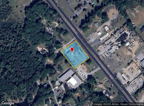
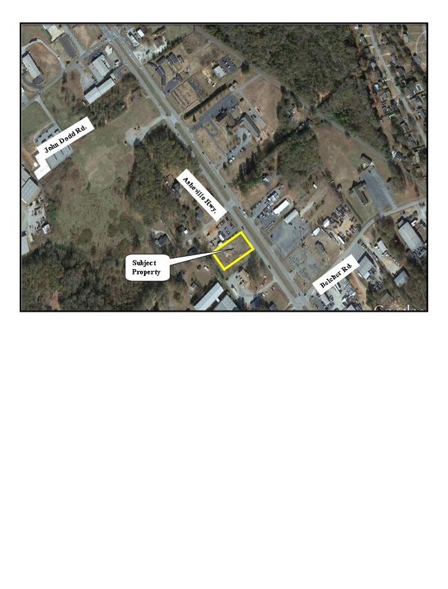
Property Record
8989 Asheville Hwy, Boiling Springs, SC 29316


NEARBY LISTINGS FOR SALE OR LEASE
Property Detail
8989 Asheville Hwy
Spartanburg, SC
Ligon & Bishop Farm
2-50-00-048.03
LOTS 4, 5 & 6 LIGON & BISHOP FARM PB 54-642 PB 160-226
Commercialnec
Spartanburg
X
South Carolina
45083C0144D
4,5,6
2024
1.80 AC
2025
Upper Spartanburg County
021804
Greenville/Spartanburg
500 SF
DEMOGRAPHICS near 8989 Asheville Hwy
1 Mile
3 Mile
5 Mile
2024 Total Population
4,748
28,788
74,290
2029 Population
5,338
32,673
84,102
Pop Growth 2024-2029
+ 12.43%
+ 13.50%
+ 13.21%
Average Age
37
37
38
2024 Total Households
1,773
10,570
27,524
HH Growth 2024-2029
+ 12.69%
+ 13.96%
+ 13.56%
Median Household Inc
$49,565
$60,350
$57,296
Avg Household Size
2.60
2.50
2.60
2024 Avg HH Vehicles
2.00
2.00
2.00
Median Home Value
$163,885
$192,069
$179,936
Median Year Built
1981
1997
1993
Nearby Places
Map Layers
Map Styles
 Street
 Aerial
- Restaurants
- Banks
- Shops
- Fitness
- Groceries
PUBLIC TRANSPORTATION
COMMUTER RAIL
Spartanburg Amtrak Station (Crescent - Amtrak)
DRIVE
WALK
Distance
Spartanburg Amtrak Station (Crescent - Amtrak)
12 min
6.4 mi
AIRPORT
Greenville Spartanburg International
DRIVE
WALK
Distance
Greenville Spartanburg International
27 min
18.4 mi
Freight Ports
North Charleston Terminal
DRIVE
WALK
Distance
North Charleston Terminal
223 min
199.2 mi
SALE & LEASE HISTORY
LISTING DATE
SALE/LEASE

Dec 15, 2016
For Sale
Nearby Properties
Address
Land Use
TOTAL SIZE
Lot Size
Zoning
Address
Land Use
TOTAL SIZE
Lot Size
Zoning
4,172 SF
15.98 AC
Address
Land Use
TOTAL SIZE
Lot Size
Zoning
5,547 SF
6.58 AC
Address
Land Use
TOTAL SIZE
Lot Size
Zoning
175,000 SF
17.70 AC
Address
Land Use
TOTAL SIZE
Lot Size
Zoning
100,000 SF
8.29 AC
Address
Land Use
TOTAL SIZE
Lot Size
Zoning
239,095 SF
22.41 AC
Address
Land Use
TOTAL SIZE
Lot Size
Zoning
Address
Land Use
TOTAL SIZE
Lot Size
Zoning
64,092 SF
30.61 AC
Address
Land Use
TOTAL SIZE
Lot Size
Zoning
37.35 AC
Address
Land Use
TOTAL SIZE
Lot Size
Zoning
1,221,473 SF
36.50 AC
Address
Land Use
TOTAL SIZE
Lot Size
Zoning
341,895 SF
31.62 AC
Address
Land Use
TOTAL SIZE
Lot Size
Zoning
81,040 SF
15.39 AC
Address
Land Use
TOTAL SIZE
Lot Size
Zoning
33,550 SF
3.77 AC
Address
Land Use
TOTAL SIZE
Lot Size
Zoning
20,976 SF
23.72 AC
Address
Land Use
TOTAL SIZE
Lot Size
Zoning
41,694 SF
4.01 AC
Address
Land Use
TOTAL SIZE
Lot Size
Zoning
8,911 SF
23.64 AC
Address
Land Use
TOTAL SIZE
Lot Size
Zoning
176,072 SF
13.72 AC
Address
Land Use
TOTAL SIZE
Lot Size
Zoning
201,900 SF
39.10 AC
Address
Land Use
TOTAL SIZE
Lot Size
Zoning
7,000 SF
3 AC
Address
Land Use
TOTAL SIZE
Lot Size
Zoning
193,279 SF
10.79 AC
Address
Land Use
TOTAL SIZE
Lot Size
Zoning
64,471 SF
18.66 AC
Address
Land Use
TOTAL SIZE
Lot Size
Zoning
2,220 SF
14.09 AC
Address
Land Use
TOTAL SIZE
Lot Size
Zoning
76,325 SF
17.28 AC
Address
Land Use
TOTAL SIZE
Lot Size
Zoning
102,400 SF
25.19 AC
Address
Land Use
TOTAL SIZE
Lot Size
Zoning
17,971 SF
39.35 AC
Address
Land Use
TOTAL SIZE
Lot Size
Zoning
277,152 SF
27.20 AC
Address
Land Use
TOTAL SIZE
Lot Size
Zoning
Address
Land Use
TOTAL SIZE
Lot Size
Zoning
5,236 SF
0.65 AC
Address
Land Use
TOTAL SIZE
Lot Size
Zoning
6,695 SF
0.30 AC
Address
Land Use
TOTAL SIZE
Lot Size
Zoning
4,426 SF
Address
Land Use
TOTAL SIZE
Lot Size
Zoning
7,600 SF
2.18 AC
The World's #1 Commercial Real Estate Marketplace
Connect with us
© 2025 CoStar Group
The information above has been obtained from sources believed reliable. While we do not doubt its accuracy we have not verified it and make no guarantee, warranty or representation about it. It is your responsibility to independently confirm its accuracy and completeness. Any projections, opinions, assumptions, or estimates used are for example only and do not represent the current or future performance of the property. The value of this transaction to you depends on tax and other factors which should be evaluated by your tax, financial, and legal advisors. You and your advisors should conduct a careful, independent investigation of the property to determine to your satisfaction the suitability of the property for your needs.