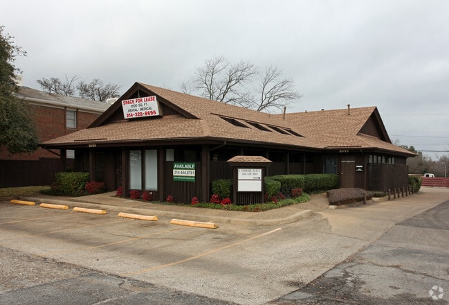
Property Record
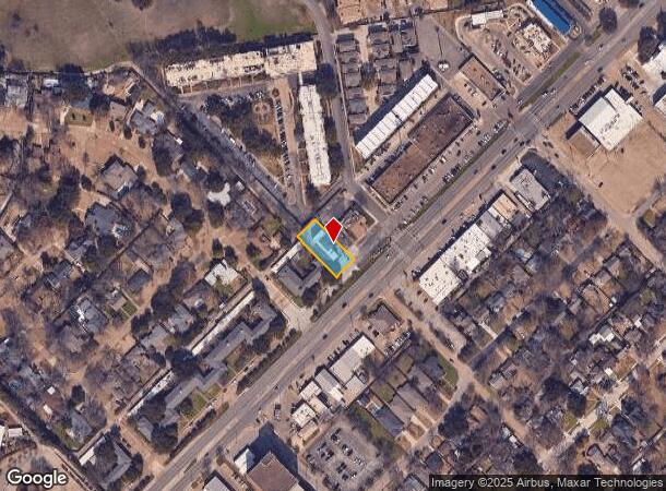
8989 Garland Rd, Dallas, TX 75218
NEARBY LISTINGS FOR SALE OR LEASE
Property Detail
8989 Garland Rd
Dallas-Fort Worth-Arlington, TX
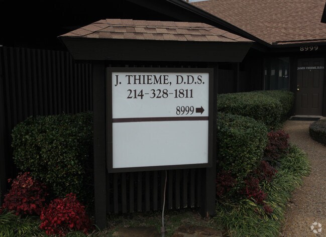
Thieme Office Addn
00441300090010000
THIEME OFFICE ADDN LT 1 BLK 9/4413 .269 AC INT202400092329 DD04302024 CO-DC 4413 009 00100 7DA4413 009
Officebuilding
Dallas
X
Texas
48113C0355K
1
2024
0.27 AC
2025
White Rock
008101
Dallas/Ft Worth
5,733 SF
DEMOGRAPHICS near 8989 Garland Rd
1 Mile
3 Mile
5 Mile
2024 Total Population
6,912
119,883
402,144
2029 Population
6,950
118,817
400,630
Pop Growth 2024-2029
+ 0.55%
(0.89%)
(0.38%)
Average Age
43
38
36
2024 Total Households
3,363
47,448
164,522
HH Growth 2024-2029
+ 0.42%
(1.02%)
(0.29%)
Median Household Inc
$87,404
$71,267
$62,613
Avg Household Size
2.00
2.50
2.40
2024 Avg HH Vehicles
2.00
2.00
2.00
Median Home Value
$438,823
$369,920
$345,930
Median Year Built
1971
1965
1975
Nearby Places
Map Layers
Map Styles
 Street
 Aerial
- Restaurants
- Banks
- Shops
- Fitness
- Groceries
PUBLIC TRANSPORTATION
COMMUTER RAIL
Victory Station (DART LIGHT RAIL - GREEN LINE - Dallas Area Rapid Transit (DART), DART LIGHT RAIL - ORANGE LINE - Dallas Area Rapid Transit (DART), TRINITY RAILWAY - Dallas Area Rapid Transit (DART))
DRIVE
WALK
Distance
Victory Station (DART LIGHT RAIL - GREEN LINE - Dallas Area Rapid Transit (DART), DART LIGHT RAIL - ORANGE LINE - Dallas Area Rapid Transit (DART), TRINITY RAILWAY - Dallas Area Rapid Transit (DART))
14 min
8.0 mi
Medical/Market Ctr Station (TRINITY RAILWAY - Dallas Area Rapid Transit (DART))
DRIVE
WALK
Distance
Medical/Market Ctr Station (TRINITY RAILWAY - Dallas Area Rapid Transit (DART))
18 min
9.9 mi
AIRPORT
Dallas Love Field
DRIVE
WALK
Distance
Dallas Love Field
23 min
11.3 mi
Dallas-Fort Worth International
DRIVE
WALK
Distance
Dallas-Fort Worth International
38 min
27.4 mi
Freight Ports
Port of Shreveport
DRIVE
WALK
Distance
Port of Shreveport
209 min
192.6 mi
Nearby Properties
Address
Land Use
TOTAL SIZE
Lot Size
Zoning
Address
Land Use
TOTAL SIZE
Lot Size
Zoning
372,564 SF
13.34 AC
Z164
Address
Land Use
TOTAL SIZE
Lot Size
Zoning
32,530 SF
0.02 AC
Z239
Address
Land Use
TOTAL SIZE
Lot Size
Zoning
392,842 SF
16.79 AC
Z164
Address
Land Use
TOTAL SIZE
Lot Size
Zoning
691,816 SF
19.50 AC
Z239
Address
Land Use
TOTAL SIZE
Lot Size
Zoning
397,809 SF
18.04 AC
Z298
Address
Land Use
TOTAL SIZE
Lot Size
Zoning
368,350 SF
1.21 AC
Z59
Address
Land Use
TOTAL SIZE
Lot Size
Zoning
252,473 SF
7.28 AC
Z165
Address
Land Use
TOTAL SIZE
Lot Size
Zoning
391,774 SF
3.97 AC
Z239
Address
Land Use
TOTAL SIZE
Lot Size
Zoning
445,781 SF
4.57 AC
Z239
Address
Land Use
TOTAL SIZE
Lot Size
Zoning
245,023 SF
6.84 AC
Z164
Address
Land Use
TOTAL SIZE
Lot Size
Zoning
247,421 SF
3.96 AC
Z133
Address
Land Use
TOTAL SIZE
Lot Size
Zoning
284,990 SF
24.80 AC
Z298
Address
Land Use
TOTAL SIZE
Lot Size
Zoning
509,014 SF
30.82 AC
Z31
Address
Land Use
TOTAL SIZE
Lot Size
Zoning
349,156 SF
10.86 AC
Z59
Address
Land Use
TOTAL SIZE
Lot Size
Zoning
196,386 SF
7.24 AC
Z164
Address
Land Use
TOTAL SIZE
Lot Size
Zoning
195,495 SF
9.61 AC
Z298
Address
Land Use
TOTAL SIZE
Lot Size
Zoning
167,340 SF
11.24 AC
Z59
Address
Land Use
TOTAL SIZE
Lot Size
Zoning
161,796 SF
14.84 AC
Z239
Address
Land Use
TOTAL SIZE
Lot Size
Zoning
244,575 SF
9.91 AC
Z164
Address
Land Use
TOTAL SIZE
Lot Size
Zoning
174,353 SF
12.64 AC
Z248
Address
Land Use
TOTAL SIZE
Lot Size
Zoning
171,348 SF
5.70 AC
Z164
Address
Land Use
TOTAL SIZE
Lot Size
Zoning
289,172 SF
12.56 AC
Z164
Address
Land Use
TOTAL SIZE
Lot Size
Zoning
228,857 SF
21.91 AC
Z298
Address
Land Use
TOTAL SIZE
Lot Size
Zoning
110,708 SF
16.79 AC
Z298
Address
Land Use
TOTAL SIZE
Lot Size
Zoning
196,470 SF
9.64 AC
Z163
Address
Land Use
TOTAL SIZE
Lot Size
Zoning
175,380 SF
6.79 AC
Z164
Address
Land Use
TOTAL SIZE
Lot Size
Zoning
89,165 SF
9.60 AC
Z248
Address
Land Use
TOTAL SIZE
Lot Size
Zoning
230,304 SF
10.03 AC
Z248
Address
Land Use
TOTAL SIZE
Lot Size
Zoning
188,463 SF
5.29 AC
Z164
Address
Land Use
TOTAL SIZE
Lot Size
Zoning
74,895 SF
64.64 AC
Z239
The World's #1 Commercial Real Estate Marketplace
Connect with us
© 2025 CoStar Group
The information above has been obtained from sources believed reliable. While we do not doubt its accuracy we have not verified it and make no guarantee, warranty or representation about it. It is your responsibility to independently confirm its accuracy and completeness. Any projections, opinions, assumptions, or estimates used are for example only and do not represent the current or future performance of the property. The value of this transaction to you depends on tax and other factors which should be evaluated by your tax, financial, and legal advisors. You and your advisors should conduct a careful, independent investigation of the property to determine to your satisfaction the suitability of the property for your needs.