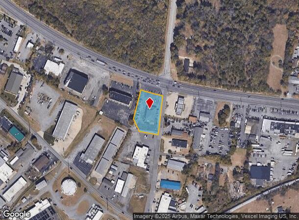
Property Record
901 W Main St, Hendersonville, TN 37075
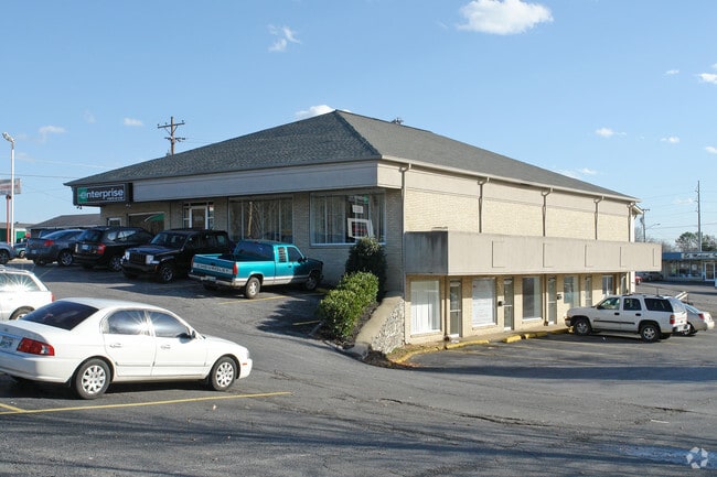
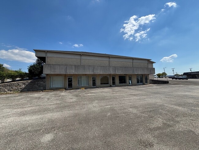
This Property Is For Sale
NEARBY LISTINGS FOR SALE OR LEASE
Property Detail
901 W Main St
160O-D-014.00
DISTRICT: 05 ENTERPRISE RENT-A-CAR, COUNTY AREA: H01
Officebuilding
Sumner
X
Tennessee
47165C0392H
0.87 AC
2024
Hendersonville-Gallatin
2025
Nashville
021105
Nashville-Davidson--Murfreesboro--Franklin, TN
8,605 SF
DEMOGRAPHICS near 901 W Main St
1 Mile
3 Mile
5 Mile
2024 Total Population
3,976
42,499
113,288
2029 Population
4,346
46,095
119,812
Pop Growth 2024-2029
+ 9.31%
+ 8.46%
+ 5.76%
Average Age
37
41
40
2024 Total Households
1,850
17,853
45,524
HH Growth 2024-2029
+ 9.57%
+ 8.31%
+ 5.46%
Median Household Inc
$54,490
$63,246
$66,490
Avg Household Size
2.10
2.30
2.40
2024 Avg HH Vehicles
2.00
2.00
2.00
Median Home Value
$268,589
$289,198
$315,608
Median Year Built
1989
1986
1985
Nearby Places
Map Layers
Map Styles
 Street
 Aerial
- Restaurants
- Banks
- Shops
- Fitness
- Groceries
PUBLIC TRANSPORTATION
AIRPORT
Nashville International
DRIVE
WALK
Distance
Nashville International
31 min
24.1 mi
Freight Ports
Port of Mobile
DRIVE
WALK
Distance
Port of Mobile
503 min
461.6 mi
Nearby Properties
Address
Land Use
TOTAL SIZE
Lot Size
Zoning
Address
Land Use
TOTAL SIZE
Lot Size
Zoning
4,851 SF
76.79 AC
RM4
Address
Land Use
TOTAL SIZE
Lot Size
Zoning
25,212 SF
31.56 AC
Address
Land Use
TOTAL SIZE
Lot Size
Zoning
102,431 SF
19.59 AC
6ZZ
Address
Land Use
TOTAL SIZE
Lot Size
Zoning
86,086 SF
8 AC
OPS
Address
Land Use
TOTAL SIZE
Lot Size
Zoning
3,993 SF
21.86 AC
6ZZ
Address
Land Use
TOTAL SIZE
Lot Size
Zoning
169,292 SF
12 AC
RM20
Address
Land Use
TOTAL SIZE
Lot Size
Zoning
3,500 SF
17.61 AC
6ZZ
Address
Land Use
TOTAL SIZE
Lot Size
Zoning
56,782 SF
11.37 AC
Address
Land Use
TOTAL SIZE
Lot Size
Zoning
31,919 SF
14.69 AC
Address
Land Use
TOTAL SIZE
Lot Size
Zoning
25,200 SF
20.36 AC
RM2
Address
Land Use
TOTAL SIZE
Lot Size
Zoning
29,068 SF
13.30 AC
TCR
Address
Land Use
TOTAL SIZE
Lot Size
Zoning
3,312 SF
33.03 AC
IR
Address
Land Use
TOTAL SIZE
Lot Size
Zoning
191,733 SF
62.90 AC
MULTI-ZONE
Address
Land Use
TOTAL SIZE
Lot Size
Zoning
42,840 SF
21.43 AC
CS
Address
Land Use
TOTAL SIZE
Lot Size
Zoning
12,576 SF
16.09 AC
6ZZ
Address
Land Use
TOTAL SIZE
Lot Size
Zoning
34,752 SF
19.09 AC
CS
Address
Land Use
TOTAL SIZE
Lot Size
Zoning
105,942 SF
14.80 AC
GCS
Address
Land Use
TOTAL SIZE
Lot Size
Zoning
15,456 SF
23.18 AC
Address
Land Use
TOTAL SIZE
Lot Size
Zoning
20,896 SF
17.79 AC
Address
Land Use
TOTAL SIZE
Lot Size
Zoning
17,500 SF
17.56 AC
SCR
Address
Land Use
TOTAL SIZE
Lot Size
Zoning
1,707 SF
15.03 AC
6ZZ
Address
Land Use
TOTAL SIZE
Lot Size
Zoning
27,038 SF
4.05 AC
Address
Land Use
TOTAL SIZE
Lot Size
Zoning
161,880 SF
23.90 AC
GCS
Address
Land Use
TOTAL SIZE
Lot Size
Zoning
105,542 SF
9.09 AC
GCS
Address
Land Use
TOTAL SIZE
Lot Size
Zoning
21,213 SF
6.56 AC
Address
Land Use
TOTAL SIZE
Lot Size
Zoning
31,728 SF
13.59 AC
GCS
Address
Land Use
TOTAL SIZE
Lot Size
Zoning
10,842 SF
17.25 AC
CS
Address
Land Use
TOTAL SIZE
Lot Size
Zoning
10,480 SF
17.37 AC
SP
Address
Land Use
TOTAL SIZE
Lot Size
Zoning
160,337 SF
24.22 AC
MULTI-ZONE
Address
Land Use
TOTAL SIZE
Lot Size
Zoning
18,762 SF
13.02 AC
The World's #1 Commercial Real Estate Marketplace
Connect with us
© 2025 CoStar Group
The information above has been obtained from sources believed reliable. While we do not doubt its accuracy we have not verified it and make no guarantee, warranty or representation about it. It is your responsibility to independently confirm its accuracy and completeness. Any projections, opinions, assumptions, or estimates used are for example only and do not represent the current or future performance of the property. The value of this transaction to you depends on tax and other factors which should be evaluated by your tax, financial, and legal advisors. You and your advisors should conduct a careful, independent investigation of the property to determine to your satisfaction the suitability of the property for your needs.