Property Record
899 Heathrow Park Ln, Lake Mary, FL 32746


NEARBY LISTINGS FOR SALE OR LEASE
Property Detail
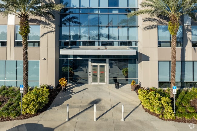
899 Heathrow Park Ln
06-20-30-300-002Y-0000
SEC 06 TWP 20S RGE 30E FROM SW COR RUN E 2627.86 FT N 3059.11 FT N 18 DEG W 507.85 FT TO POB RUN N 18 DEG W 314.56 FT S 72 DEG W 274.13 FT N 18 DEG W 447.49 FT N 115.74 FT N 72 DEG E 159.91 FT N 22 DEG 55 MIN 9 SEC W 27.27 FT N 66 DEG 57 MIN 53 SEC E
Officebuilding
Seminole
X
Florida
12069C0450E
13.45 AC
2024
Lake Mary
2024
Orlando
020704
Orlando-Kissimmee-Sanford, FL
220,400 SF
DEMOGRAPHICS near 899 Heathrow Park Ln
1 Mile
3 Mile
5 Mile
2024 Total Population
9,015
62,230
127,992
2029 Population
9,500
65,045
133,830
Pop Growth 2024-2029
+ 5.38%
+ 4.52%
+ 4.56%
Average Age
41
41
40
2024 Total Households
3,916
24,897
48,824
HH Growth 2024-2029
+ 5.54%
+ 4.73%
+ 4.73%
Median Household Inc
$100,966
$91,641
$77,698
Avg Household Size
2.30
2.50
2.50
2024 Avg HH Vehicles
2.00
2.00
2.00
Median Home Value
$389,375
$377,553
$352,763
Median Year Built
2002
1998
1995
Nearby Places
Map Layers
Map Styles
 Street
 Aerial
- Restaurants
- Banks
- Shops
- Fitness
- Groceries
PUBLIC TRANSPORTATION
AIRPORT
Orlando Sanford International
DRIVE
WALK
Distance
Orlando Sanford International
19 min
11.1 mi
Daytona Beach International
DRIVE
WALK
Distance
Daytona Beach International
46 min
35.5 mi
Orlando International
DRIVE
WALK
Distance
Orlando International
48 min
38.0 mi
Freight Ports
Port Canaveral
DRIVE
WALK
Distance
Port Canaveral
85 min
71.0 mi
Nearby Properties
Address
Land Use
TOTAL SIZE
Lot Size
Zoning
Address
Land Use
TOTAL SIZE
Lot Size
Zoning
50,558 SF
15.47 AC
Address
Land Use
TOTAL SIZE
Lot Size
Zoning
1,225 SF
17 AC
Address
Land Use
TOTAL SIZE
Lot Size
Zoning
1,770 SF
47.41 AC
PUD
Address
Land Use
TOTAL SIZE
Lot Size
Zoning
3,206 SF
47.56 AC
PUD
Address
Land Use
TOTAL SIZE
Lot Size
Zoning
1,096 SF
22.55 AC
PUD
Address
Land Use
TOTAL SIZE
Lot Size
Zoning
2,548 SF
34.45 AC
PUD
Address
Land Use
TOTAL SIZE
Lot Size
Zoning
1,992 SF
4.76 AC
A1
Address
Land Use
TOTAL SIZE
Lot Size
Zoning
6.26 AC
Address
Land Use
TOTAL SIZE
Lot Size
Zoning
425,407 SF
19.88 AC
Address
Land Use
TOTAL SIZE
Lot Size
Zoning
2,181 SF
4.92 AC
A1
Address
Land Use
TOTAL SIZE
Lot Size
Zoning
0.93 AC
A1
Address
Land Use
TOTAL SIZE
Lot Size
Zoning
120,877 SF
12 AC
Address
Land Use
TOTAL SIZE
Lot Size
Zoning
311,881 SF
10.52 AC
PCD
Address
Land Use
TOTAL SIZE
Lot Size
Zoning
23,184 SF
31.05 AC
PUD
Address
Land Use
TOTAL SIZE
Lot Size
Zoning
92,995 SF
31.61 AC
PUD
Address
Land Use
TOTAL SIZE
Lot Size
Zoning
5,814 SF
0.87 AC
PUD
Address
Land Use
TOTAL SIZE
Lot Size
Zoning
4,254 SF
23.23 AC
PUD
Address
Land Use
TOTAL SIZE
Lot Size
Zoning
60,605 SF
42.71 AC
C1
Address
Land Use
TOTAL SIZE
Lot Size
Zoning
24,382 SF
18.45 AC
A1
Address
Land Use
TOTAL SIZE
Lot Size
Zoning
299,844 SF
20.34 AC
PUD
Address
Land Use
TOTAL SIZE
Lot Size
Zoning
605,535 SF
39.31 AC
PUD
Address
Land Use
TOTAL SIZE
Lot Size
Zoning
320,968 SF
2.96 AC
PUD
Address
Land Use
TOTAL SIZE
Lot Size
Zoning
21,266 SF
14.61 AC
Address
Land Use
TOTAL SIZE
Lot Size
Zoning
241,653 SF
6.69 AC
Address
Land Use
TOTAL SIZE
Lot Size
Zoning
3,433 SF
11.15 AC
Address
Land Use
TOTAL SIZE
Lot Size
Zoning
3,668 SF
3.12 AC
C1
Address
Land Use
TOTAL SIZE
Lot Size
Zoning
505 SF
1.94 AC
Address
Land Use
TOTAL SIZE
Lot Size
Zoning
269,490 SF
24.57 AC
PD
Address
Land Use
TOTAL SIZE
Lot Size
Zoning
62,547 SF
15.16 AC
The World's #1 Commercial Real Estate Marketplace
Connect with us
© 2025 CoStar Group
The information above has been obtained from sources believed reliable. While we do not doubt its accuracy we have not verified it and make no guarantee, warranty or representation about it. It is your responsibility to independently confirm its accuracy and completeness. Any projections, opinions, assumptions, or estimates used are for example only and do not represent the current or future performance of the property. The value of this transaction to you depends on tax and other factors which should be evaluated by your tax, financial, and legal advisors. You and your advisors should conduct a careful, independent investigation of the property to determine to your satisfaction the suitability of the property for your needs.