Property Record
899 Mount Ulla Hwy, Mooresville, NC 28115
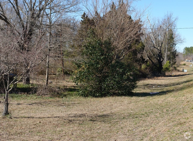
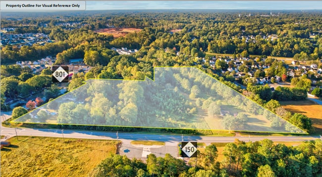

This Property Is For Sale
NEARBY LISTINGS FOR SALE OR LEASE
Property Detail
899 Mount Ulla Hwy
Charlotte
Iredell
Charlotte-Concord-Gastonia, NC-SC
North Carolina
4668-60-9923.000
2.55 AC
Sfr
Iredell County
1,042 SF
DEMOGRAPHICS near 899 Mount Ulla Hwy
1 Mile
3 Mile
5 Mile
2024 Total Population
5,272
26,339
59,352
2029 Population
5,938
29,583
67,062
Pop Growth 2024-2029
+ 12.63%
+ 12.32%
+ 12.99%
Average Age
37
38
39
2024 Total Households
1,934
9,927
22,869
HH Growth 2024-2029
+ 12.56%
+ 12.22%
+ 12.92%
Median Household Inc
$72,633
$69,466
$74,779
Avg Household Size
2.70
2.60
2.60
2024 Avg HH Vehicles
2.00
2.00
2.00
Median Home Value
$262,419
$252,185
$267,086
Median Year Built
1998
1997
2000
Nearby Places
Map Layers
Map Styles
 Street
 Aerial
- Restaurants
- Banks
- Shops
- Fitness
- Groceries
PUBLIC TRANSPORTATION
AIRPORT
Concord-Padgett Regional
DRIVE
WALK
Distance
Concord-Padgett Regional
33 min
18.5 mi
Charlotte/Douglas International
DRIVE
WALK
Distance
Charlotte/Douglas International
51 min
36.5 mi
Freight Ports
Port of Wilmington
DRIVE
WALK
Distance
Port of Wilmington
284 min
227.4 mi
Nearby Properties
Address
Land Use
TOTAL SIZE
Lot Size
Zoning
Address
Land Use
TOTAL SIZE
Lot Size
Zoning
354,759 SF
10.25 AC
RLI
Address
Land Use
TOTAL SIZE
Lot Size
Zoning
548,374 SF
76.20 AC
IN
Address
Land Use
TOTAL SIZE
Lot Size
Zoning
8,328 SF
38.14 AC
IN
Address
Land Use
TOTAL SIZE
Lot Size
Zoning
30,300 SF
104.98 AC
IN
Address
Land Use
TOTAL SIZE
Lot Size
Zoning
129,131 SF
73.02 AC
RLS
Address
Land Use
TOTAL SIZE
Lot Size
Zoning
36,376 SF
2.27 AC
TD
Address
Land Use
TOTAL SIZE
Lot Size
Zoning
499,300 SF
38.56 AC
HLI
Address
Land Use
TOTAL SIZE
Lot Size
Zoning
229,615 SF
23.01 AC
HLI
Address
Land Use
TOTAL SIZE
Lot Size
Zoning
220,327 SF
22.17 AC
HLI
Address
Land Use
TOTAL SIZE
Lot Size
Zoning
13,740 SF
15 AC
CC
Address
Land Use
TOTAL SIZE
Lot Size
Zoning
339,265 SF
61.75 AC
IN
Address
Land Use
TOTAL SIZE
Lot Size
Zoning
27,766 SF
15.29 AC
RG
Address
Land Use
TOTAL SIZE
Lot Size
Zoning
110,000 SF
32.22 AC
RLS
Address
Land Use
TOTAL SIZE
Lot Size
Zoning
293,128 SF
42.14 AC
HLI
Address
Land Use
TOTAL SIZE
Lot Size
Zoning
88,045 SF
2.11 AC
TD
Address
Land Use
TOTAL SIZE
Lot Size
Zoning
248,283 SF
16.56 AC
IN
Address
Land Use
TOTAL SIZE
Lot Size
Zoning
401,119 SF
20 AC
IN
Address
Land Use
TOTAL SIZE
Lot Size
Zoning
290,852 SF
28.73 AC
TD
Address
Land Use
TOTAL SIZE
Lot Size
Zoning
300,000 SF
21.53 AC
IN
Address
Land Use
TOTAL SIZE
Lot Size
Zoning
34,851 SF
7.43 AC
CC
Address
Land Use
TOTAL SIZE
Lot Size
Zoning
122,804 SF
20.72 AC
HLI
Address
Land Use
TOTAL SIZE
Lot Size
Zoning
43,250 SF
22.74 AC
RA
Address
Land Use
TOTAL SIZE
Lot Size
Zoning
142,620 SF
7.47 AC
IN
Address
Land Use
TOTAL SIZE
Lot Size
Zoning
10,986 SF
20.66 AC
CC
Address
Land Use
TOTAL SIZE
Lot Size
Zoning
37,997 SF
49.13 AC
HLI
Address
Land Use
TOTAL SIZE
Lot Size
Zoning
110,544 SF
4.14 AC
DE
Address
Land Use
TOTAL SIZE
Lot Size
Zoning
25,457 SF
5.56 AC
HLI
Address
Land Use
TOTAL SIZE
Lot Size
Zoning
372,232 SF
31.24 AC
IN
Address
Land Use
TOTAL SIZE
Lot Size
Zoning
55,864 SF
11.47 AC
IN
Address
Land Use
TOTAL SIZE
Lot Size
Zoning
90,845 SF
6.50 AC
RG
The World's #1 Commercial Real Estate Marketplace
Connect with us
© 2026 CoStar Group
The information above has been obtained from sources believed reliable. While we do not doubt its accuracy we have not verified it and make no guarantee, warranty or representation about it. It is your responsibility to independently confirm its accuracy and completeness. Any projections, opinions, assumptions, or estimates used are for example only and do not represent the current or future performance of the property. The value of this transaction to you depends on tax and other factors which should be evaluated by your tax, financial, and legal advisors. You and your advisors should conduct a careful, independent investigation of the property to determine to your satisfaction the suitability of the property for your needs.