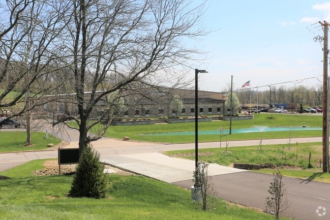
Property Record
899 Venture Blvd, Wooster, OH 44691


NEARBY LISTINGS FOR SALE OR LEASE
Property Detail
899 Venture Blvd
Wooster, OH
Seaman Development Group Subdivision
68-00379-009
LOT 9501 SEAMAN DEVELOPMENT GROUP SUBDIV PH 2 1020.64' 20.747A MP 56
Manufacturinglight
Wayne
X
Ohio
39169C0212E
9501
2024
20.75 AC
2024
Ohio North Area
000600
Other Market Areas
80,000 SF
DEMOGRAPHICS near 899 Venture Blvd
1 Mile
3 Mile
5 Mile
2024 Total Population
3,163
27,703
38,903
2029 Population
3,207
27,965
39,218
Pop Growth 2024-2029
+ 1.39%
+ 0.95%
+ 0.81%
Average Age
42
41
41
2024 Total Households
1,357
11,158
15,727
HH Growth 2024-2029
+ 1.18%
+ 0.88%
+ 0.74%
Median Household Inc
$51,496
$54,909
$57,028
Avg Household Size
2.20
2.20
2.20
2024 Avg HH Vehicles
2.00
2.00
2.00
Median Home Value
$176,399
$177,879
$183,859
Median Year Built
1988
1971
1975
Nearby Places
Map Layers
Map Styles
 Street
 Aerial
- Restaurants
- Banks
- Shops
- Fitness
- Groceries
PUBLIC TRANSPORTATION
AIRPORT
Akron-Canton Regional
DRIVE
WALK
Distance
Akron-Canton Regional
58 min
44.3 mi
Freight Ports
Port of Toledo
DRIVE
WALK
Distance
Port of Toledo
161 min
117.7 mi
SALE & LEASE HISTORY
LISTING DATE
SALE/LEASE

May 27, 2020
For Sale
Apr 29, 2021
For Sale
Nearby Properties
Address
Land Use
TOTAL SIZE
Lot Size
Zoning
Address
Land Use
TOTAL SIZE
Lot Size
Zoning
537,309 SF
43.72 AC
CF
Address
Land Use
TOTAL SIZE
Lot Size
Zoning
70,726 SF
9 AC
CF
Address
Land Use
TOTAL SIZE
Lot Size
Zoning
2,268 SF
106.60 AC
CF
Address
Land Use
TOTAL SIZE
Lot Size
Zoning
152,523 SF
74.14 AC
CF
Address
Land Use
TOTAL SIZE
Lot Size
Zoning
81,133 SF
41.43 AC
CF
Address
Land Use
TOTAL SIZE
Lot Size
Zoning
7.28 AC
CF
Address
Land Use
TOTAL SIZE
Lot Size
Zoning
48,096 SF
1.67 AC
C4
Address
Land Use
TOTAL SIZE
Lot Size
Zoning
50,110 SF
19.26 AC
CF
Address
Land Use
TOTAL SIZE
Lot Size
Zoning
25.14 AC
CF
Address
Land Use
TOTAL SIZE
Lot Size
Zoning
62,910 SF
11.24 AC
C5
Address
Land Use
TOTAL SIZE
Lot Size
Zoning
47,160 SF
3.22 AC
C4
Address
Land Use
TOTAL SIZE
Lot Size
Zoning
125,350 SF
17.20 AC
C5
Address
Land Use
TOTAL SIZE
Lot Size
Zoning
4,486 SF
5.57 AC
CF
Address
Land Use
TOTAL SIZE
Lot Size
Zoning
210,000 SF
20 AC
Address
Land Use
TOTAL SIZE
Lot Size
Zoning
2,536 SF
16.79 AC
R4
Address
Land Use
TOTAL SIZE
Lot Size
Zoning
62,976 SF
10.46 AC
CF
Address
Land Use
TOTAL SIZE
Lot Size
Zoning
58,600 SF
6.30 AC
CF
Address
Land Use
TOTAL SIZE
Lot Size
Zoning
81,724 SF
19.59 AC
CF
Address
Land Use
TOTAL SIZE
Lot Size
Zoning
10.68 AC
M3
Address
Land Use
TOTAL SIZE
Lot Size
Zoning
71,511 SF
9.53 AC
CF
Address
Land Use
TOTAL SIZE
Lot Size
Zoning
41,173 SF
6.77 AC
Address
Land Use
TOTAL SIZE
Lot Size
Zoning
5,156 SF
2.68 AC
R1
Address
Land Use
TOTAL SIZE
Lot Size
Zoning
6,120 SF
12.43 AC
R4
Address
Land Use
TOTAL SIZE
Lot Size
Zoning
49,001 SF
9.79 AC
C5
Address
Land Use
TOTAL SIZE
Lot Size
Zoning
134,248 SF
14.37 AC
C5
Address
Land Use
TOTAL SIZE
Lot Size
Zoning
6,631 SF
7.18 AC
R4
Address
Land Use
TOTAL SIZE
Lot Size
Zoning
19,806 SF
11.70 AC
C5
Address
Land Use
TOTAL SIZE
Lot Size
Zoning
89,980 SF
17.58 AC
M2
Address
Land Use
TOTAL SIZE
Lot Size
Zoning
25,920 SF
42 AC
CF
Address
Land Use
TOTAL SIZE
Lot Size
Zoning
2,380 SF
10.01 AC
CF
The World's #1 Commercial Real Estate Marketplace
Connect with us
© 2025 CoStar Group
The information above has been obtained from sources believed reliable. While we do not doubt its accuracy we have not verified it and make no guarantee, warranty or representation about it. It is your responsibility to independently confirm its accuracy and completeness. Any projections, opinions, assumptions, or estimates used are for example only and do not represent the current or future performance of the property. The value of this transaction to you depends on tax and other factors which should be evaluated by your tax, financial, and legal advisors. You and your advisors should conduct a careful, independent investigation of the property to determine to your satisfaction the suitability of the property for your needs.