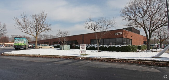
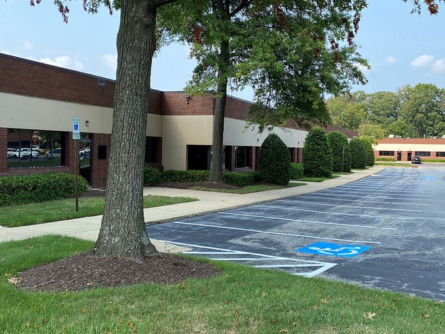
Property Record
8970 State Route 108, Columbia, MD 21045


NEARBY LISTINGS FOR SALE OR LEASE
Property Detail
8970 State Route 108
Baltimore-Columbia-Towson, MD
Oaklnd Ridge Ind Park Sec 02
12-000146
4.53 A GCE. ROUTE 108 OAKLAND RIDGE S 2 LAND
Commercialcondominium
Howard
AE
Maryland
24027C0155D
gce
2022
4.53 AC
2025
Columbia North
602302
Baltimore
34,680 SF
DEMOGRAPHICS near 8970 State Route 108
1 Mile
3 Mile
5 Mile
2024 Total Population
9,239
92,535
217,369
2029 Population
9,391
94,839
222,769
Pop Growth 2024-2029
+ 1.65%
+ 2.49%
+ 2.48%
Average Age
40
40
40
2024 Total Households
3,327
35,832
81,187
HH Growth 2024-2029
+ 1.53%
+ 2.61%
+ 2.55%
Median Household Inc
$139,087
$126,497
$124,568
Avg Household Size
2.70
2.50
2.60
2024 Avg HH Vehicles
2.00
2.00
2.00
Median Home Value
$458,731
$480,485
$470,604
Median Year Built
1977
1985
1985
Nearby Places
Map Layers
Map Styles
 Street
 Aerial
- Restaurants
- Banks
- Shops
- Fitness
- Groceries
PUBLIC TRANSPORTATION
COMMUTER RAIL
Jessup (Camden Line - Maryland Area Regional Commuter Trains (The MARC))
DRIVE
WALK
Distance
Jessup (Camden Line - Maryland Area Regional Commuter Trains (The MARC))
14 min
6.9 mi
DRIVE
WALK
Distance
12 min
7.0 mi
AIRPORT
Baltimore/Washington International Thurgood Marshall
DRIVE
WALK
Distance
Baltimore/Washington International Thurgood Marshall
20 min
13.4 mi
Ronald Reagan Washington Ntl
DRIVE
WALK
Distance
Ronald Reagan Washington Ntl
54 min
33.6 mi
Freight Ports
Port of Baltimore
DRIVE
WALK
Distance
Port of Baltimore
24 min
16.0 mi
SALE & LEASE HISTORY
LISTING DATE
SALE/LEASE

Sep 24, 2016
For Lease
Sep 15, 2021
For Sale
Sep 15, 2021
For Lease
Sep 12, 2023
For Sale
Nearby Properties
Address
Land Use
TOTAL SIZE
Lot Size
Zoning
Address
Land Use
TOTAL SIZE
Lot Size
Zoning
454,000 SF
62.33 AC
NT
Address
Land Use
TOTAL SIZE
Lot Size
Zoning
47,815 SF
11.76 AC
NT
Address
Land Use
TOTAL SIZE
Lot Size
Zoning
172,360 SF
2.79 AC
NT
Address
Land Use
TOTAL SIZE
Lot Size
Zoning
233,265 SF
28.95 AC
NT
Address
Land Use
TOTAL SIZE
Lot Size
Zoning
514,261 SF
3.36 AC
NT
Address
Land Use
TOTAL SIZE
Lot Size
Zoning
218,688 SF
1.11 AC
NT
Address
Land Use
TOTAL SIZE
Lot Size
Zoning
279,539 SF
68.15 AC
R20
Address
Land Use
TOTAL SIZE
Lot Size
Zoning
17,528 SF
20.15 AC
NT
Address
Land Use
TOTAL SIZE
Lot Size
Zoning
230,401 SF
52.25 AC
NT
Address
Land Use
TOTAL SIZE
Lot Size
Zoning
357,008 SF
1.57 AC
NT
Address
Land Use
TOTAL SIZE
Lot Size
Zoning
137,340 SF
2.80 AC
NT
Address
Land Use
TOTAL SIZE
Lot Size
Zoning
14,040 SF
10.86 AC
RA15
Address
Land Use
TOTAL SIZE
Lot Size
Zoning
309,703 SF
39.71 AC
R20
Address
Land Use
TOTAL SIZE
Lot Size
Zoning
11,244 SF
23.20 AC
NT
Address
Land Use
TOTAL SIZE
Lot Size
Zoning
56,584 SF
12.03 AC
RA15
Address
Land Use
TOTAL SIZE
Lot Size
Zoning
195,996 SF
48.91 AC
NT
Address
Land Use
TOTAL SIZE
Lot Size
Zoning
210,772 SF
9.05 AC
NT
Address
Land Use
TOTAL SIZE
Lot Size
Zoning
214,009 SF
8.99 AC
NT
Address
Land Use
TOTAL SIZE
Lot Size
Zoning
234,007 SF
49.96 AC
NT
Address
Land Use
TOTAL SIZE
Lot Size
Zoning
27,423 SF
12.72 AC
NT
Address
Land Use
TOTAL SIZE
Lot Size
Zoning
213,120 SF
1.33 AC
NT
Address
Land Use
TOTAL SIZE
Lot Size
Zoning
237,128 SF
24.77 AC
B2
Address
Land Use
TOTAL SIZE
Lot Size
Zoning
24,716 SF
10.05 AC
NT
Address
Land Use
TOTAL SIZE
Lot Size
Zoning
49,443 SF
27.21 AC
NT
Address
Land Use
TOTAL SIZE
Lot Size
Zoning
160,000 SF
12.19 AC
NT
Address
Land Use
TOTAL SIZE
Lot Size
Zoning
208,312 SF
5.85 AC
NT
Address
Land Use
TOTAL SIZE
Lot Size
Zoning
16,651 SF
11.65 AC
NT
Address
Land Use
TOTAL SIZE
Lot Size
Zoning
32,000 SF
26.24 AC
NT
Address
Land Use
TOTAL SIZE
Lot Size
Zoning
27,105 SF
10 AC
NT
Address
Land Use
TOTAL SIZE
Lot Size
Zoning
21,726 SF
10.14 AC
NT
The World's #1 Commercial Real Estate Marketplace
Connect with us
© 2026 CoStar Group
The information above has been obtained from sources believed reliable. While we do not doubt its accuracy we have not verified it and make no guarantee, warranty or representation about it. It is your responsibility to independently confirm its accuracy and completeness. Any projections, opinions, assumptions, or estimates used are for example only and do not represent the current or future performance of the property. The value of this transaction to you depends on tax and other factors which should be evaluated by your tax, financial, and legal advisors. You and your advisors should conduct a careful, independent investigation of the property to determine to your satisfaction the suitability of the property for your needs.