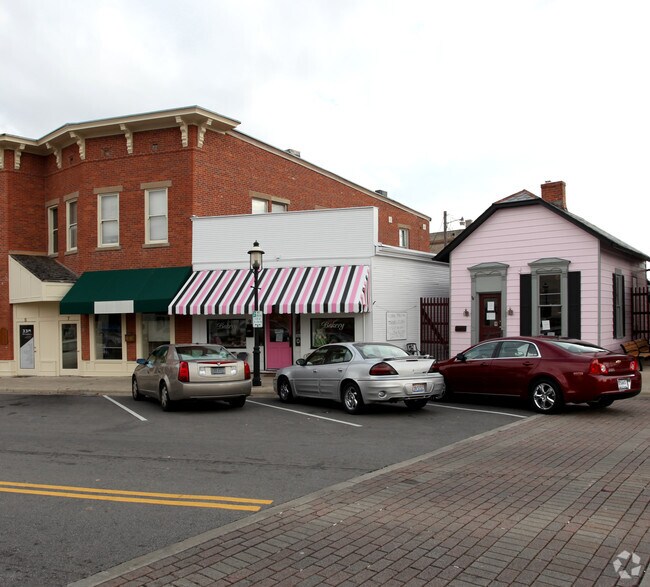
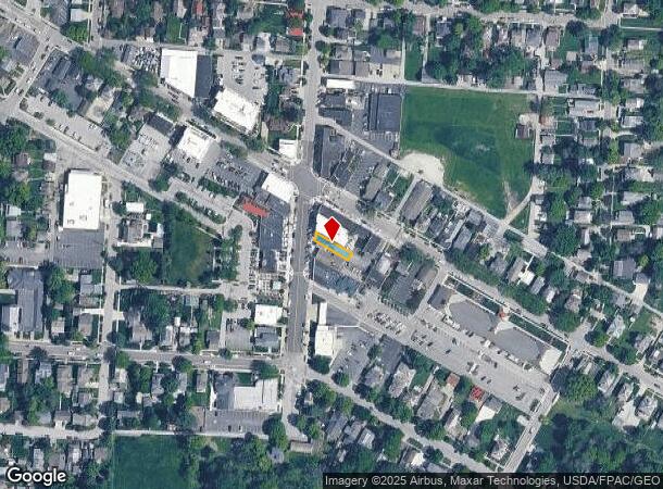
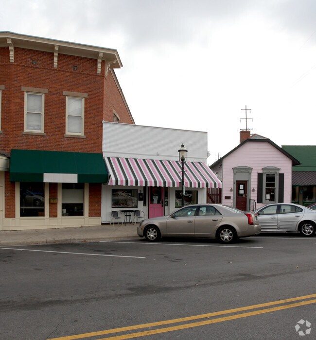
Property Record
9 S High St, Canal Winchester, OH 43110
NEARBY LISTINGS FOR SALE OR LEASE
Property Detail
9 S High St
Columbus, OH
Reuben Doves
184-000447
S HIGH ST DOVES PT LOTS 17&52&18
Officebuilding
Franklin
X
Ohio
39045C0110G
52
2024
0.04 AC
2024
Southeast
009404
Columbus
789 SF
DEMOGRAPHICS near 9 S High St
1 Mile
3 Mile
5 Mile
2024 Total Population
5,738
31,863
75,921
2029 Population
5,862
32,642
78,584
Pop Growth 2024-2029
+ 2.16%
+ 2.44%
+ 3.51%
Average Age
42
37
38
2024 Total Households
2,142
11,283
28,122
HH Growth 2024-2029
+ 2.10%
+ 2.20%
+ 3.28%
Median Household Inc
$106,859
$93,463
$83,635
Avg Household Size
2.60
2.80
2.60
2024 Avg HH Vehicles
2.00
2.00
2.00
Median Home Value
$267,660
$263,155
$250,483
Median Year Built
1996
2000
1999
Nearby Places
Map Layers
Map Styles
 Street
 Aerial
- Restaurants
- Banks
- Shops
- Fitness
- Groceries
PUBLIC TRANSPORTATION
AIRPORT
Rickenbacker International
DRIVE
WALK
Distance
Rickenbacker International
19 min
8.8 mi
John Glenn Columbus International
DRIVE
WALK
Distance
John Glenn Columbus International
29 min
15.9 mi
Nearby Properties
Address
Land Use
TOTAL SIZE
Lot Size
Zoning
Address
Land Use
TOTAL SIZE
Lot Size
Zoning
553,548 SF
46.23 AC
Address
Land Use
TOTAL SIZE
Lot Size
Zoning
195,626 SF
41.45 AC
Address
Land Use
TOTAL SIZE
Lot Size
Zoning
528,750 SF
42.14 AC
Address
Land Use
TOTAL SIZE
Lot Size
Zoning
224,090 SF
66.22 AC
Address
Land Use
TOTAL SIZE
Lot Size
Zoning
446,160 SF
91.12 AC
Address
Land Use
TOTAL SIZE
Lot Size
Zoning
46,340 SF
10.58 AC
Address
Land Use
TOTAL SIZE
Lot Size
Zoning
446,160 SF
22.71 AC
Address
Land Use
TOTAL SIZE
Lot Size
Zoning
129,499 SF
107.80 AC
Address
Land Use
TOTAL SIZE
Lot Size
Zoning
122,938 SF
29.37 AC
Address
Land Use
TOTAL SIZE
Lot Size
Zoning
452,764 SF
34.81 AC
Address
Land Use
TOTAL SIZE
Lot Size
Zoning
263,120 SF
23.12 AC
Address
Land Use
TOTAL SIZE
Lot Size
Zoning
374,220 SF
Address
Land Use
TOTAL SIZE
Lot Size
Zoning
22,368 SF
23.08 AC
Address
Land Use
TOTAL SIZE
Lot Size
Zoning
141,966 SF
40.45 AC
Address
Land Use
TOTAL SIZE
Lot Size
Zoning
87,458 SF
7.44 AC
Address
Land Use
TOTAL SIZE
Lot Size
Zoning
54,754 SF
23.10 AC
Address
Land Use
TOTAL SIZE
Lot Size
Zoning
215,776 SF
35.86 AC
Address
Land Use
TOTAL SIZE
Lot Size
Zoning
211,019 SF
52.14 AC
Address
Land Use
TOTAL SIZE
Lot Size
Zoning
49,448 SF
9.35 AC
Address
Land Use
TOTAL SIZE
Lot Size
Zoning
756,088 SF
52.66 AC
Address
Land Use
TOTAL SIZE
Lot Size
Zoning
211,600 SF
24.63 AC
Address
Land Use
TOTAL SIZE
Lot Size
Zoning
209,250 SF
12.03 AC
Address
Land Use
TOTAL SIZE
Lot Size
Zoning
67,824 SF
7.57 AC
Address
Land Use
TOTAL SIZE
Lot Size
Zoning
175,000 SF
16 AC
Address
Land Use
TOTAL SIZE
Lot Size
Zoning
43,541 SF
5.85 AC
Address
Land Use
TOTAL SIZE
Lot Size
Zoning
64,340 SF
2.31 AC
Address
Land Use
TOTAL SIZE
Lot Size
Zoning
149,850 SF
10.77 AC
Address
Land Use
TOTAL SIZE
Lot Size
Zoning
47,548 SF
3.48 AC
Address
Land Use
TOTAL SIZE
Lot Size
Zoning
48,192 SF
2.28 AC
Address
Land Use
TOTAL SIZE
Lot Size
Zoning
47,539 SF
13.85 AC
The World's #1 Commercial Real Estate Marketplace
Connect with us
© 2025 CoStar Group
The information above has been obtained from sources believed reliable. While we do not doubt its accuracy we have not verified it and make no guarantee, warranty or representation about it. It is your responsibility to independently confirm its accuracy and completeness. Any projections, opinions, assumptions, or estimates used are for example only and do not represent the current or future performance of the property. The value of this transaction to you depends on tax and other factors which should be evaluated by your tax, financial, and legal advisors. You and your advisors should conduct a careful, independent investigation of the property to determine to your satisfaction the suitability of the property for your needs.