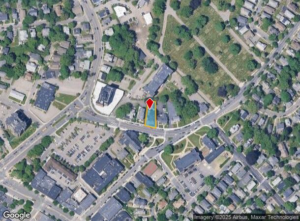
Property Record
9 Chestnut St, Arlington, MA 02474

NEARBY LISTINGS FOR SALE OR LEASE
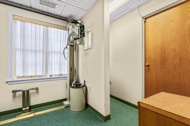
Property Detail
9 Chestnut St
ARLI-000045-000002-000003
Middlesex
Commercialbuilding
Massachusetts
X
3
25017C0417F
0.18 AC
2025
Lexington/Arlington
2025
Boston
356400
Boston-Cambridge-Newton, MA-NH
1,818 SF
DEMOGRAPHICS near 9 Chestnut St
1 Mile
3 Mile
5 Mile
2024 Total Population
26,270
212,889
592,627
2029 Population
25,599
208,101
579,902
Pop Growth 2024-2029
(2.55%)
(2.25%)
(2.15%)
Average Age
42
39
39
2024 Total Households
11,610
85,855
242,033
HH Growth 2024-2029
(2.78%)
(2.46%)
(2.26%)
Median Household Inc
$120,235
$132,939
$112,466
Avg Household Size
2.20
2.30
2.30
2024 Avg HH Vehicles
1.00
1.00
1.00
Median Home Value
$798,912
$873,608
$809,854
Median Year Built
1948
1948
1949
Nearby Places
Map Layers
Map Styles
 Street
 Aerial
- Restaurants
- Banks
- Shops
- Fitness
- Groceries
PUBLIC TRANSPORTATION
COMMUTER RAIL
West Medford (Lowell Line - Massachusetts Bay Transportation Authority Commuter Rail (Purple Line))
DRIVE
WALK
Distance
West Medford (Lowell Line - Massachusetts Bay Transportation Authority Commuter Rail (Purple Line))
3 min
20 min
1.1 mi
Belmont Center (Fitchburg/South Acton Line - Massachusetts Bay Transportation Authority Commuter Rail (Purple Line))
DRIVE
WALK
Distance
Belmont Center (Fitchburg/South Acton Line - Massachusetts Bay Transportation Authority Commuter Rail (Purple Line))
5 min
2.1 mi
AIRPORT
General Edward Lawrence Logan International
DRIVE
WALK
Distance
General Edward Lawrence Logan International
18 min
10.0 mi
Freight Ports
Port of Boston
DRIVE
WALK
Distance
Port of Boston
19 min
9.8 mi
SALE & LEASE HISTORY
LISTING DATE
SALE/LEASE

Sep 04, 2025
For Lease
Feb 05, 2025
For Sale
Nearby Properties
Address
Land Use
TOTAL SIZE
Lot Size
Zoning
Address
Land Use
TOTAL SIZE
Lot Size
Zoning
283,554 SF
2.76 AC
O-2A
Address
Land Use
TOTAL SIZE
Lot Size
Zoning
54,500 SF
4.01 AC
O-2A
Address
Land Use
TOTAL SIZE
Lot Size
Zoning
47.67 AC
UN
Address
Land Use
TOTAL SIZE
Lot Size
Zoning
2.87 AC
O-2A
Address
Land Use
TOTAL SIZE
Lot Size
Zoning
213,834 SF
1.48 AC
SD-4
Address
Land Use
TOTAL SIZE
Lot Size
Zoning
224,115 SF
2.35 AC
O-2A
Address
Land Use
TOTAL SIZE
Lot Size
Zoning
244,008 SF
4 AC
SD-4A
Address
Land Use
TOTAL SIZE
Lot Size
Zoning
43.90 AC
Address
Land Use
TOTAL SIZE
Lot Size
Zoning
Address
Land Use
TOTAL SIZE
Lot Size
Zoning
530,113 SF
29.43 AC
Address
Land Use
TOTAL SIZE
Lot Size
Zoning
13.48 AC
Address
Land Use
TOTAL SIZE
Lot Size
Zoning
117,783 SF
0.63 AC
Address
Land Use
TOTAL SIZE
Lot Size
Zoning
16.96 AC
UN
Address
Land Use
TOTAL SIZE
Lot Size
Zoning
12.90 AC
R
Address
Land Use
TOTAL SIZE
Lot Size
Zoning
16.79 AC
BA
Address
Land Use
TOTAL SIZE
Lot Size
Zoning
21,024 SF
18.19 AC
Address
Land Use
TOTAL SIZE
Lot Size
Zoning
155,866 SF
2.60 AC
O-1
Address
Land Use
TOTAL SIZE
Lot Size
Zoning
3.69 AC
C-2B
Address
Land Use
TOTAL SIZE
Lot Size
Zoning
145,839 SF
1.81 AC
O-2A
Address
Land Use
TOTAL SIZE
Lot Size
Zoning
160,900 SF
0.64 AC
C-2
Address
Land Use
TOTAL SIZE
Lot Size
Zoning
253,440 SF
3.20 AC
C-3
Address
Land Use
TOTAL SIZE
Lot Size
Zoning
Address
Land Use
TOTAL SIZE
Lot Size
Zoning
79.60 AC
SD
Address
Land Use
TOTAL SIZE
Lot Size
Zoning
73.10 AC
SA
Address
Land Use
TOTAL SIZE
Lot Size
Zoning
153,732 SF
12.50 AC
SCI
Address
Land Use
TOTAL SIZE
Lot Size
Zoning
218,825 SF
2.93 AC
O-2A
Address
Land Use
TOTAL SIZE
Lot Size
Zoning
139,520 SF
1.21 AC
SD-4
Address
Land Use
TOTAL SIZE
Lot Size
Zoning
44.94 AC
R2
Address
Land Use
TOTAL SIZE
Lot Size
Zoning
208,852 SF
16.17 AC
MU
Address
Land Use
TOTAL SIZE
Lot Size
Zoning
38.10 AC
B
The World's #1 Commercial Real Estate Marketplace
Connect with us
© 2026 CoStar Group
The information above has been obtained from sources believed reliable. While we do not doubt its accuracy we have not verified it and make no guarantee, warranty or representation about it. It is your responsibility to independently confirm its accuracy and completeness. Any projections, opinions, assumptions, or estimates used are for example only and do not represent the current or future performance of the property. The value of this transaction to you depends on tax and other factors which should be evaluated by your tax, financial, and legal advisors. You and your advisors should conduct a careful, independent investigation of the property to determine to your satisfaction the suitability of the property for your needs.