Property Record
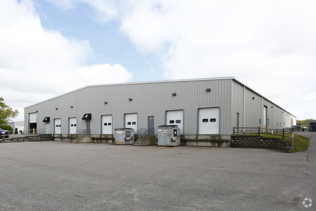
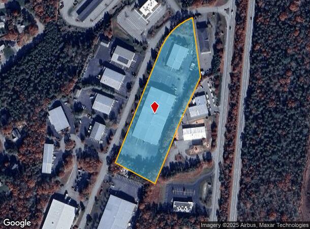
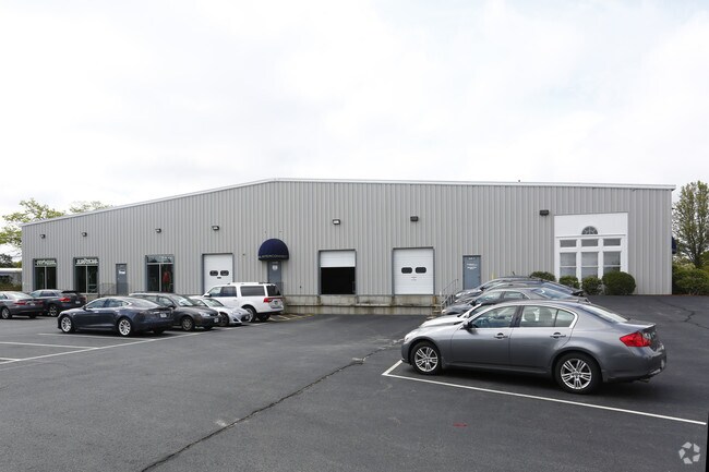
9 Jonathan Bourne Dr, Pocasset, MA 02559
NEARBY LISTINGS FOR SALE OR LEASE
Property Detail
9 Jonathan Bourne Dr
BOUR-000350-000000-000096
Barnstable
Commercialnec
Massachusetts
X
5.19 AC
25001C0504J
Cape Cod
2025
Other Market Areas
2025
Barnstable Town, MA
014002
DEMOGRAPHICS near 9 Jonathan Bourne Dr
1 Mile
3 Mile
5 Mile
2024 Total Population
1,244
8,145
23,850
2029 Population
1,215
8,102
23,703
Pop Growth 2024-2029
(2.33%)
(0.53%)
(0.62%)
Average Age
47
49
46
2024 Total Households
577
3,634
9,812
HH Growth 2024-2029
(2.60%)
(0.96%)
(1.07%)
Median Household Inc
$94,572
$83,034
$84,916
Avg Household Size
2.10
2.10
2.20
2024 Avg HH Vehicles
2.00
2.00
2.00
Median Home Value
$416,667
$478,943
$459,004
Median Year Built
1981
1976
1973
Nearby Places
Map Layers
Map Styles
 Street
 Aerial
- Restaurants
- Banks
- Shops
- Fitness
- Groceries
PUBLIC TRANSPORTATION
AIRPORT
Barnstable Municipal-Boardman-Polando Field
DRIVE
WALK
Distance
Barnstable Municipal-Boardman-Polando Field
38 min
23.9 mi
Nearby Properties
Address
Land Use
TOTAL SIZE
Lot Size
Zoning
Address
Land Use
TOTAL SIZE
Lot Size
Zoning
18.82 AC
R40
Address
Land Use
TOTAL SIZE
Lot Size
Zoning
75.70 AC
R40
Address
Land Use
TOTAL SIZE
Lot Size
Zoning
46 AC
R40
Address
Land Use
TOTAL SIZE
Lot Size
Zoning
22,000 SF
749.29 AC
GD
Address
Land Use
TOTAL SIZE
Lot Size
Zoning
73,483 SF
16.18 AC
Address
Land Use
TOTAL SIZE
Lot Size
Zoning
67,216 SF
2.70 AC
DTD
Address
Land Use
TOTAL SIZE
Lot Size
Zoning
74.05 AC
B-3
Address
Land Use
TOTAL SIZE
Lot Size
Zoning
68.53 AC
R40
Address
Land Use
TOTAL SIZE
Lot Size
Zoning
11.20 AC
Address
Land Use
TOTAL SIZE
Lot Size
Zoning
57,942 SF
7.20 AC
Address
Land Use
TOTAL SIZE
Lot Size
Zoning
45.85 AC
Address
Land Use
TOTAL SIZE
Lot Size
Zoning
2.82 AC
Address
Land Use
TOTAL SIZE
Lot Size
Zoning
1,452 SF
6.70 AC
Address
Land Use
TOTAL SIZE
Lot Size
Zoning
15.80 AC
Address
Land Use
TOTAL SIZE
Lot Size
Zoning
Address
Land Use
TOTAL SIZE
Lot Size
Zoning
Address
Land Use
TOTAL SIZE
Lot Size
Zoning
10.02 AC
R40
Address
Land Use
TOTAL SIZE
Lot Size
Zoning
7,856 SF
5.34 AC
R40
Address
Land Use
TOTAL SIZE
Lot Size
Zoning
38,800 SF
5.24 AC
B-4
Address
Land Use
TOTAL SIZE
Lot Size
Zoning
2.70 AC
R40
Address
Land Use
TOTAL SIZE
Lot Size
Zoning
118.50 AC
R40
Address
Land Use
TOTAL SIZE
Lot Size
Zoning
2,951 SF
0.90 AC
R40
Address
Land Use
TOTAL SIZE
Lot Size
Zoning
73,477 SF
4.37 AC
R40
Address
Land Use
TOTAL SIZE
Lot Size
Zoning
17,249 SF
4.10 AC
Address
Land Use
TOTAL SIZE
Lot Size
Zoning
10,443 SF
0.70 AC
Address
Land Use
TOTAL SIZE
Lot Size
Zoning
11.64 AC
R40
Address
Land Use
TOTAL SIZE
Lot Size
Zoning
7.70 AC
R40
Address
Land Use
TOTAL SIZE
Lot Size
Zoning
4.62 AC
R40
Address
Land Use
TOTAL SIZE
Lot Size
Zoning
4.57 AC
R40
Address
Land Use
TOTAL SIZE
Lot Size
Zoning
39,989 SF
1.90 AC
The World's #1 Commercial Real Estate Marketplace
Connect with us
© 2025 CoStar Group
The information above has been obtained from sources believed reliable. While we do not doubt its accuracy we have not verified it and make no guarantee, warranty or representation about it. It is your responsibility to independently confirm its accuracy and completeness. Any projections, opinions, assumptions, or estimates used are for example only and do not represent the current or future performance of the property. The value of this transaction to you depends on tax and other factors which should be evaluated by your tax, financial, and legal advisors. You and your advisors should conduct a careful, independent investigation of the property to determine to your satisfaction the suitability of the property for your needs.