Property Record
9 Lewiston Rd, Gray, ME 04039
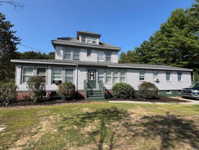

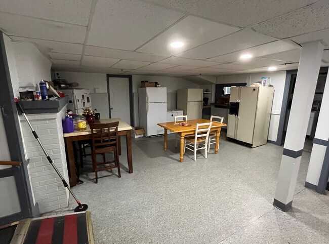
This Property Is For Sale
Property Detail
9 Lewiston Rd
GRAY-000035-000403-000031
Cumberland
Commercialofficeresidentialmixeduse
Maine
BB
31-0
B and X Area of moderate flood hazard, usually the area between the limits of the 100-year and 500-year floods.
1.50 AC
2025
NE Cumberland County
2025
Portland/South Portland
004702
Portland-South Portland, ME
5,892 SF
NEARBY LISTINGS FOR SALE OR LEASE
-
-
View all Gray listings for sale on LoopNet.com
DEMOGRAPHICS near 9 Lewiston Rd
1 mile
3 mile
5 mile
2025 Total Population
1,017
5,047
14,048
2030 Population
1,018
5,096
14,263
Pop Growth 2025-2030
+ 0.10%
+ 0.97%
+ 1.53%
Average Age
42
42
43
2025 Total Households
424
2,068
5,616
HH Growth 2025-2030
+ 0.47%
+ 1.11%
+ 1.75%
Median Household Inc
$113,124
$113,658
$111,842
Avg Household Size
2.40
2.40
2.50
2025 Avg HH Vehicles
2.00
2.00
2.00
Median Home Value
$353,738
$349,080
$391,298
Median Year Built
1968
1984
1984
Nearby Places
Map Layers
Map Styles
 Street
 Aerial
Transit
 Traffic
 Biking
Places
Listings with unknown addresses are not visible on the map
- Restaurants
- Banks
- Shops
- Fitness
- Groceries
PUBLIC TRANSPORTATION
AIRPORT
Portland International Jetport
Drive
Walk
Distance
Portland International Jetport
28 min
19.7 mi
Freight Ports
Portland, ME
Drive
Walk
Distance
Portland, ME
28 min
19.2 mi
Nearby Properties
Address
Land Use
TOTAL SIZE
Lot Size
Zoning
Address
Land Use
TOTAL SIZE
Lot Size
Zoning
6.80 AC
BUSINE
Address
Land Use
TOTAL SIZE
Lot Size
Zoning
19.06 AC
BUSINE
Address
Land Use
TOTAL SIZE
Lot Size
Zoning
66.66 AC
RA
Address
Land Use
TOTAL SIZE
Lot Size
Zoning
14,315 SF
2.25 AC
VILLAG
Address
Land Use
TOTAL SIZE
Lot Size
Zoning
9,864 SF
153.52 AC
RA
Address
Land Use
TOTAL SIZE
Lot Size
Zoning
Address
Land Use
TOTAL SIZE
Lot Size
Zoning
5.50 AC
BUSINE
Address
Land Use
TOTAL SIZE
Lot Size
Zoning
12.62 AC
VILLAG
Address
Land Use
TOTAL SIZE
Lot Size
Zoning
7,032 SF
5 AC
RB
Address
Land Use
TOTAL SIZE
Lot Size
Zoning
10.30 AC
VILLAG
Address
Land Use
TOTAL SIZE
Lot Size
Zoning
7.62 AC
RURAL
Address
Land Use
TOTAL SIZE
Lot Size
Zoning
720 SF
14 AC
RURAL
Address
Land Use
TOTAL SIZE
Lot Size
Zoning
2.76 AC
BUSINE
Address
Land Use
TOTAL SIZE
Lot Size
Zoning
147.49 AC
RA
Address
Land Use
TOTAL SIZE
Lot Size
Zoning
20 AC
RA
Address
Land Use
TOTAL SIZE
Lot Size
Zoning
1.20 AC
VILLAG
Address
Land Use
TOTAL SIZE
Lot Size
Zoning
148 AC
RA
Address
Land Use
TOTAL SIZE
Lot Size
Zoning
6,600 SF
5.43 AC
BUSINE
Address
Land Use
TOTAL SIZE
Lot Size
Zoning
13,240 SF
9 AC
VILLAG
Address
Land Use
TOTAL SIZE
Lot Size
Zoning
2,579 SF
1.36 AC
VILLAG
Address
Land Use
TOTAL SIZE
Lot Size
Zoning
4.12 AC
RURAL
Address
Land Use
TOTAL SIZE
Lot Size
Zoning
5.50 AC
VILLAG
Address
Land Use
TOTAL SIZE
Lot Size
Zoning
12 AC
RURAL
Address
Land Use
TOTAL SIZE
Lot Size
Zoning
19 AC
RA
Address
Land Use
TOTAL SIZE
Lot Size
Zoning
5.83 AC
RURAL
Address
Land Use
TOTAL SIZE
Lot Size
Zoning
1.81 AC
RURAL
Address
Land Use
TOTAL SIZE
Lot Size
Zoning
243.83 AC
RA
Address
Land Use
TOTAL SIZE
Lot Size
Zoning
1.94 AC
VILLAG
Address
Land Use
TOTAL SIZE
Lot Size
Zoning
90.16 AC
RA
Address
Land Use
TOTAL SIZE
Lot Size
Zoning
1.85 AC
RURAL
The World's #1 Commercial Real Estate Marketplace
Connect with us
© 2026 CoStar Group
The information above has been obtained from sources believed reliable. While we do not doubt its accuracy we have not verified it and make no guarantee, warranty or representation about it. It is your responsibility to independently confirm its accuracy and completeness. Any projections, opinions, assumptions, or estimates used are for example only and do not represent the current or future performance of the property. The value of this transaction to you depends on tax and other factors which should be evaluated by your tax, financial, and legal advisors. You and your advisors should conduct a careful, independent investigation of the property to determine to your satisfaction the suitability of the property for your needs.