Property Record
9 Maple Ave, Uncasville, CT 06382


NEARBY LISTINGS FOR SALE OR LEASE
Property Detail
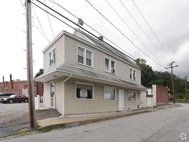
9 Maple Ave
Duplex
New London
AE
Connecticut
09011C0361J
0.73 AC
2025
New London
2025
Hartford
870502
Norwich-New London-Willimantic, CT
1,544 SF
MONT-000073-000046
DEMOGRAPHICS near 9 Maple Ave
1 mile
3 mile
5 mile
2024 Total Population
3,302
15,679
44,485
2029 Population
3,314
15,600
44,356
Pop Growth 2024-2029
+ 0.36%
(0.50%)
(0.29%)
Average Age
42
42
39
2024 Total Households
894
5,783
15,732
HH Growth 2024-2029
(1.01%)
(0.88%)
(0.41%)
Median Household Inc
$81,896
$88,437
$81,379
Avg Household Size
2.30
2.40
2.50
2024 Avg HH Vehicles
2.00
2.00
2.00
Median Home Value
$217,816
$246,202
$251,500
Median Year Built
1961
1967
1970
Nearby Places
Map Layers
Map Styles
 Street
 Aerial
Transit
 Traffic
 Biking
Places
Listings with unknown addresses are not visible on the map
- Restaurants
- Banks
- Shops
- Fitness
- Groceries
PUBLIC TRANSPORTATION
COMMUTER RAIL
New London (Shore Line East - Shore Line East)
Drive
Walk
Distance
New London (Shore Line East - Shore Line East)
10 min
6.2 mi
Freight Ports
Port of Davisville, RI
Drive
Walk
Distance
Port of Davisville, RI
76 min
56.0 mi
Nearby Properties
Address
Land Use
TOTAL SIZE
Lot Size
Zoning
Address
Land Use
TOTAL SIZE
Lot Size
Zoning
Address
Land Use
TOTAL SIZE
Lot Size
Zoning
251.73 AC
RM40
Address
Land Use
TOTAL SIZE
Lot Size
Zoning
69,658 SF
16.31 AC
VR-10
Address
Land Use
TOTAL SIZE
Lot Size
Zoning
113.19 AC
C2/OZ
Address
Land Use
TOTAL SIZE
Lot Size
Zoning
22.87 AC
C-2
Address
Land Use
TOTAL SIZE
Lot Size
Zoning
38.30 AC
R40
Address
Land Use
TOTAL SIZE
Lot Size
Zoning
4,415 SF
128.73 AC
R40
Address
Land Use
TOTAL SIZE
Lot Size
Zoning
28.40 AC
RU120
Address
Land Use
TOTAL SIZE
Lot Size
Zoning
150,052 SF
IND
Address
Land Use
TOTAL SIZE
Lot Size
Zoning
35.36 AC
RSRVT
Address
Land Use
TOTAL SIZE
Lot Size
Zoning
35.61 AC
RU-20
Address
Land Use
TOTAL SIZE
Lot Size
Zoning
6.54 AC
GOV
Address
Land Use
TOTAL SIZE
Lot Size
Zoning
55,562 SF
29.68 AC
GOV
Address
Land Use
TOTAL SIZE
Lot Size
Zoning
34,436 SF
19.52 AC
IND
Address
Land Use
TOTAL SIZE
Lot Size
Zoning
18,015 SF
17.16 AC
GOV
Address
Land Use
TOTAL SIZE
Lot Size
Zoning
450,955 SF
157.97 AC
I
Address
Land Use
TOTAL SIZE
Lot Size
Zoning
46,011 SF
4.96 AC
C-2
Address
Land Use
TOTAL SIZE
Lot Size
Zoning
47,715 SF
3.41 AC
C-2
Address
Land Use
TOTAL SIZE
Lot Size
Zoning
6 AC
IND
Address
Land Use
TOTAL SIZE
Lot Size
Zoning
13,677 SF
1.90 AC
GFDD
Address
Land Use
TOTAL SIZE
Lot Size
Zoning
12.02 AC
R20-M
Address
Land Use
TOTAL SIZE
Lot Size
Zoning
26,956 SF
2.07 AC
C-1
Address
Land Use
TOTAL SIZE
Lot Size
Zoning
4.77 AC
R20
Address
Land Use
TOTAL SIZE
Lot Size
Zoning
11.89 AC
GFDD
Address
Land Use
TOTAL SIZE
Lot Size
Zoning
243.10 AC
RU120
Address
Land Use
TOTAL SIZE
Lot Size
Zoning
16.58 AC
GOV
Address
Land Use
TOTAL SIZE
Lot Size
Zoning
6.23 AC
CIP
Address
Land Use
TOTAL SIZE
Lot Size
Zoning
22.72 AC
GOV
Address
Land Use
TOTAL SIZE
Lot Size
Zoning
15,400 SF
0.70 AC
C-1
Address
Land Use
TOTAL SIZE
Lot Size
Zoning
8.30 AC
VR-75
The World's #1 Commercial Real Estate Marketplace
Connect with us
© 2026 CoStar Group
The information above has been obtained from sources believed reliable. While we do not doubt its accuracy we have not verified it and make no guarantee, warranty or representation about it. It is your responsibility to independently confirm its accuracy and completeness. Any projections, opinions, assumptions, or estimates used are for example only and do not represent the current or future performance of the property. The value of this transaction to you depends on tax and other factors which should be evaluated by your tax, financial, and legal advisors. You and your advisors should conduct a careful, independent investigation of the property to determine to your satisfaction the suitability of the property for your needs.