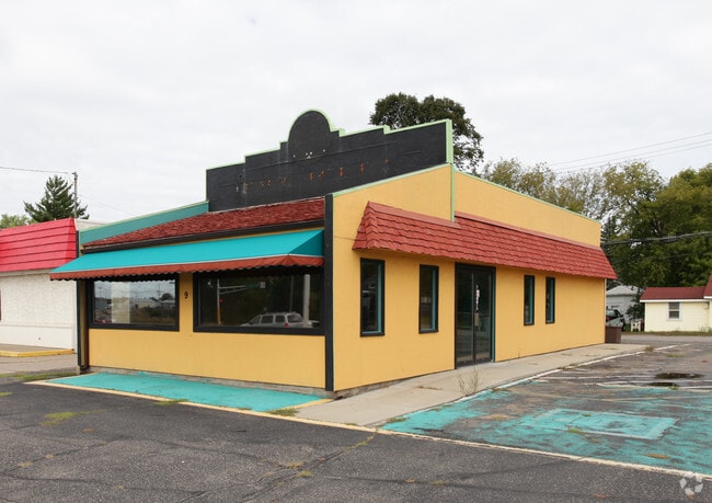
Property Record
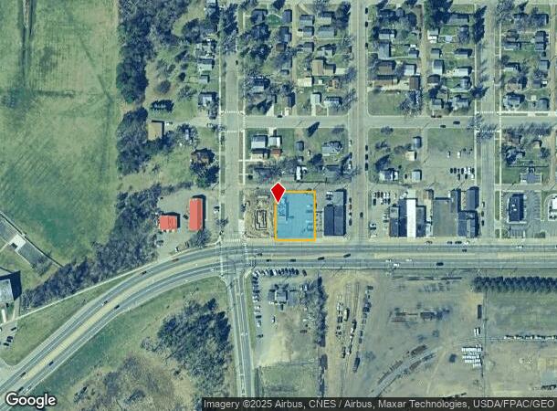
9 Washington St Ne, Brainerd, MN 56401
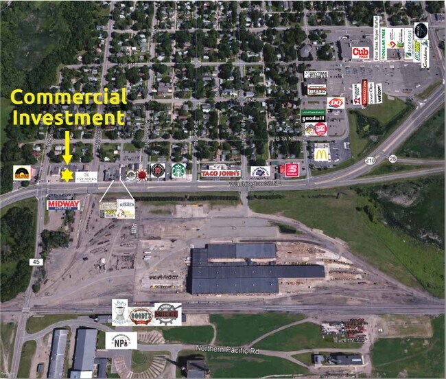
NEARBY LISTINGS FOR SALE OR LEASE
Property Detail
9 Washington St Ne
Brainerd, MN
Fairview Addition To The City Of
09127001004Z009
LOTS 4 THRU 7 BLK 1 INCLUSIVE
Restaurantdrivein
Crow Wing
X
Minnesota
27035C0527C
4-7
2025
0.37 AC
2025
Minnesota Central Area
951200
Other Market Areas
1,280 SF
DEMOGRAPHICS near 9 Washington St Ne
1 Mile
3 Mile
5 Mile
2024 Total Population
5,984
16,876
22,983
2029 Population
6,203
17,574
23,958
Pop Growth 2024-2029
+ 3.66%
+ 4.14%
+ 4.24%
Average Age
37
39
40
2024 Total Households
2,491
7,017
9,351
HH Growth 2024-2029
+ 3.25%
+ 3.79%
+ 3.90%
Median Household Inc
$44,499
$51,532
$55,167
Avg Household Size
2.20
2.20
2.30
2024 Avg HH Vehicles
2.00
2.00
2.00
Median Home Value
$135,164
$170,496
$186,870
Median Year Built
1957
1976
1981
Nearby Places
Map Layers
Map Styles
 Street
 Aerial
- Restaurants
- Banks
- Shops
- Fitness
- Groceries
SALE & LEASE HISTORY
LISTING DATE
SALE/LEASE

Sep 24, 2016
For Sale
Nearby Properties
Address
Land Use
TOTAL SIZE
Lot Size
Zoning
Address
Land Use
TOTAL SIZE
Lot Size
Zoning
320,708 SF
35.89 AC
Address
Land Use
TOTAL SIZE
Lot Size
Zoning
3,829 SF
1.04 AC
Address
Land Use
TOTAL SIZE
Lot Size
Zoning
186,000 SF
8.71 AC
Address
Land Use
TOTAL SIZE
Lot Size
Zoning
229,123 SF
11.84 AC
Address
Land Use
TOTAL SIZE
Lot Size
Zoning
128,295 SF
2.08 AC
Address
Land Use
TOTAL SIZE
Lot Size
Zoning
110,624 SF
5.62 AC
Address
Land Use
TOTAL SIZE
Lot Size
Zoning
33,460 SF
94.30 AC
Address
Land Use
TOTAL SIZE
Lot Size
Zoning
91,464 SF
4.83 AC
Address
Land Use
TOTAL SIZE
Lot Size
Zoning
61,704 SF
16.09 AC
Address
Land Use
TOTAL SIZE
Lot Size
Zoning
Address
Land Use
TOTAL SIZE
Lot Size
Zoning
25,104 SF
18.43 AC
Address
Land Use
TOTAL SIZE
Lot Size
Zoning
50,741 SF
13.48 AC
Address
Land Use
TOTAL SIZE
Lot Size
Zoning
113,024 SF
2.96 AC
Address
Land Use
TOTAL SIZE
Lot Size
Zoning
83,078 SF
9.71 AC
Address
Land Use
TOTAL SIZE
Lot Size
Zoning
90,147 SF
12.93 AC
Address
Land Use
TOTAL SIZE
Lot Size
Zoning
55,953 SF
14.52 AC
Address
Land Use
TOTAL SIZE
Lot Size
Zoning
69,515 SF
2.14 AC
Address
Land Use
TOTAL SIZE
Lot Size
Zoning
68,675 SF
3.12 AC
Address
Land Use
TOTAL SIZE
Lot Size
Zoning
68,675 SF
3.06 AC
Address
Land Use
TOTAL SIZE
Lot Size
Zoning
147,137 SF
16.34 AC
Address
Land Use
TOTAL SIZE
Lot Size
Zoning
54,164 SF
5.65 AC
Address
Land Use
TOTAL SIZE
Lot Size
Zoning
270,176 SF
17.13 AC
Address
Land Use
TOTAL SIZE
Lot Size
Zoning
87,007 SF
4.98 AC
Address
Land Use
TOTAL SIZE
Lot Size
Zoning
66,967 SF
2.95 AC
Address
Land Use
TOTAL SIZE
Lot Size
Zoning
167,226 SF
24.08 AC
Address
Land Use
TOTAL SIZE
Lot Size
Zoning
50,344 SF
12.62 AC
Address
Land Use
TOTAL SIZE
Lot Size
Zoning
89,709 SF
8.69 AC
Address
Land Use
TOTAL SIZE
Lot Size
Zoning
68,564 SF
3.41 AC
Address
Land Use
TOTAL SIZE
Lot Size
Zoning
47,378 SF
1.56 AC
Address
Land Use
TOTAL SIZE
Lot Size
Zoning
844 SF
31.98 AC
The World's #1 Commercial Real Estate Marketplace
Connect with us
© 2025 CoStar Group
The information above has been obtained from sources believed reliable. While we do not doubt its accuracy we have not verified it and make no guarantee, warranty or representation about it. It is your responsibility to independently confirm its accuracy and completeness. Any projections, opinions, assumptions, or estimates used are for example only and do not represent the current or future performance of the property. The value of this transaction to you depends on tax and other factors which should be evaluated by your tax, financial, and legal advisors. You and your advisors should conduct a careful, independent investigation of the property to determine to your satisfaction the suitability of the property for your needs.