Property Record
9 Post Pl, Babylon, NY 11702

Save to a Folder
{{folder.Name}}
{{folder.ListingIds.length}} Properties
{{folder.ListingIds.length}} Property
Create a New Folder
Property Detail
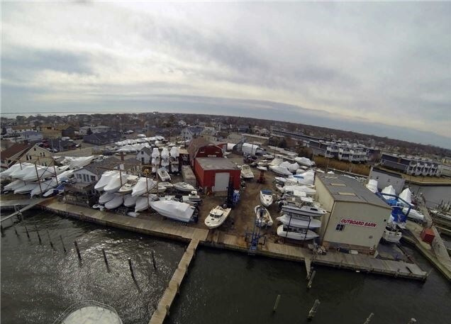
9 Post Pl
Nassau County-Suffolk County, NY
FILED MAP 529 LOTS 3 & 4
0102-019-00-03-00-025-003
Suffolk
Commercialnec
New York
AE The base floodplain where base flood elevations are provided. AE Zones are now used on new format FIRMs instead of A1-A30 Zones.
25
2024
0.20 AC
2025
Southwestern Suffolk
124602
Long Island (New York)
1,954 SF
NEARBY LISTINGS FOR SALE OR LEASE
DEMOGRAPHICS near 9 Post Pl
1 mile
3 mile
5 mile
2025 Total Population
7,095
74,000
210,209
2030 Population
7,083
73,122
206,751
Pop Growth 2025-2030
(0.17%)
(1.19%)
(1.65%)
Average Age
43
42
41
2025 Total Households
2,510
25,595
68,911
HH Growth 2025-2030
(0.48%)
(1.52%)
(1.88%)
Median Household Inc
$148,777
$137,115
$126,701
Avg Household Size
2.70
2.80
2.90
2025 Avg HH Vehicles
2.00
2.00
2.00
Median Home Value
$824,515
$663,199
$587,511
Median Year Built
1955
1959
1960
Nearby Places
Map Layers
Map Styles
 Street
 Aerial
Layers
 Traffic
 Biking
Places
Listings with unknown addresses are not visible on the map
- Restaurants
- Banks
- Shops
- Fitness
- Groceries
PUBLIC TRANSPORTATION
COMMUTER RAIL
Babylon (Babylon Branch - Long Island Rail Road, Montauk Branch - Long Island Rail Road)
Drive
Walk
Distance
Babylon (Babylon Branch - Long Island Rail Road, Montauk Branch - Long Island Rail Road)
5 min
1.6 mi
Lindenhurst (Babylon Branch - Long Island Rail Road)
Drive
Walk
Distance
Lindenhurst (Babylon Branch - Long Island Rail Road)
9 min
3.7 mi
AIRPORT
Long Island MacArthur
Drive
Walk
Distance
Long Island MacArthur
28 min
17.2 mi
John F Kennedy International
Drive
Walk
Distance
John F Kennedy International
45 min
29.6 mi
LaGuardia
Drive
Walk
Distance
LaGuardia
55 min
36.6 mi
Freight Ports
NY - Red Hook Container Terminal
Drive
Walk
Distance
NY - Red Hook Container Terminal
66 min
41.1 mi
SALE & LEASE HISTORY
LISTING DATE
SALE/LEASE

Sep 24, 2016
For Sale
Nearby Properties
Address
Land Use
TOTAL SIZE
Lot Size
Zoning
Address
Land Use
TOTAL SIZE
Lot Size
Zoning
48.97 AC
GSC
Address
Land Use
TOTAL SIZE
Lot Size
Zoning
256 SF
24.20 AC
GSC
Address
Land Use
TOTAL SIZE
Lot Size
Zoning
20 AC
A
Address
Land Use
TOTAL SIZE
Lot Size
Zoning
10.07 AC
Address
Land Use
TOTAL SIZE
Lot Size
Zoning
20.50 AC
B
Address
Land Use
TOTAL SIZE
Lot Size
Zoning
231.30 AC
AAA
Address
Land Use
TOTAL SIZE
Lot Size
Zoning
20.10 AC
A
Address
Land Use
TOTAL SIZE
Lot Size
Zoning
4,290 SF
1.50 AC
VILLA
Address
Land Use
TOTAL SIZE
Lot Size
Zoning
18.70 AC
A
Address
Land Use
TOTAL SIZE
Lot Size
Zoning
6.66 AC
A
Address
Land Use
TOTAL SIZE
Lot Size
Zoning
9.80 AC
AA
Address
Land Use
TOTAL SIZE
Lot Size
Zoning
14.60 AC
A
Address
Land Use
TOTAL SIZE
Lot Size
Zoning
9.70 AC
B
Address
Land Use
TOTAL SIZE
Lot Size
Zoning
19.40 AC
IND1
Address
Land Use
TOTAL SIZE
Lot Size
Zoning
11 AC
B
Address
Land Use
TOTAL SIZE
Lot Size
Zoning
7.50 AC
B
Address
Land Use
TOTAL SIZE
Lot Size
Zoning
6.37 AC
BUS1
Address
Land Use
TOTAL SIZE
Lot Size
Zoning
1.82 AC
Address
Land Use
TOTAL SIZE
Lot Size
Zoning
15.60 AC
A
Address
Land Use
TOTAL SIZE
Lot Size
Zoning
3.91 AC
IND1
Address
Land Use
TOTAL SIZE
Lot Size
Zoning
4.15 AC
BUS1
Address
Land Use
TOTAL SIZE
Lot Size
Zoning
2.40 AC
A
Address
Land Use
TOTAL SIZE
Lot Size
Zoning
3.04 AC
BUS1
Address
Land Use
TOTAL SIZE
Lot Size
Zoning
150.48 AC
Address
Land Use
TOTAL SIZE
Lot Size
Zoning
66.80 AC
AAA
Address
Land Use
TOTAL SIZE
Lot Size
Zoning
5,010 SF
0.30 AC
R10
Address
Land Use
TOTAL SIZE
Lot Size
Zoning
3.01 AC
BUS1
Address
Land Use
TOTAL SIZE
Lot Size
Zoning
4.06 AC
BUS1
Address
Land Use
TOTAL SIZE
Lot Size
Zoning
2.69 AC
BUS1
Address
Land Use
TOTAL SIZE
Lot Size
Zoning
2.38 AC
The World's #1 Commercial Real Estate Marketplace
Connect with us
© 2026 CoStar Group
The information above has been obtained from sources believed reliable. While we do not doubt its accuracy we have not verified it and make no guarantee, warranty or representation about it. It is your responsibility to independently confirm its accuracy and completeness. Any projections, opinions, assumptions, or estimates used are for example only and do not represent the current or future performance of the property. The value of this transaction to you depends on tax and other factors which should be evaluated by your tax, financial, and legal advisors. You and your advisors should conduct a careful, independent investigation of the property to determine to your satisfaction the suitability of the property for your needs.