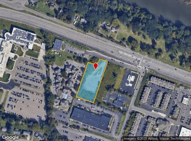
Property Record
9 Service Rd, Vestal, NY 13850

NEARBY LISTINGS FOR SALE OR LEASE
Property Detail
9 Service Rd
Syracuse
Vestal Sub
Binghamton, NY
019000000102S0290000
034800-159-015-0002-003-000-0000
Broome
Commercialacreage
New York
2025
3.000
2024
1.44 AC
014400
Broome County
DEMOGRAPHICS near 9 Service Rd
1 Mile
3 Mile
5 Mile
2024 Total Population
10,611
69,838
115,301
2029 Population
10,284
68,729
113,121
Pop Growth 2024-2029
(3.08%)
(1.59%)
(1.89%)
Average Age
37
38
40
2024 Total Households
3,491
27,390
46,678
HH Growth 2024-2029
(3.95%)
(1.81%)
(2.14%)
Median Household Inc
$47,500
$44,249
$49,490
Avg Household Size
2.20
2.10
2.20
2024 Avg HH Vehicles
1.00
1.00
1.00
Median Home Value
$147,081
$137,573
$139,108
Median Year Built
1955
1954
1955
Nearby Places
Map Layers
Map Styles
 Street
 Aerial
- Restaurants
- Banks
- Shops
- Fitness
- Groceries
SALE & LEASE HISTORY
LISTING DATE
SALE/LEASE

Sep 25, 2016
For Lease
Nearby Properties
Address
Land Use
TOTAL SIZE
Lot Size
Zoning
Address
Land Use
TOTAL SIZE
Lot Size
Zoning
65,256 SF
579.06 AC
Address
Land Use
TOTAL SIZE
Lot Size
Zoning
9,790 SF
11.23 AC
ID
Address
Land Use
TOTAL SIZE
Lot Size
Zoning
418,288 SF
33.64 AC
Address
Land Use
TOTAL SIZE
Lot Size
Zoning
88,796 SF
20.04 AC
Address
Land Use
TOTAL SIZE
Lot Size
Zoning
470,272 SF
5.30 AC
Address
Land Use
TOTAL SIZE
Lot Size
Zoning
283,373 SF
1.47 AC
Address
Land Use
TOTAL SIZE
Lot Size
Zoning
20,411 SF
0.66 AC
Address
Land Use
TOTAL SIZE
Lot Size
Zoning
203,306 SF
30.33 AC
C-2
Address
Land Use
TOTAL SIZE
Lot Size
Zoning
87,453 SF
6.77 AC
C-2
Address
Land Use
TOTAL SIZE
Lot Size
Zoning
68,845 SF
4.74 AC
C-2
Address
Land Use
TOTAL SIZE
Lot Size
Zoning
124,053 SF
7.63 AC
RC
Address
Land Use
TOTAL SIZE
Lot Size
Zoning
0.98 AC
RR
Address
Land Use
TOTAL SIZE
Lot Size
Zoning
206,537 SF
15.02 AC
C-2
Address
Land Use
TOTAL SIZE
Lot Size
Zoning
153,616 SF
2.73 AC
Address
Land Use
TOTAL SIZE
Lot Size
Zoning
143,718 SF
1.37 AC
Address
Land Use
TOTAL SIZE
Lot Size
Zoning
117,267 SF
17.65 AC
C-2
Address
Land Use
TOTAL SIZE
Lot Size
Zoning
102,306 SF
1.92 AC
Address
Land Use
TOTAL SIZE
Lot Size
Zoning
41,535 SF
4.16 AC
Address
Land Use
TOTAL SIZE
Lot Size
Zoning
203,296 SF
3.73 AC
Address
Land Use
TOTAL SIZE
Lot Size
Zoning
126,000 SF
10.76 AC
C-2
Address
Land Use
TOTAL SIZE
Lot Size
Zoning
180,095 SF
3.86 AC
Address
Land Use
TOTAL SIZE
Lot Size
Zoning
139,175 SF
13.43 AC
C-2
Address
Land Use
TOTAL SIZE
Lot Size
Zoning
313,570 SF
4.88 AC
Address
Land Use
TOTAL SIZE
Lot Size
Zoning
135,382 SF
14.47 AC
Address
Land Use
TOTAL SIZE
Lot Size
Zoning
184,243 SF
11.46 AC
Address
Land Use
TOTAL SIZE
Lot Size
Zoning
0.53 AC
RR
Address
Land Use
TOTAL SIZE
Lot Size
Zoning
68,546 SF
28.40 AC
Address
Land Use
TOTAL SIZE
Lot Size
Zoning
88,625 SF
2.33 AC
Address
Land Use
TOTAL SIZE
Lot Size
Zoning
97,204 SF
1.45 AC
C-1
Address
Land Use
TOTAL SIZE
Lot Size
Zoning
87,842 SF
7.73 AC
C-2
The World's #1 Commercial Real Estate Marketplace
Connect with us
© 2025 CoStar Group
The information above has been obtained from sources believed reliable. While we do not doubt its accuracy we have not verified it and make no guarantee, warranty or representation about it. It is your responsibility to independently confirm its accuracy and completeness. Any projections, opinions, assumptions, or estimates used are for example only and do not represent the current or future performance of the property. The value of this transaction to you depends on tax and other factors which should be evaluated by your tax, financial, and legal advisors. You and your advisors should conduct a careful, independent investigation of the property to determine to your satisfaction the suitability of the property for your needs.