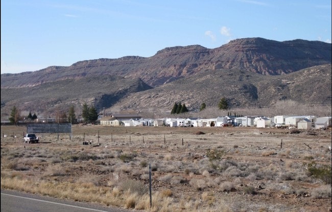
Property Record
9 Sr, Saint George, UT 84738


Property Detail
9 Sr
0342082
S: 36 T: 41S R: 14W BEG AT INTSEC N R/W/L HWY U-9 & E LN SEC 36 T41S R14W BEING N0*0808 E ALG SEC/L 114.25 FT FM SE COR SEC 36 TH S73*4223 W ALG N R/W/L 1124.93 FT; TH N0*02 W 312.50 FT TO PT ON S LN BRENTWOOD RV PARK PH 1; TH N73*4225 E 1125.89 FT T
Commercialnec
WASHINGTON
HC
Utah
B and X Area of moderate flood hazard, usually the area between the limits of the 100-year and 500-year floods.
6.14 AC
2024
Cedar City & St George
2025
Other Market Areas
270402
St. George, UT
NEARBY LISTINGS FOR SALE OR LEASE
DEMOGRAPHICS near 9 Sr
1 mile
3 mile
5 mile
2025 Total Population
2,360
11,710
24,525
2030 Population
2,595
12,926
26,911
Pop Growth 2025-2030
+ 9.96%
+ 10.38%
+ 9.73%
Average Age
42
44
42
2025 Total Households
911
4,517
8,723
HH Growth 2025-2030
+ 10.32%
+ 10.56%
+ 10.09%
Median Household Inc
$51,290
$72,732
$74,065
Avg Household Size
2.50
2.50
2.70
2025 Avg HH Vehicles
2.00
2.00
2.00
Median Home Value
$351,209
$475,164
$483,306
Median Year Built
2006
2009
2004
Nearby Places
Map Layers
Map Styles
 Street
 Aerial
Transit
 Traffic
 Biking
Places
Listings with unknown addresses are not visible on the map
- Restaurants
- Banks
- Shops
- Fitness
- Groceries
PUBLIC TRANSPORTATION
AIRPORT
St George Regional
Drive
Walk
Distance
St George Regional
25 min
16.0 mi
Freight Ports
Port of Long Beach
Drive
Walk
Distance
Port of Long Beach
457 min
415.2 mi
Nearby Properties
Address
Land Use
TOTAL SIZE
Lot Size
Zoning
Address
Land Use
TOTAL SIZE
Lot Size
Zoning
500.58 AC
Address
Land Use
TOTAL SIZE
Lot Size
Zoning
112,925 SF
211 AC
OS
Address
Land Use
TOTAL SIZE
Lot Size
Zoning
163,468 SF
19.73 AC
HC
Address
Land Use
TOTAL SIZE
Lot Size
Zoning
81,097 SF
23.10 AC
Address
Land Use
TOTAL SIZE
Lot Size
Zoning
277,666 SF
13.25 AC
PD
Address
Land Use
TOTAL SIZE
Lot Size
Zoning
17,388 SF
41.83 AC
Address
Land Use
TOTAL SIZE
Lot Size
Zoning
48,529 SF
26.71 AC
M1
Address
Land Use
TOTAL SIZE
Lot Size
Zoning
1,144 SF
189.53 AC
PDO
Address
Land Use
TOTAL SIZE
Lot Size
Zoning
64,047 SF
19.99 AC
M1
Address
Land Use
TOTAL SIZE
Lot Size
Zoning
133,182 SF
11.67 AC
PDO
Address
Land Use
TOTAL SIZE
Lot Size
Zoning
57,202 SF
2.50 AC
Address
Land Use
TOTAL SIZE
Lot Size
Zoning
23,235 SF
49.61 AC
A
Address
Land Use
TOTAL SIZE
Lot Size
Zoning
38,940 SF
1.03 AC
Address
Land Use
TOTAL SIZE
Lot Size
Zoning
90,302 SF
5.03 AC
PDO
Address
Land Use
TOTAL SIZE
Lot Size
Zoning
11,451 SF
31.90 AC
PDO
Address
Land Use
TOTAL SIZE
Lot Size
Zoning
20,139 SF
6.46 AC
HC
Address
Land Use
TOTAL SIZE
Lot Size
Zoning
29,523 SF
13.21 AC
PDO
Address
Land Use
TOTAL SIZE
Lot Size
Zoning
7,254 SF
6.15 AC
HC
Address
Land Use
TOTAL SIZE
Lot Size
Zoning
86,000 SF
6.05 AC
BMP
Address
Land Use
TOTAL SIZE
Lot Size
Zoning
112,222 SF
5 AC
PDO
Address
Land Use
TOTAL SIZE
Lot Size
Zoning
49,953 SF
1.83 AC
HC
Address
Land Use
TOTAL SIZE
Lot Size
Zoning
40,320 SF
10.67 AC
PDO
Address
Land Use
TOTAL SIZE
Lot Size
Zoning
79,426 SF
5.65 AC
PDO
Address
Land Use
TOTAL SIZE
Lot Size
Zoning
32,230 SF
14.21 AC
OS
Address
Land Use
TOTAL SIZE
Lot Size
Zoning
77,317 SF
5.01 AC
The World's #1 Commercial Real Estate Marketplace
Connect with us
© 2026 CoStar Group
The information above has been obtained from sources believed reliable. While we do not doubt its accuracy we have not verified it and make no guarantee, warranty or representation about it. It is your responsibility to independently confirm its accuracy and completeness. Any projections, opinions, assumptions, or estimates used are for example only and do not represent the current or future performance of the property. The value of this transaction to you depends on tax and other factors which should be evaluated by your tax, financial, and legal advisors. You and your advisors should conduct a careful, independent investigation of the property to determine to your satisfaction the suitability of the property for your needs.