Property Record
9 Swallow Rd, South Paris, ME 04281


NEARBY LISTINGS FOR SALE OR LEASE
-
-
View all South Paris listings for sale on LoopNet.com
Property Detail
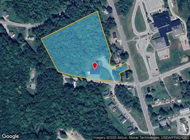
9 Swallow Rd
PARI-000004R-000000-000067
Oxford
Charitableorganization
Maine
X
67
23017C1232D
6.87 AC
2021
Maine South & Augusta
2024
Other Market Areas
966200
DEMOGRAPHICS near 9 Swallow Rd
1 Mile
3 Mile
5 Mile
2024 Total Population
801
7,157
11,771
2029 Population
866
7,768
12,774
Pop Growth 2024-2029
+ 8.11%
+ 8.54%
+ 8.52%
Average Age
43
44
45
2024 Total Households
325
3,134
5,108
HH Growth 2024-2029
+ 7.69%
+ 8.14%
+ 8.10%
Median Household Inc
$39,047
$46,142
$50,232
Avg Household Size
2.20
2.20
2.20
2024 Avg HH Vehicles
2.00
2.00
2.00
Median Home Value
$152,173
$172,906
$183,154
Median Year Built
1993
1986
1985
Nearby Places
Map Layers
Map Styles
 Street
 Aerial
- Restaurants
- Banks
- Shops
- Fitness
- Groceries
Nearby Properties
Address
Land Use
TOTAL SIZE
Lot Size
Zoning
Address
Land Use
TOTAL SIZE
Lot Size
Zoning
9.60 AC
Address
Land Use
TOTAL SIZE
Lot Size
Zoning
11.36 AC
Address
Land Use
TOTAL SIZE
Lot Size
Zoning
15.89 AC
B
Address
Land Use
TOTAL SIZE
Lot Size
Zoning
1.84 AC
B
Address
Land Use
TOTAL SIZE
Lot Size
Zoning
16.50 AC
Address
Land Use
TOTAL SIZE
Lot Size
Zoning
Address
Land Use
TOTAL SIZE
Lot Size
Zoning
2,112 SF
0.24 AC
B
Address
Land Use
TOTAL SIZE
Lot Size
Zoning
3 AC
B
Address
Land Use
TOTAL SIZE
Lot Size
Zoning
Address
Land Use
TOTAL SIZE
Lot Size
Zoning
3.05 AC
B
Address
Land Use
TOTAL SIZE
Lot Size
Zoning
2.79 AC
B
Address
Land Use
TOTAL SIZE
Lot Size
Zoning
5.94 AC
Address
Land Use
TOTAL SIZE
Lot Size
Zoning
0.54 AC
RA
Address
Land Use
TOTAL SIZE
Lot Size
Zoning
17.50 AC
Address
Land Use
TOTAL SIZE
Lot Size
Zoning
5 AC
RA
Address
Land Use
TOTAL SIZE
Lot Size
Zoning
9 AC
RA
Address
Land Use
TOTAL SIZE
Lot Size
Zoning
6.35 AC
Address
Land Use
TOTAL SIZE
Lot Size
Zoning
13.38 AC
Address
Land Use
TOTAL SIZE
Lot Size
Zoning
1.48 AC
Address
Land Use
TOTAL SIZE
Lot Size
Zoning
1.42 AC
Address
Land Use
TOTAL SIZE
Lot Size
Zoning
5.24 AC
Address
Land Use
TOTAL SIZE
Lot Size
Zoning
18.17 AC
B
Address
Land Use
TOTAL SIZE
Lot Size
Zoning
Address
Land Use
TOTAL SIZE
Lot Size
Zoning
5.70 AC
Address
Land Use
TOTAL SIZE
Lot Size
Zoning
1.98 AC
RA
Address
Land Use
TOTAL SIZE
Lot Size
Zoning
2.04 AC
Address
Land Use
TOTAL SIZE
Lot Size
Zoning
4.77 AC
Address
Land Use
TOTAL SIZE
Lot Size
Zoning
1.50 AC
Address
Land Use
TOTAL SIZE
Lot Size
Zoning
2.21 AC
B
Address
Land Use
TOTAL SIZE
Lot Size
Zoning
0.37 AC
The World's #1 Commercial Real Estate Marketplace
Connect with us
© 2026 CoStar Group
The information above has been obtained from sources believed reliable. While we do not doubt its accuracy we have not verified it and make no guarantee, warranty or representation about it. It is your responsibility to independently confirm its accuracy and completeness. Any projections, opinions, assumptions, or estimates used are for example only and do not represent the current or future performance of the property. The value of this transaction to you depends on tax and other factors which should be evaluated by your tax, financial, and legal advisors. You and your advisors should conduct a careful, independent investigation of the property to determine to your satisfaction the suitability of the property for your needs.