No Photo
Property Record
90 S Ga Highway 90 Hwy, Cordele, GA 31015

NEARBY LISTINGS FOR SALE OR LEASE
Property Detail
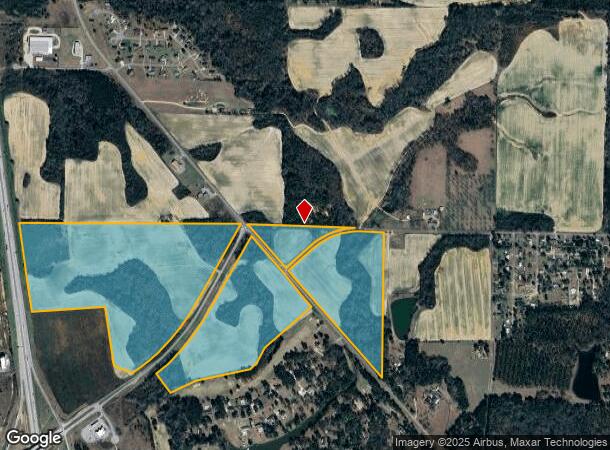
90 S Ga Highway 90 Hwy
Cordele, GA
1-Cordele-Urban
C39I-001
AC UN IMPROVED
Commercialacreage
Crisp
A
Georgia
13081C0165B
44
2024
136.45 AC
2025
Georgia South Area
010400
Other Market Areas
DEMOGRAPHICS near 90 S Ga Highway 90 Hwy
1 Mile
3 Mile
5 Mile
2024 Total Population
393
8,527
14,236
2029 Population
372
8,228
13,808
Pop Growth 2024-2029
(5.34%)
(3.51%)
(3.01%)
Average Age
41
40
40
2024 Total Households
156
3,533
5,798
HH Growth 2024-2029
(5.13%)
(3.31%)
(2.83%)
Median Household Inc
$78,409
$39,575
$37,515
Avg Household Size
2.40
2.30
2.40
2024 Avg HH Vehicles
2.00
2.00
2.00
Median Home Value
$161,956
$102,195
$91,526
Median Year Built
1976
1977
1979
Nearby Places
- Restaurants
- Banks
- Shops
- Fitness
- Groceries
SALE & LEASE HISTORY
LISTING DATE
SALE/LEASE

Sep 24, 2016
For Sale
Jul 03, 2017
For Sale
Nearby Properties
Address
Land Use
TOTAL SIZE
Lot Size
Zoning
Address
Land Use
TOTAL SIZE
Lot Size
Zoning
60,800 SF
202.26 AC
RURAL
Address
Land Use
TOTAL SIZE
Lot Size
Zoning
126 AC
COMMERCIAL
Address
Land Use
TOTAL SIZE
Lot Size
Zoning
145,350 SF
17.34 AC
COMMERCIAL
Address
Land Use
TOTAL SIZE
Lot Size
Zoning
64,825 SF
2.97 AC
Address
Land Use
TOTAL SIZE
Lot Size
Zoning
46.29 AC
RURAL
Address
Land Use
TOTAL SIZE
Lot Size
Zoning
44,172 SF
2.10 AC
COMMERCIAL
Address
Land Use
TOTAL SIZE
Lot Size
Zoning
104,761 SF
17.35 AC
COMMERCIAL
Address
Land Use
TOTAL SIZE
Lot Size
Zoning
9.80 AC
RESIDENTIA
Address
Land Use
TOTAL SIZE
Lot Size
Zoning
49,311 SF
1.72 AC
COMMERCIAL
Address
Land Use
TOTAL SIZE
Lot Size
Zoning
113,502 SF
7.82 AC
COMMERCIAL
Address
Land Use
TOTAL SIZE
Lot Size
Zoning
96,726 SF
49.27 AC
II
Address
Land Use
TOTAL SIZE
Lot Size
Zoning
108,392 SF
17.34 AC
INDUSTRIAL
Address
Land Use
TOTAL SIZE
Lot Size
Zoning
47,172 SF
2.27 AC
Address
Land Use
TOTAL SIZE
Lot Size
Zoning
75,075 SF
10.21 AC
INDUSTRIAL
Address
Land Use
TOTAL SIZE
Lot Size
Zoning
23,084 SF
4.18 AC
RESIDENTIA
Address
Land Use
TOTAL SIZE
Lot Size
Zoning
13,004 SF
31.82 AC
RURAL
Address
Land Use
TOTAL SIZE
Lot Size
Zoning
14,466 SF
1.74 AC
COMMERCIAL
Address
Land Use
TOTAL SIZE
Lot Size
Zoning
10,786 SF
3.75 AC
COMMERCIAL
Address
Land Use
TOTAL SIZE
Lot Size
Zoning
625 SF
6.44 AC
RESIDENTIA
Address
Land Use
TOTAL SIZE
Lot Size
Zoning
69,641 SF
7.72 AC
COMMERCIAL
Address
Land Use
TOTAL SIZE
Lot Size
Zoning
4,148 SF
4.73 AC
COMMERCIAL
Address
Land Use
TOTAL SIZE
Lot Size
Zoning
14,772 SF
2.82 AC
COMMERCIAL
Address
Land Use
TOTAL SIZE
Lot Size
Zoning
16,588 SF
2.63 AC
COMMERCIAL
Address
Land Use
TOTAL SIZE
Lot Size
Zoning
7,980 SF
6.62 AC
COMMERCIAL
Address
Land Use
TOTAL SIZE
Lot Size
Zoning
12,988 SF
5.76 AC
COMMERCIAL
Address
Land Use
TOTAL SIZE
Lot Size
Zoning
1,600 SF
2.34 AC
COMMERCIAL
Address
Land Use
TOTAL SIZE
Lot Size
Zoning
52,605 SF
5.03 AC
COMMERCIAL
Address
Land Use
TOTAL SIZE
Lot Size
Zoning
12,064 SF
3.13 AC
COMMERCIAL
Address
Land Use
TOTAL SIZE
Lot Size
Zoning
80,000 SF
15 AC
INDUSTRIAL
Address
Land Use
TOTAL SIZE
Lot Size
Zoning
1,782 SF
2.47 AC
The World's #1 Commercial Real Estate Marketplace
Connect with us
© 2025 CoStar Group
The information above has been obtained from sources believed reliable. While we do not doubt its accuracy we have not verified it and make no guarantee, warranty or representation about it. It is your responsibility to independently confirm its accuracy and completeness. Any projections, opinions, assumptions, or estimates used are for example only and do not represent the current or future performance of the property. The value of this transaction to you depends on tax and other factors which should be evaluated by your tax, financial, and legal advisors. You and your advisors should conduct a careful, independent investigation of the property to determine to your satisfaction the suitability of the property for your needs.