Property Record
90 Stone Castle Rd, Rock Tavern, NY 12575

NEARBY LISTINGS FOR SALE OR LEASE
Property Detail
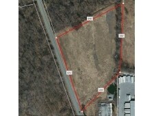
90 Stone Castle Rd
New York-Jersey City-White Plains, NY-NJ
LT 1 C ITOH CO MAP 7815
334289-015-000-0001-087.000-0000
Orange
Shipyard
New York
X
87.00
36071C0120E
7.30 AC
2024
Newburgh
2024
Northern New Jersey
010602
DEMOGRAPHICS near 90 Stone Castle Rd
1 Mile
3 Mile
5 Mile
2024 Total Population
1,414
13,944
41,712
2029 Population
1,447
14,242
42,517
Pop Growth 2024-2029
+ 2.33%
+ 2.14%
+ 1.93%
Average Age
41
42
41
2024 Total Households
507
5,026
14,920
HH Growth 2024-2029
+ 2.37%
+ 2.19%
+ 2.01%
Median Household Inc
$88,679
$97,163
$94,583
Avg Household Size
2.70
2.70
2.70
2024 Avg HH Vehicles
2.00
2.00
2.00
Median Home Value
$278,571
$294,737
$294,197
Median Year Built
1967
1977
1976
Nearby Places
Map Layers
Map Styles
 Street
 Aerial
- Restaurants
- Banks
- Shops
- Fitness
- Groceries
PUBLIC TRANSPORTATION
COMMUTER RAIL
Salisbury Mills Cornwall (Bergen County/Port Jervis Line - NJ Transit Commuter Rail (NJ Transit), Main/Port Jervis Line - NJ Transit Commuter Rail (NJ Transit))
DRIVE
WALK
Distance
Salisbury Mills Cornwall (Bergen County/Port Jervis Line - NJ Transit Commuter Rail (NJ Transit), Main/Port Jervis Line - NJ Transit Commuter Rail (NJ Transit))
19 min
9.7 mi
AIRPORT
New York Stewart International
DRIVE
WALK
Distance
New York Stewart International
10 min
5.0 mi
Freight Ports
Port Newark Container Terminal
DRIVE
WALK
Distance
Port Newark Container Terminal
94 min
71.2 mi
Nearby Properties
Address
Land Use
TOTAL SIZE
Lot Size
Zoning
Address
Land Use
TOTAL SIZE
Lot Size
Zoning
1,015,632 SF
187.20 AC
I1
Address
Land Use
TOTAL SIZE
Lot Size
Zoning
130,037 SF
128.80 AC
Address
Land Use
TOTAL SIZE
Lot Size
Zoning
44.50 AC
Address
Land Use
TOTAL SIZE
Lot Size
Zoning
71,379 SF
20.80 AC
Address
Land Use
TOTAL SIZE
Lot Size
Zoning
20.90 AC
Address
Land Use
TOTAL SIZE
Lot Size
Zoning
10.30 AC
Address
Land Use
TOTAL SIZE
Lot Size
Zoning
653 AC
AP
Address
Land Use
TOTAL SIZE
Lot Size
Zoning
32,505 SF
15.10 AC
I1
Address
Land Use
TOTAL SIZE
Lot Size
Zoning
Address
Land Use
TOTAL SIZE
Lot Size
Zoning
Address
Land Use
TOTAL SIZE
Lot Size
Zoning
102,239 SF
62.90 AC
RA2
Address
Land Use
TOTAL SIZE
Lot Size
Zoning
Address
Land Use
TOTAL SIZE
Lot Size
Zoning
3.20 AC
Address
Land Use
TOTAL SIZE
Lot Size
Zoning
64,191 SF
10 AC
06
Address
Land Use
TOTAL SIZE
Lot Size
Zoning
12.30 AC
Address
Land Use
TOTAL SIZE
Lot Size
Zoning
85,275 SF
70.20 AC
RA-.5
Address
Land Use
TOTAL SIZE
Lot Size
Zoning
Address
Land Use
TOTAL SIZE
Lot Size
Zoning
149,051 SF
14.10 AC
I1
Address
Land Use
TOTAL SIZE
Lot Size
Zoning
195,821 SF
27.50 AC
I1
Address
Land Use
TOTAL SIZE
Lot Size
Zoning
40,200 SF
14.40 AC
Address
Land Use
TOTAL SIZE
Lot Size
Zoning
Address
Land Use
TOTAL SIZE
Lot Size
Zoning
Address
Land Use
TOTAL SIZE
Lot Size
Zoning
69,636 SF
7.20 AC
Address
Land Use
TOTAL SIZE
Lot Size
Zoning
353,311 SF
13.50 AC
Address
Land Use
TOTAL SIZE
Lot Size
Zoning
2.10 AC
Address
Land Use
TOTAL SIZE
Lot Size
Zoning
1,096 SF
5.60 AC
Address
Land Use
TOTAL SIZE
Lot Size
Zoning
82,465 SF
14.40 AC
I1
Address
Land Use
TOTAL SIZE
Lot Size
Zoning
81,563 SF
5.70 AC
B4
Address
Land Use
TOTAL SIZE
Lot Size
Zoning
60.60 AC
06
Address
Land Use
TOTAL SIZE
Lot Size
Zoning
26,988 SF
53 AC
RA2
The World's #1 Commercial Real Estate Marketplace
Connect with us
© 2025 CoStar Group
The information above has been obtained from sources believed reliable. While we do not doubt its accuracy we have not verified it and make no guarantee, warranty or representation about it. It is your responsibility to independently confirm its accuracy and completeness. Any projections, opinions, assumptions, or estimates used are for example only and do not represent the current or future performance of the property. The value of this transaction to you depends on tax and other factors which should be evaluated by your tax, financial, and legal advisors. You and your advisors should conduct a careful, independent investigation of the property to determine to your satisfaction the suitability of the property for your needs.