Property Record
900 4Th St, Beloit, WI 53511


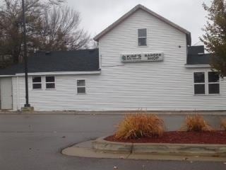
Property Detail
900 4Th St
Janesville-Beloit, WI
L 1 CSM VOL 34 PGS 280, 281 & 282 ALSO S 37 FT L 4 B 6 MERRILLS ADD EXCEPTING THEREFROM THAT PART DEEDED TO THE CITY OF BELOI
135-10280
ROCK
Commercialnec
Wisconsin
AE The base floodplain where base flood elevations are provided. AE Zones are now used on new format FIRMs instead of A1-A30 Zones.
4
2025
1.91 AC
2025
Rock County
001700
Milwaukee/Madison
5,120 SF
NEARBY LISTINGS FOR SALE OR LEASE
DEMOGRAPHICS near 900 4Th St
1 mile
3 mile
5 mile
2025 Total Population
14,623
46,955
67,363
2030 Population
14,770
47,341
67,916
Pop Growth 2025-2030
+ 1.01%
+ 0.82%
+ 0.82%
Average Age
35
39
40
2025 Total Households
5,191
18,197
26,219
HH Growth 2025-2030
+ 1.16%
+ 0.82%
+ 0.84%
Median Household Inc
$53,168
$61,026
$69,945
Avg Household Size
2.50
2.40
2.50
2025 Avg HH Vehicles
2.00
2.00
2.00
Median Home Value
$138,345
$162,007
$187,559
Median Year Built
1948
1959
1967
Nearby Places
Map Layers
Map Styles
 Street
 Aerial
Transit
 Traffic
 Biking
Places
Listings with unknown addresses are not visible on the map
- Restaurants
- Banks
- Shops
- Fitness
- Groceries
PUBLIC TRANSPORTATION
AIRPORT
Chicago/Rockford International
Drive
Walk
Distance
Chicago/Rockford International
44 min
32.3 mi
Freight Ports
Port Milwaukee
Drive
Walk
Distance
Port Milwaukee
89 min
75.0 mi
Nearby Properties
Address
Land Use
TOTAL SIZE
Lot Size
Zoning
Address
Land Use
TOTAL SIZE
Lot Size
Zoning
24.76 AC
Address
Land Use
TOTAL SIZE
Lot Size
Zoning
202,676 SF
19.31 AC
Address
Land Use
TOTAL SIZE
Lot Size
Zoning
400,014 SF
43.71 AC
Address
Land Use
TOTAL SIZE
Lot Size
Zoning
186,691 SF
17.06 AC
Address
Land Use
TOTAL SIZE
Lot Size
Zoning
3.39 AC
Address
Land Use
TOTAL SIZE
Lot Size
Zoning
3.47 AC
Address
Land Use
TOTAL SIZE
Lot Size
Zoning
3.65 AC
Address
Land Use
TOTAL SIZE
Lot Size
Zoning
13.21 AC
Address
Land Use
TOTAL SIZE
Lot Size
Zoning
361,947 SF
23.26 AC
Address
Land Use
TOTAL SIZE
Lot Size
Zoning
24.15 AC
Address
Land Use
TOTAL SIZE
Lot Size
Zoning
193,013 SF
22.93 AC
Address
Land Use
TOTAL SIZE
Lot Size
Zoning
38,012 SF
2.74 AC
Address
Land Use
TOTAL SIZE
Lot Size
Zoning
100,000 SF
14.78 AC
Address
Land Use
TOTAL SIZE
Lot Size
Zoning
16.81 AC
Address
Land Use
TOTAL SIZE
Lot Size
Zoning
16,336 SF
9.06 AC
Address
Land Use
TOTAL SIZE
Lot Size
Zoning
3.30 AC
Address
Land Use
TOTAL SIZE
Lot Size
Zoning
32.79 AC
Address
Land Use
TOTAL SIZE
Lot Size
Zoning
89,678 SF
12.90 AC
Address
Land Use
TOTAL SIZE
Lot Size
Zoning
296,731 SF
18.14 AC
Address
Land Use
TOTAL SIZE
Lot Size
Zoning
17,116 SF
97.70 AC
Address
Land Use
TOTAL SIZE
Lot Size
Zoning
6.08 AC
Address
Land Use
TOTAL SIZE
Lot Size
Zoning
131,218 SF
1.65 AC
Address
Land Use
TOTAL SIZE
Lot Size
Zoning
48,036 SF
1.26 AC
Address
Land Use
TOTAL SIZE
Lot Size
Zoning
125,000 SF
12.53 AC
Address
Land Use
TOTAL SIZE
Lot Size
Zoning
13.70 AC
Address
Land Use
TOTAL SIZE
Lot Size
Zoning
57,512 SF
1.62 AC
Address
Land Use
TOTAL SIZE
Lot Size
Zoning
7.57 AC
Address
Land Use
TOTAL SIZE
Lot Size
Zoning
47,561 SF
0.58 AC
Address
Land Use
TOTAL SIZE
Lot Size
Zoning
10,456 SF
3.58 AC
Address
Land Use
TOTAL SIZE
Lot Size
Zoning
76,570 SF
6.74 AC
The World's #1 Commercial Real Estate Marketplace
Connect with us
© 2026 CoStar Group
The information above has been obtained from sources believed reliable. While we do not doubt its accuracy we have not verified it and make no guarantee, warranty or representation about it. It is your responsibility to independently confirm its accuracy and completeness. Any projections, opinions, assumptions, or estimates used are for example only and do not represent the current or future performance of the property. The value of this transaction to you depends on tax and other factors which should be evaluated by your tax, financial, and legal advisors. You and your advisors should conduct a careful, independent investigation of the property to determine to your satisfaction the suitability of the property for your needs.