Property Record
900 Airport Rd, Santa Ynez, CA 93460


NEARBY LISTINGS FOR SALE OR LEASE
-
-
View all Santa Ynez listings for sale on LoopNet.com
Property Detail
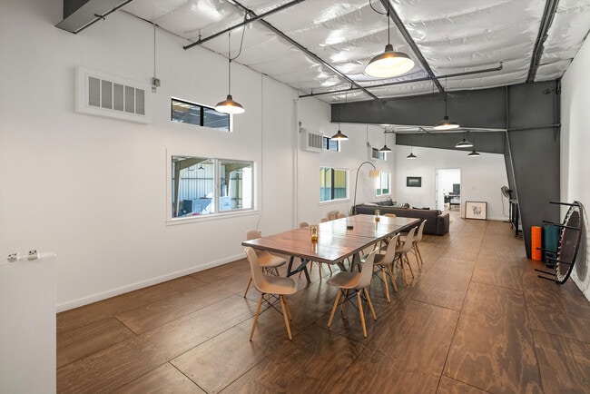
900 Airport Rd
141-440-002
Santa Ynez Vly Airport
Processingplant
Santa Barbara
X
California
06083C1077G
123.97 AC
0
Central SB County
2025
Santa Barbara/Sta Maria/Goleta
001908
Santa Maria-Santa Barbara, CA
DEMOGRAPHICS near 900 Airport Rd
1 Mile
3 Mile
5 Mile
2024 Total Population
1,951
5,943
13,008
2029 Population
1,843
5,615
12,429
Pop Growth 2024-2029
(5.54%)
(5.52%)
(4.45%)
Average Age
45
46
46
2024 Total Households
728
2,291
5,067
HH Growth 2024-2029
(5.63%)
(5.67%)
(4.64%)
Median Household Inc
$122,108
$117,307
$119,922
Avg Household Size
2.60
2.50
2.40
2024 Avg HH Vehicles
3.00
3.00
2.00
Median Home Value
$1,100,379
$1,098,998
$1,081,214
Median Year Built
1979
1976
1979
Nearby Places
Map Layers
Map Styles
 Street
 Aerial
- Restaurants
- Banks
- Shops
- Fitness
- Groceries
PUBLIC TRANSPORTATION
AIRPORT
Santa Barbara Municipal
DRIVE
WALK
Distance
Santa Barbara Municipal
59 min
33.2 mi
Freight Ports
The Port of Hueneme
DRIVE
WALK
Distance
The Port of Hueneme
95 min
69.4 mi
SALE & LEASE HISTORY
LISTING DATE
SALE/LEASE

Sep 25, 2016
For Lease
Nov 14, 2024
For Sale
Nearby Properties
Address
Land Use
TOTAL SIZE
Lot Size
Zoning
Address
Land Use
TOTAL SIZE
Lot Size
Zoning
5.10 AC
Address
Land Use
TOTAL SIZE
Lot Size
Zoning
14,794 SF
34.82 AC
AGII40
Address
Land Use
TOTAL SIZE
Lot Size
Zoning
4.35 AC
C2
Address
Land Use
TOTAL SIZE
Lot Size
Zoning
8,775 SF
71.38 AC
AGII100
Address
Land Use
TOTAL SIZE
Lot Size
Zoning
52 AC
AGII40
Address
Land Use
TOTAL SIZE
Lot Size
Zoning
5,454 SF
110.42 AC
AGII100
Address
Land Use
TOTAL SIZE
Lot Size
Zoning
8,469 SF
103.41 AC
AGII100
Address
Land Use
TOTAL SIZE
Lot Size
Zoning
15.19 AC
AGI10
Address
Land Use
TOTAL SIZE
Lot Size
Zoning
413.83 AC
AGII100
Address
Land Use
TOTAL SIZE
Lot Size
Zoning
5,093 SF
40 AC
AGII40
Address
Land Use
TOTAL SIZE
Lot Size
Zoning
6,615 SF
49.67 AC
AGII100
Address
Land Use
TOTAL SIZE
Lot Size
Zoning
1,190 SF
52.62 AC
AGII40
Address
Land Use
TOTAL SIZE
Lot Size
Zoning
227.42 AC
AGII100
Address
Land Use
TOTAL SIZE
Lot Size
Zoning
0.86 AC
Address
Land Use
TOTAL SIZE
Lot Size
Zoning
2.62 AC
1E1
Address
Land Use
TOTAL SIZE
Lot Size
Zoning
0.46 AC
C2
Address
Land Use
TOTAL SIZE
Lot Size
Zoning
9,062 SF
0.52 AC
C2
Address
Land Use
TOTAL SIZE
Lot Size
Zoning
Address
Land Use
TOTAL SIZE
Lot Size
Zoning
94.96 AC
AGII100
Address
Land Use
TOTAL SIZE
Lot Size
Zoning
5,900 SF
21.69 AC
AGI20
Address
Land Use
TOTAL SIZE
Lot Size
Zoning
60.78 AC
AGII100
Address
Land Use
TOTAL SIZE
Lot Size
Zoning
39,204 SF
1.15 AC
C2
Address
Land Use
TOTAL SIZE
Lot Size
Zoning
4,753 SF
475.27 AC
AGII100
Address
Land Use
TOTAL SIZE
Lot Size
Zoning
62.79 AC
AGII100
Address
Land Use
TOTAL SIZE
Lot Size
Zoning
7,297 SF
123.05 AC
AGII100
Address
Land Use
TOTAL SIZE
Lot Size
Zoning
1,994 SF
107.07 AC
AGII100
The World's #1 Commercial Real Estate Marketplace
Connect with us
© 2026 CoStar Group
The information above has been obtained from sources believed reliable. While we do not doubt its accuracy we have not verified it and make no guarantee, warranty or representation about it. It is your responsibility to independently confirm its accuracy and completeness. Any projections, opinions, assumptions, or estimates used are for example only and do not represent the current or future performance of the property. The value of this transaction to you depends on tax and other factors which should be evaluated by your tax, financial, and legal advisors. You and your advisors should conduct a careful, independent investigation of the property to determine to your satisfaction the suitability of the property for your needs.