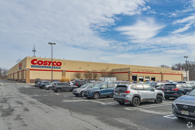
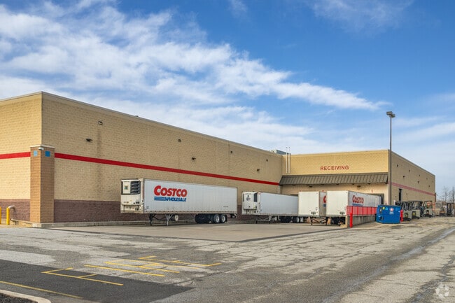
Property Record
900 Center Blvd, Newark, DE 19702

Current Lease Availabilities
Property Detail
900 Center Blvd
09-024.00-030
New Castle
Departmentstore
Delaware
CR
1b
C and X Area of minimal flood hazard, usually depicted on FIRMs as above the 500-year flood level.
12.43 AC
2025
South New Castle County
2025
Philadelphia
013800
Philadelphia-Camden-Wilmington, PA-NJ-DE-MD
3,850 SF
NEARBY LISTINGS FOR SALE OR LEASE
DEMOGRAPHICS near 900 Center Blvd
1 mile
3 mile
5 mile
2025 Total Population
6,195
76,916
202,143
2030 Population
6,538
79,685
207,737
Pop Growth 2025-2030
+ 5.54%
+ 3.60%
+ 2.77%
Average Age
39
40
40
2025 Total Households
2,502
31,304
79,859
HH Growth 2025-2030
+ 5.72%
+ 3.85%
+ 2.98%
Median Household Inc
$96,326
$76,268
$79,464
Avg Household Size
2.40
2.40
2.50
2025 Avg HH Vehicles
2.00
2.00
2.00
Median Home Value
$330,352
$281,821
$290,407
Median Year Built
1975
1981
1975
Nearby Places
Map Layers
Map Styles
 Street
 Aerial
Layers
 Traffic
 Biking
Places
Listings with unknown addresses are not visible on the map
- Restaurants
- Banks
- Shops
- Fitness
- Groceries
PUBLIC TRANSPORTATION
COMMUTER RAIL
Churchmans Crossing (R2 - Southeastern Pennsylvania Transportation Authority Regional Rail (SEPTA Regional Rail))
Drive
Walk
Distance
Churchmans Crossing (R2 - Southeastern Pennsylvania Transportation Authority Regional Rail (SEPTA Regional Rail))
6 min
2.9 mi
Newark (R2 - Southeastern Pennsylvania Transportation Authority Regional Rail (SEPTA Regional Rail))
Drive
Walk
Distance
Newark (R2 - Southeastern Pennsylvania Transportation Authority Regional Rail (SEPTA Regional Rail))
12 min
8.6 mi
AIRPORT
Philadelphia International
Drive
Walk
Distance
Philadelphia International
40 min
29.3 mi
Freight Ports
Port of Wilmington, RI
Drive
Walk
Distance
Port of Wilmington, RI
14 min
9.2 mi
Nearby Properties
Address
Land Use
TOTAL SIZE
Lot Size
Zoning
Address
Land Use
TOTAL SIZE
Lot Size
Zoning
525,757 SF
189.70 AC
NCPUD
Address
Land Use
TOTAL SIZE
Lot Size
Zoning
163,588 SF
1,229.95 AC
I
Address
Land Use
TOTAL SIZE
Lot Size
Zoning
467,262 SF
28.74 AC
CR
Address
Land Use
TOTAL SIZE
Lot Size
Zoning
803,690 SF
155.50 AC
NCPUD
Address
Land Use
TOTAL SIZE
Lot Size
Zoning
488,637 SF
229.83 AC
NCPUD
Address
Land Use
TOTAL SIZE
Lot Size
Zoning
56.07 AC
I
Address
Land Use
TOTAL SIZE
Lot Size
Zoning
735,703 SF
49.15 AC
NCAP
Address
Land Use
TOTAL SIZE
Lot Size
Zoning
351,528 SF
24.88 AC
NCAP
Address
Land Use
TOTAL SIZE
Lot Size
Zoning
33,790 SF
45.17 AC
S
Address
Land Use
TOTAL SIZE
Lot Size
Zoning
216,689 SF
16.44 AC
CR
Address
Land Use
TOTAL SIZE
Lot Size
Zoning
76,357 SF
145.10 AC
CR
Address
Land Use
TOTAL SIZE
Lot Size
Zoning
38,900 SF
16.31 AC
BP
Address
Land Use
TOTAL SIZE
Lot Size
Zoning
294,518 SF
29.44 AC
ST
Address
Land Use
TOTAL SIZE
Lot Size
Zoning
203,570 SF
83.85 AC
OR
Address
Land Use
TOTAL SIZE
Lot Size
Zoning
333,334 SF
20.57 AC
NCPUD
Address
Land Use
TOTAL SIZE
Lot Size
Zoning
135,764 SF
18.59 AC
NCAP
Address
Land Use
TOTAL SIZE
Lot Size
Zoning
234,941 SF
19.54 AC
NCPUD
Address
Land Use
TOTAL SIZE
Lot Size
Zoning
30,127 SF
6.53 AC
CR
Address
Land Use
TOTAL SIZE
Lot Size
Zoning
660 SF
291.15 AC
I
Address
Land Use
TOTAL SIZE
Lot Size
Zoning
269,354 SF
29.13 AC
NCPUD
Address
Land Use
TOTAL SIZE
Lot Size
Zoning
18,476 SF
18 AC
NCAP
Address
Land Use
TOTAL SIZE
Lot Size
Zoning
138,735 SF
20.38 AC
CR
Address
Land Use
TOTAL SIZE
Lot Size
Zoning
276,191 SF
54.91 AC
BP
Address
Land Use
TOTAL SIZE
Lot Size
Zoning
242,811 SF
38.77 AC
CR
Address
Land Use
TOTAL SIZE
Lot Size
Zoning
281,611 SF
26.39 AC
NCAP
Address
Land Use
TOTAL SIZE
Lot Size
Zoning
295,200 SF
17.94 AC
NCAP
Address
Land Use
TOTAL SIZE
Lot Size
Zoning
102,955 SF
9.57 AC
I
Address
Land Use
TOTAL SIZE
Lot Size
Zoning
305,422 SF
22.35 AC
NCPUD
Address
Land Use
TOTAL SIZE
Lot Size
Zoning
2,368 SF
486.90 AC
SR
Address
Land Use
TOTAL SIZE
Lot Size
Zoning
187,286 SF
24.20 AC
CR
The World's #1 Commercial Real Estate Marketplace
Connect with us
© 2026 CoStar Group
The information above has been obtained from sources believed reliable. While we do not doubt its accuracy we have not verified it and make no guarantee, warranty or representation about it. It is your responsibility to independently confirm its accuracy and completeness. Any projections, opinions, assumptions, or estimates used are for example only and do not represent the current or future performance of the property. The value of this transaction to you depends on tax and other factors which should be evaluated by your tax, financial, and legal advisors. You and your advisors should conduct a careful, independent investigation of the property to determine to your satisfaction the suitability of the property for your needs.